This six-mile-loop hike approaches Ramapo Mountain State Forest from the west via Back Beach Park in Wanaque. It climbs to the scenic Ramapo Lake, heads north along its shore, then proceeds south along the Wanaque Ridge, with panoramic views to the west and east. The hike is of moderate difficulty and should take about three-and-a-half hours. Please note that dogs are not allowed in Back Beach Park.
To get there, take N.J. Route 4 West and continue on Route 208 West, which becomes I-287 South. Take Exit 55 (Wanaque/Pompton Lakes). Turn right at the bottom of the ramp onto Union Avenue, then turn left at the next light onto Ringwood Avenue (County 511). Continue for 0.7 miles to the next light, and turn right onto Second Avenue. At a stop sign in 0.3 miles, turn left onto Boulevard. At the next intersection, bear right to continue on Fourth Avenue. In 0.2 miles, where Fourth Avenue bears left, continue straight ahead on Back Beach Road and follow it to its end at a large parking area for Back Beach Park.
At the southern end of the parking area (to the right, as you enter), you will see a kiosk and three inverted-red-triangle-on-white blazes on a tree. These blazes mark the start of the Indian Rock Trail, blazed many years ago by Joseph “Ace” Tachine (who also erected many hand-painted signs along the trail), and more recently reblazed by the New York-New Jersey Trail Conference.
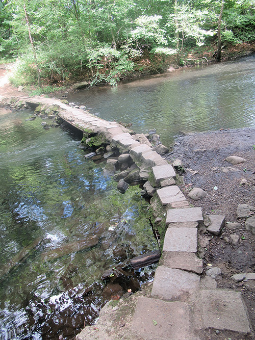
Follow the Indian Rock Trail into the woods on a level footpath. After bearing left at a T-intersection with a woods road, you’ll reach the Wanaque River, which is crossed on a stone-and-concrete footbridge. A short distance beyond, the trail crosses another woods road, with stone-and-concrete ruins visible on either side of the trail. These are remnants of manufacturing facilities constructed many years ago by the E.I. duPont de Nemours Company.
After a brief but steep climb, the trail turns right and levels off, soon passing a large rock outcrop on the left. You may notice several faded figures of Native Americans in feathered headdress painted on the rock, giving it the name “Indian Rock.” The trail continues to ascend more gradually, crossing yet another woods road (the route of a gas pipeline) half a mile from the start. Just beyond, the trail bears right at a fork.
In another third of a mile, you’ll reach a T-intersection. Here, the Indian Rock Trail turns right, while the orange-blazed Wanaque Ridge Trail begins on the left. This will be your return route, but for now, turn right to continue on the Indian Rock Trail. Soon, the trail bears left at a fork. A short distance ahead, the Indian Rock Trail ends at a junction with another woods road, which comes in from the right. Bear left and proceed ahead on the road, now following the white-“C”-on-red-blazed Cannonball Trail.
After a short climb, you’ll come to a Y-intersection. Here, you should bear right to continue on the Cannonball Trail, which now follows a wide, level woods road. In 400 feet, you’ll reach another Y-intersection. Bear sharply left here and continue to follow the Cannonball Trail, which is now joined by the blue-on-white-blazed Ramapo Lake Loop.
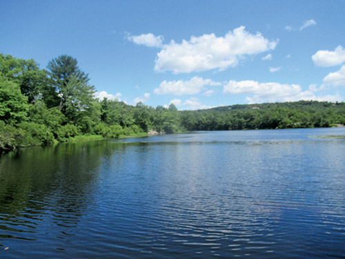
You’re now heading north on a level gravel road, paralleling the western shore of Ramapo Lake, but some distance from the water. Because of the dense vegetation, you’ll only be able to catch glimpses of the lake through the trees.
After paralleling the lake for half a mile, you’ll pass a building on the hillside to the left that was formerly used as a ranger station. The road now approaches the scenic lake and, a short distance ahead, a rock ledge on the right offers a broad view over the lake.
In 500 feet, you’ll reach another rock ledge that also offers a good view over the lake. Just beyond, a gravel road joins from the left. Continue ahead on the road, crossing a stone causeway that isolates a quiet pond on the left from the main body of the lake.
A short distance beyond, follow the Cannonball Trail as it turns left onto an intersecting gravel road, leaving Ramapo Lake. Here, a triple-orange blaze marks the start of the Wanaque Ridge Trail, and you now follow both white-“C”-on-red and orange blazes. Soon, the Cannonball Trail turns right onto a footpath, but you should continue ahead on the gravel road, now following only the orange blazes of the Wanaque Ridge Trail (ignore the sign for the blue-blazed MacEvoy Trail).
After a slight climb, you’ll reach a clearing for a pipeline. Turn right, continuing along the Wanaque Ridge Trail, which follows the pipeline for about 250 feet, then bears left and reenters the woods. Just beyond, the black-square-on-orange Wanaque Ridge Spur begins on the right, but you should bear left to continue along the orange-blazed trail. The Wanaque Ridge Trail soon begins a steady descent on a rocky woods road. In about a third of a mile, it bears left onto a narrower woods road, which levels off and even climbs a little.
In another third of a mile, you’ll reach a fork. Follow the orange blazes, which bear right, leaving the woods road, and soon begin to descend through a ravine. You’ll cross a wet area and a stream, and eventually bear left onto a woods road that goes through another ravine, passing a large rock outcrop (known as Profile Rock) on the left. Be alert, for in 300 feet the trail turns sharply right and begins to climb to the western ridge of the Ramapo Mountains.
The trail soon bears right, climbs a little and heads north on a level footpath. It then turns left and climbs to the crest of the ridge. Here, at a Y-intersection, the trail turns left again and heads south along the ridge.
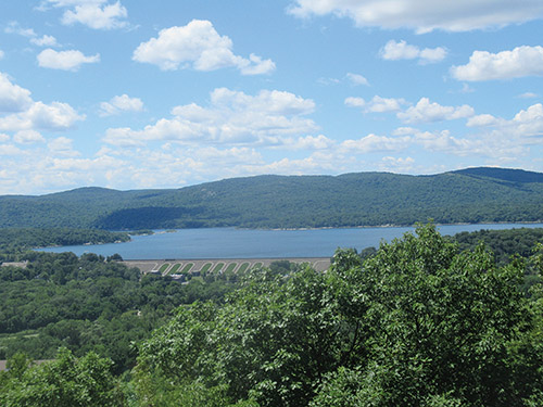
In a quarter mile, you’ll emerge in an open area at a high point on the ridge, with a panoramic west-facing view. The Wanaque Reservoir is below, with the massive Raymond Dam in the foreground, and the Wyanokies beyond.
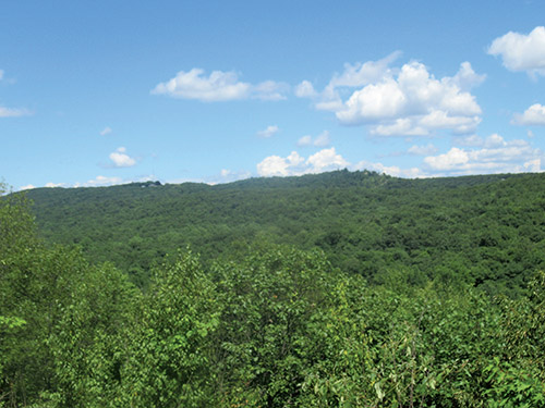
Continue south along the trail. In another quarter mile, the trail turns left, leaving the woods road it has been following, and climbs to an east-facing viewpoint from a rock outcrop. Just beyond, there is another view to the west over the Wanaque Reservoir.
The trail continues south along the crest of the ridge. After passing through an area studded with cedars, it bears left and descends rather steeply on a rocky path. After descending more gradually, the trail turns sharply left, then turns right onto a woods road.
A short distance beyond, you’ll come to a Y-intersection, where the red-stripe-on-yellow-blazed Pete’s Path begins on the right. This trail leads to the private Wanaque Reserve, but you should bear left to continue on the orange-blazed trail, which crosses a stream, climbs to cross the gas pipeline, and turns right onto the woods road that parallels the pipeline.
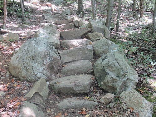
The trail follows the pipeline road for only 60 feet, then turns left and climbs stone steps. After a relatively level section, the trail resumes its climb, then descends to end at a junction with the Indian Rock Trail. Turn right and follow the Indian Rock Trail, retracing your steps for about three-quarters of a mile to the parking lot where the hike began.
This hiking article is provided by Daniel Chazin of the New York-New Jersey Trail Conference. The Trail Conference is a volunteer organization that builds and maintains over 2,000 miles of hiking trails and publishes a library of hiking maps and books, including a two-map set for North Jersey Trails ($10.95). The Trail Conference’s office is at 600 Ramapo Valley Road (Route 202), Mahwah; 201-512-9348; www.nynjtc.org. Daniel Chazin can be reached at [email protected].