This seven-mile moderate hike loops around Hook Mountain on the Palisades of the Hudson River. It begins by following the Long Path along the undulating ridge, with many ups and downs, and returns via the level bike path along the river. Along the way, there are many views over the river. The hike should take about four-and-a-half hours. Dogs are permitted on leash.
To get there, take the Palisades Interstate Parkway north to Exit 4, and turn left at the bottom of the ramp onto US 9W. Continue north on US 9W for about 10 miles (2.6 miles beyond the intersection with NY 59 in Nyack). At the bottom of a hill, turn right and enter Rockland Lake State Park. Continue ahead on the main park road, which curves to the right, and proceed for 1.5 miles to a three-way intersection. Here, the main road bears left, but you should continue ahead onto Landing Road (marked by a “No Outlet” sign). After passing a fire station on the right, park along the road, just before a barricade.
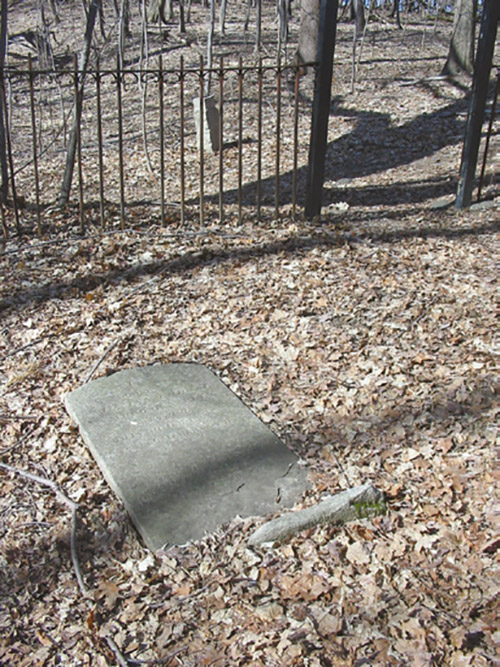
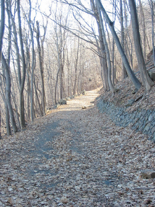
The aqua-blazed Long Path—which will be your route for the first part of the hike—crosses the road near the barricade. Follow the Long Path to the north (left) as it begins to climb the ridge of Hook Mountain. In a short distance, you’ll notice an old cemetery behind an iron fence on the right, with gravestones dating to the 1840s.
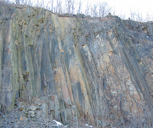
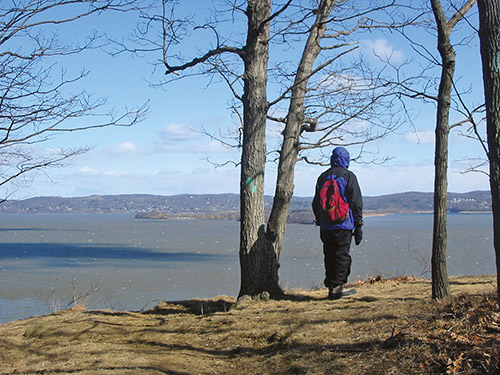
A short distance beyond the cemetery, the climb steepens. As the grade moderates and the trail bends to the left, there is a view over the Hudson River. After reaching the top of the rise, the trail begins a steady descent. Towards the base of the descent, as the trail bends to the left, you’ll come to an unobstructed viewpoint over the river. Croton Point Park juts out into the river on the left, and the Village of Ossining is on the right. Directly below you is the site of a former quarry. Down below, along the river, you can see the Hook Mountain Bike Path, which will be your return route.
After passing a chain-link fence on the right at the base of the descent, the trail resumes its ascent, soon beginning to parallel a stone wall on the left, with tennis courts behind it. Just beyond the end of the wall, where the trail bears left and continues to ascend, a vague, unmarked path leads ahead to another viewpoint over the river.
After reaching the crest of the ridge, the Long Path descends steadily along the east side of the ridge. It then bears left and begins to climb along the west side of the ridge, with the park’s Championship Golf Course visible through the trees on the left. After descending rather steeply, the trail again bears left and climbs to a open rocky area at the crest of the ridge, with several cedar trees. The trail now begins a steep descent, then bends left and soon again begins a gradual ascent.
For the next mile and a half, the Long Path continues along the undulating ridge, with the grades along this section being more gentle than those on the first part of the hike. The trail goes over one peak, passes to the right of a second peak, then climbs to two more peaks. The last peak, elevation 560 feet, is the highest point on this section of Hook Mountain.
After descending from the high point, you’ll reach a three-way trail intersection marked by a cairn. Here, the Long Path turns left, but you should turn right, now following the white-blazed Treason Trail (named for the treason of Benedict Arnold, who handed the plans to West Point to the British agent Major Andre along the shore of the Hudson River at the base of Hook Mountain). Soon, the Treason Trail bears left and begins its descent to the river on switchbacks. Directly below you is the West Shore Railroad, built in 1883 and now operated by CSX. The railroad tunnels through the mountain, and the north portal of the tunnel is only about 150 feet from the trail.
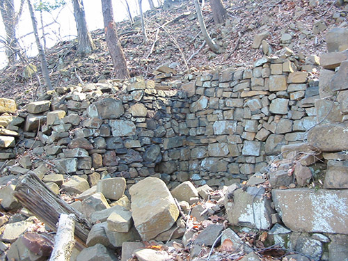
As you approach the river, you’ll pass a ruined stone structure to the right. Just beyond, the white-blazed Treason Trail ends at the Hook Mountain Bike Path, which is paved at this point. An abandoned stone park building is adjacent to the intersection. Turn right and follow the bike path, which continues south along the river as a wide gravel path on a shelf about 80 feet above the water level. You’ll soon pass an abandoned quarry.
Continue along the bike path as it winds along the river, passing ruins of several former structures and two unobstructed viewpoints over the river. After about two miles of pleasant walking, you’ll notice two more old quarries to the right. On the left, at the end of the second quarry, an abandoned road leads down to the river. This is the site of Rockland Landing North. Just beyond, on the right, is another vandalized stone building surrounded by cedar trees. Beyond the stone building, the site of yet another, even larger, quarry is visible on the right.
In another half mile, the bike path descends rather steeply to the river level (this portion of the path is paved). You’re now at the site of Rockland Landing South, where ice from Rockland Lake was once shipped to New York City by boat. You’ll pass some more abandoned buildings and see wooden pilings in the river—the remains of former docks.
Beyond the pilings, the bike path (once again paved) begins to climb, soon reaching a junction with another park road. Turn sharply right, following the sign to “Rockland Lake,” and proceed along the park road past the remnants of the largest quarry in the area and a stone building, now used as a private residence. Continue uphill on the road until you reach the Long Path, where the hike began.
This hiking article is provided by Daniel Chazin of the New York-New Jersey Trail Conference. The Trail Conference is a volunteer organization that builds and maintains over 2,000 miles of hiking trails and publishes a library of hiking maps and books, including a five-map set for Hudson Palisades Trails ($9.95). The Trail Conference’s office is at 600 Ramapo Valley Road (Route 202), Mahwah; 201-512-9348; www.nynjtc.org. Daniel Chazin can be reached at [email protected].