")
")
")
")
")
This easy-to-moderate, 4.6-mile hike follows the Catfish Loop Trail in the southwest section of Fahnestock State Park in Putnam County, New York. The trail is well blazed and easy to follow, and it traverses a less-used area of the park. The hike should take about 3 1/2 hours, and dogs are permitted on leash.
To get there, take the Palisades Interstate Parkway to its end at the Bear Mountain Bridge. After crossing the bridge, turn left and proceed north on N.Y. Route 9D for 8.0 miles to Peekskill Road at the southern end of Cold Spring (just beyond the Boscobel Restoration). Turn right and follow Peekskill Road for 0.5 miles to its terminus at a junction with N.Y. Route 301, then turn right and follow Route 301 for 4.5 miles to its intersection with Dennytown Road. Turn right onto Dennytown Road and continue for 1.2 miles to the second dirt parking area on the left side of the road. GPS address: 295 Dennytown Road, Putnam Valley, NY 10579.
(If coming from east of the Hudson River, take the Taconic State Parkway north to Exit 31A. Turn left at the end of the ramp and proceed west on N.Y. Route 301 for 3.6 miles to its intersection with Dennytown Road. Turn left onto Dennytown Road and continue for 1.2 miles to the second dirt parking area on the left side of the road.)
On the west side of Dennytown Road, just south of the parking area, you will see a sign for the Catfish Loop Trail. Head west into the woods on the white-blazed Appalachian Trail. In a short distance, you’ll reach an intersection with the red-blazed Catfish Loop Trail. Turn left to follow the Catfish Loop Trail in the clockwise direction.
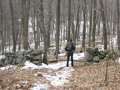
The Catfish Loop Trail immediately crosses a stone wall. You’ll observe many stone walls—which indicate that the area was once used for agricultural purposes—along the hike. In a quarter mile, the trail turns sharply right and crosses a stream. After crossing another stream, the trail begins a steady climb. At the crest of the rise, it passes through a mountain-laurel thicket. The trail then descends to cross yet another stream, and it soon reaches the highest point on this section of the ridge.
After a relatively level stretch, the Catfish Loop Trail crosses the white-blazed A.T. (this junction is marked by a cairn). The trail now proceeds through mountain-laurel thickets and soon begins a steady descent to cross a woods road (blazed yellow as a horse trail). It continues to descend and, in a short distance, crosses a stream on rocks.
The trail now climbs gradually to the most interesting point on the hike, where it goes through a narrow passage between large, lichen-covered boulders. From the top of the boulders, there is a panoramic west-facing view (especially in leaf-off season), with Crows Nest and Storm King Mountains visible on the west side of the Hudson River. You’ve now hiked for nearly two miles, and this attractive spot is a good place to take a break.
Continue ahead on the Catfish Loop Trail, which descends through mountain laurel, climbs a rock outcrop, then descends steeply. The trail crosses several more rock outcrops and passes through dense mountain-laurel thickets. After going by a cliff on the left, the trail bends sharply to the right and begins to head north on a relatively level footpath through mountain laurel.
After crossing a small stream, the trail climbs to a ridge overlooking a valley on the left. It descends a little to cross a wider stream, then goes through a gap in a stone wall and climbs again to a rock outcrop that overlooks the valley. You’ll notice an abundance of rock walls near the trail in this area, and it is hard to believe that this land that appears so inhospitable to settlement was once devoted to agricultural pursuits. In leaf-off season, there are several limited west-facing viewpoints along this section of the trail, with the West Hudson Highlands visible in the distance.
Soon, the trail begins to parallel a stone wall on the left, which marks the park boundary. After a while, the blazes bear right, away from the wall. A short distance beyond, the trail crosses a stream and continues through dense mountain-laurel thickets. It climbs gradually to a rock outcrop from which Duck Pond is visible through the trees on the left. Just north of this outcrop, the trail makes a very sharp bend and nearly doubles back on itself, heading south and then east. Soon, it reaches a large rock outcrop with a view of the valley below on the left.
From the outcrop, the Catfish Loop Trail descends steeply to the valley below, where it crosses a wide stream on rocks. After going over a minor rise, the trail begins a steep, steady climb of about 150 vertical feet. Upon reaching the crest of the ridge, the trail goes down a little, regains the lost altitude and levels off, heading north along the west side of the ridge.
After bending to the right, the Catfish Loop Trail crosses a yellow-blazed woods road—the same horse trail that you crossed earlier in the hike.
The trail now climbs briefly to a rock outcrop, descends steadily through the woods, and climbs once more to reach a junction with the white-blazed Appalachian Trail, completing the loop. Follow the Appalachian Trail uphill to Dennytown Road and the parking area where the hike began.
This hiking article is provided by Daniel Chazin of the New York-New Jersey Trail Conference. The Trail Conference is a volunteer organization that builds and maintains over 2,000 miles of hiking trails and publishes a library of hiking maps and books, including a three-map set for East Hudson Trails ($11.95). The Trail Conference’s office is at 600 Ramapo Valley Road (Route 202), Mahwah. Phone: 201-512-9348, website: www.nynjtc.org. Daniel Chazin can be reached at [email protected].