


This moderate loop hike in the Black River County Park in Morris County traverses the gorge of the wild and scenic Black River—one of the wildest rivers in New Jersey—and passes a waterfall and interesting stone ruins. The hike is 2.5 miles long and should take about two hours (possibly a little longer, if you wish to linger and admire the scenery in the gorge). Dogs are permitted on leash. Part of the route follows a narrow, rocky trail, so care must be exercised, especially when the trail is covered with leaves.
To get to the trailhead, take I-80 to Exit 27A (Somerville) and proceed south on U.S. Route 206 for 8.3 miles to the intersection of County Route 513 (West Main Street) in Chester. Continue south on Route 206 for another 1.4 miles beyond this intersection and turn right onto Pottersville Road (watch carefully for this turn, as there is only a very small street sign at this intersection). Turn left at the next intersection, then turn right and continue on Pottersville Road for 0.9 mile to the entrance to the Elizabeth D. Kay Environmental Center on the right. Follow the entrance road for 0.5 mile to the parking area. GPS address: 200 Pottersville Road, Chester, NJ 07930. GPS coordinates: 40.764231 -74.711459. The trailhead is 53 miles from Teaneck, and it should take about an hour to get there. A map is available online at www.morrisparks.net/index.php/parks/elizabeth-d-kay-environmental-center.
When you reach the parking area, you’ll notice the building of the Kay Environmental Center (one of the components of the Black River County Park). The hike begins just to the left of the Environmental Center, at a small wooden sign for the Bamboo Brook Trail. At first, you’ll be following a blue-blazed spur of the Patriots’ Path (marked by a path-and-tree logo). Follow the blue-on-white logo blazes, which head south, passing to the left (east) of the center, and continue on a wide grassy path between fields, which becomes a grassy woods road.
In 750 feet, you’ll reach a T-intersection. Here, the Patriots’ Path turns left, but you should turn right, now following the Orange Trail, which begins here. The Orange Trail follows a grassy woods road, crossing a field. In another 750 feet, the Yellow Trail begins on the right, but you should continue ahead on the Orange Trail. Just ahead, the Orange Trail turns right and reaches a junction with the other end of the Yellow Trail. Turn left here, continuing to follow the Orange Trail, which now begins to descend on a woods road.
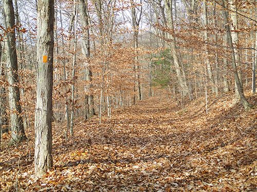
In another 750 feet, turn very sharply left onto the Red Trail. Look carefully for this turn, which is very easy to miss. (If you reach a fork where the Orange Trail bears left, you have gone too far and should retrace your steps.) The Red Trail heads south on a footpath high above the river, with the cascading river below on the right. You’ll be able to hear, but probably not see, the river. Along the way, two unmarked footpaths join from the right; in each case, continue along the Red Trail, which follows a shelf above the river.
In half a mile from its junction with the Orange Trail, the Red Trail joins a grassy woods road which comes in from the left. Continue ahead on this road, still following the red blazes. In a short distance, the road turns sharply right and begins to descend. Just beyond the sharp turn, the Red Trail turns left, leaving the road. You should continue ahead on the road, now following the Green Trail, which begins here.
In 100 feet, you’ll notice on the left a stone chimney and several stone supports for a building that no longer exists. The Green Trail now goes down to the river level, passing rhododendron thickets on the left, and narrows to a footpath. After running along the river for a short distance, the Green Trail climbs a little, then once again descends towards the river, passing attractive cascades.
In a third of a mile, after passing the stone abutments of a former bridge, the Green Trail reaches a curved stone dam across the river, with a waterfall in the center. On the opposite shore are the ruins of a stone building. You’ll want to walk down to the river’s edge to get a better view of these interesting features. The trail now climbs to a shelf above the river and continues to head north, passing more cascades. Soon, the trail moves away from the river.
After crossing the Orange Trail, the Green Trail ends at a junction with the blue-blazed spur of the Patriots’ Path. Turn right onto the Patriots’ Path, which begins to climb. Just ahead, follow the Patriots’ Path as it bears left at a fork. Soon, the trail begins to parallel Chubb Brook (below on the left). The Patriots’ Path now curves right and continues to climb more steeply.
At the top of the climb, the Patriots’ Path reaches a junction in a clearing, marked by signposts. Follow the Patriots’ Path as it turns left, then immediately turns left again at the next intersection. After passing the start of the White Trail on the right, the Patriots’ Path continues along open fields and arrives at the parking area where the hike began.
This hiking article is provided by Daniel Chazin of the New York-New Jersey Trail Conference. The Trail Conference is a volunteer organization that builds and maintains over 2,000 miles of hiking trails and publishes a library of hiking maps and books. The Trail Conference’s office is at 600 Ramapo Valley Road (Route 202), Mahwah; (201) 512-9348; www.nynjtc.org. Daniel Chazin can be reached at [email protected].