This seven-mile moderate hike in Putnam County, New York climbs on the Appalachian Trail to a ridge overlooking the Hudson River and follows former carriage roads along the ridge through dense thickets of mountain laurel. It involves an elevation gain of about 1,000 feet, but most of the elevation gain is relatively moderate. Dogs are permitted on leash. The main route of the hike (which should take about four hours) includes some views over the Hudson River, but an optional mile-long side hike (with a steep gain of 250 feet in elevation) leads to a panoramic viewpoint from the adjacent Sugarloaf Hill.
To get there from Teaneck, take N.J. 4 East to Fort Lee, continue north on the Palisades Interstate Parkway to its end at the Bear Mountain Circle, and cross the Bear Mountain Bridge. At the east end of the bridge, turn left onto N.Y. 9D and proceed north for 4.5 miles to a junction with N.Y. 403. Turn right onto N.Y. 403 and continue for 2.2 miles to Cross Road (just north of the terminus of N.Y. 403 at U.S. 9). Turn left onto Cross Road (a one-block road that leads to U.S. 9) and park along the shoulder of the road. The trailhead is about 50 miles from Teaneck, and it should take about one hour to get there. GPS address: Cross Road, Philipstown, NY 10524.
If coming from Riverdale, follow the Henry Hudson Parkway, which becomes the Saw Mill River Parkway, to Exit 26, and continue north on the Taconic State Parkway for one mile. Take Exit 5 and continue on N.Y. 9A North. When N.Y. 9A ends, continue north on N.Y. 9 for about 13 miles. About 0.2 miles north of its intersection with N.Y. 403, turn left onto Cross Road and park along the shoulder of the road. The trailhead is about 40 miles from Riverdale, and it should take about 50 minutes to get there.
To begin the hike, follow N.Y. 403 or U.S. 9 south to their intersection, just beyond a gas station/convenience store. On the right (west), you will see a kiosk. Turn right and follow the white-blazed Appalachian Trail across a meadow on puncheons. At the end of the meadow, the trail goes through a gap in a stone wall and bears left. Soon, the trail turns right and heads gently uphill on an old carriage road.
In half a mile, after crossing a stream, follow the white blazes as they turn left and begin a steeper climb on switchbacks. (Ahead, the carriage road is the route of the yellow-blazed Carriage Connector Trail, which will be your return route.) Near the top of the hill, turn sharply left, joining another carriage road, as the blue-blazed Osborn Loop Trail begins on the right.
Follow the Appalachian Trail for about a mile along a relatively level carriage road, with a few gentle ups and downs. After a short climb, you’ll notice a cairn and a triple yellow blaze to the right of the trail, marking the start of the Curry Pond Trail. Turn right, leaving the carriage road, and follow the yellow blazes along a footpath.
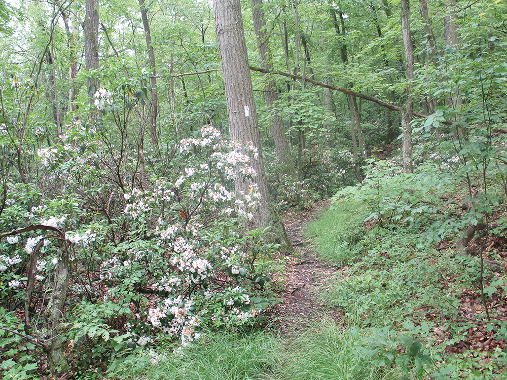
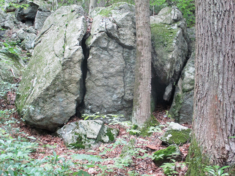
The Curry Pond Trail descends through dense mountain laurel thickets, steeply in places, and passes interesting rock outcrops. At the base of the descent, the trail crosses a stream, turns sharply left, then bears right and climbs a little. Next, the trail descends towards Curry Pond, which often resembles a wetland. It crosses the pond’s inlet stream, skirts the eastern shore of the pond, crosses the outlet stream, and soon ends at a junction with the blue-blazed Osborn Loop Trail.
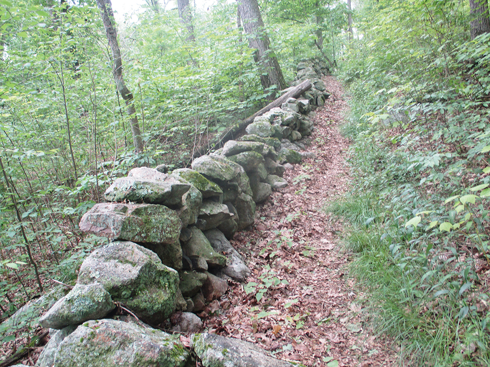
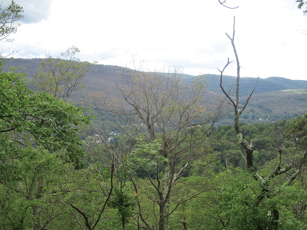
Turn right and follow the Osborn Loop Trail north. The trail briefly follows a carriage road, but soon turns right and descends to cross a stream on large rocks. It continues along the side of Canada Hill and, after crossing a few more streams, bears left and begins to ascend. Soon, the climb moderates as the trail parallels an old stone wall on the left. At the top of the climb, the trail bears right, with views to the left through the trees over the Hudson River.
Follow the blue-blazed trail as it descends from the crest of the ridge, first gently, then more steeply, paralleling a stream. At the base of the descent, the Osborn Loop Trail turns right onto a woods road. It briefly climbs, then continues to descend more gradually through mountain laurel and hemlocks. At the base of the descent, the trail crosses a stream and climbs gently to reach a junction with the red-blazed Sugarloaf Trail, which is ahead and to the left.
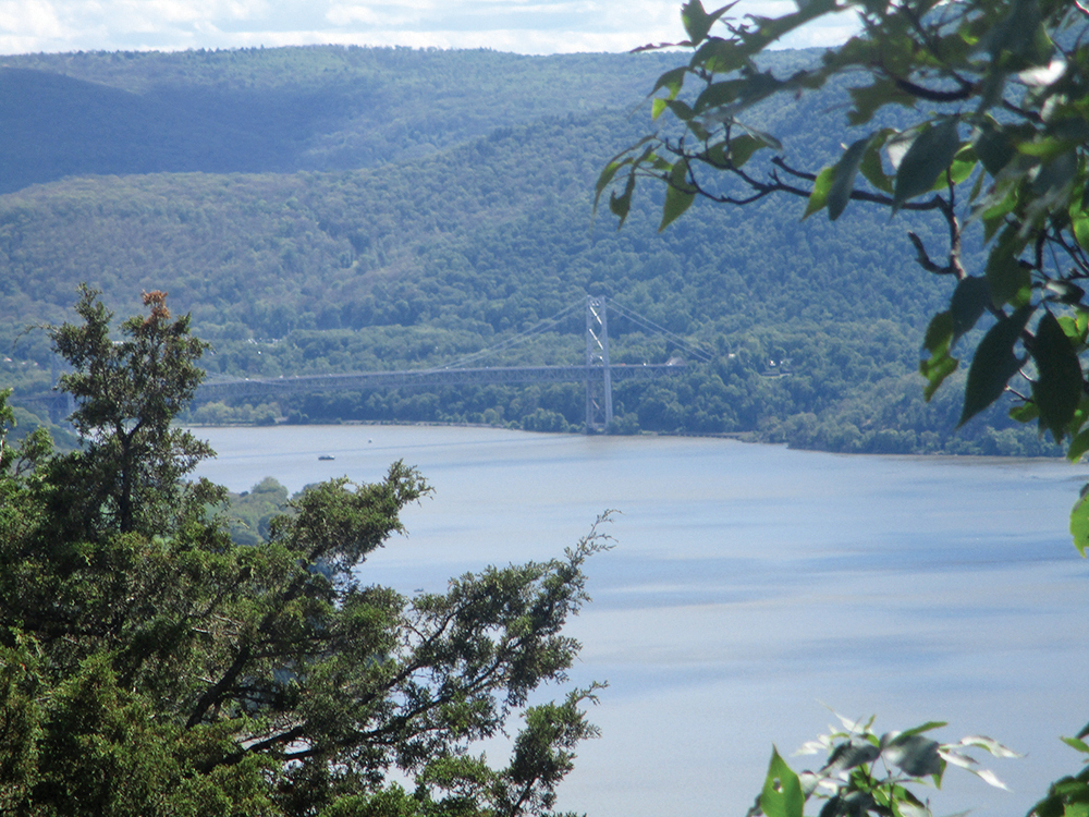
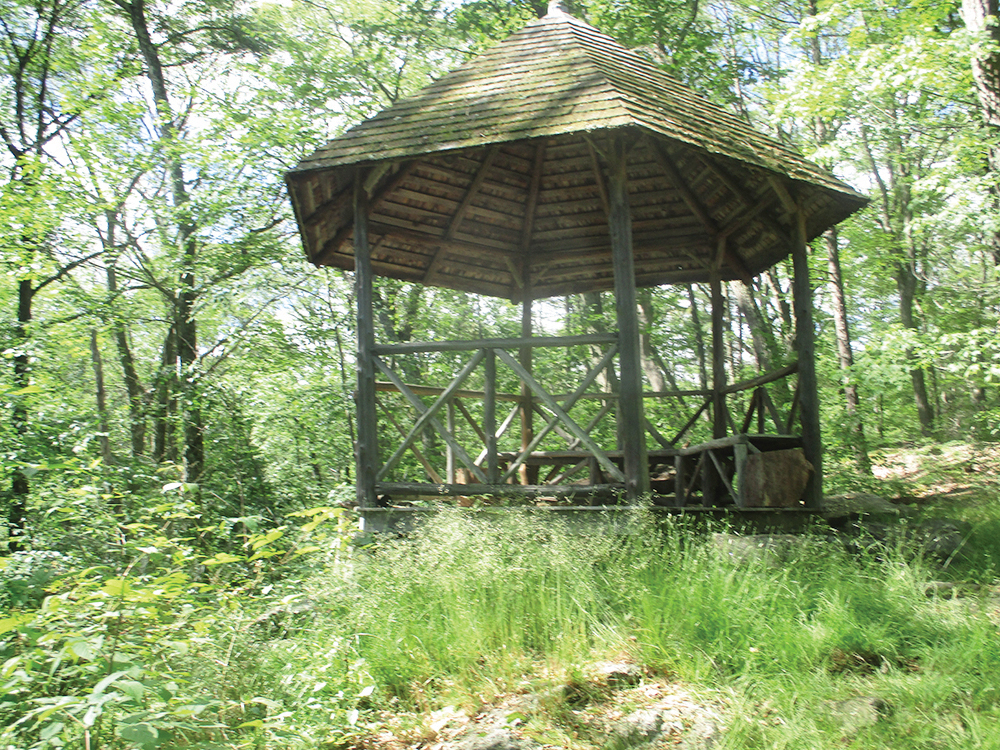
If you’d like to climb Sugarloaf Hill, which involves a steep climb of about 250 vertical feet but affords a great view of the Hudson River and the Bear Mountain Bridge, see the directions below for the “Optional Side Trip to Sugarloaf Hill.” Otherwise, turn right at this junction, continuing to follow the blue-blazed Osborn Loop Trail. You’re now on a wide, well-engineered carriage road, supported by a stone wall on the right. After climbing a little, you’ll notice a rustic gazebo to the left of the trail—another good place to take a break.
Continue ahead on the Osborn Loop Trail, which continues to climb gently. To the right, you’ll notice an area with many young trees. This area was devastated by a severe localized storm in May 2018, which destroyed many mature trees, and is now starting to regenerate.
Just beyond the height of land, you’ll reach a junction. Here, the blue-blazed Osborn Loop Trail turns right, but you should continue ahead on the carriage road, now following the yellow blazes of the Carriage Connector Trail. Bear right at the next junction and continue along the yellow-blazed carriage road. Soon, you’ll pass through stands of hemlock. After bearing right at the next two trail junctions, the trail narrows and goes slightly uphill, passing through mountain laurel and hemlock. It then levels off, passes a wetland on the right, and again widens to a carriage road.
When the Carriage Connector Trail ends at a junction with the white-blazed Appalachian Trail, continue ahead along the carriage road, now following the white blazes. Retrace your steps along the Appalachian Trail until you reach the intersection of Routes 403 and 9, then turn left and continue to Cross Road, where you parked your car.
Optional side trip to Sugarloaf Hill: When you reach the junction with the Sugarloaf Trail, turn left, then immediately turn left again and follow this red-blazed trail steeply up Sugarloaf Hill. After climbing about 250 feet in vertical elevation, the trail bears left and heads southwest along the summit ridge of Sugarloaf Hill, with views over the Hudson River through the trees on the right. The trail goes over the summit and descends a little to a rock outcrop that offers a panoramic south-facing view over the Hudson River, with the Bear Mountain Bridge visible in the distance. After taking in the view, retrace your steps along the Sugarloaf Trail to the junction with the Osborn Loop Trail, and continue ahead (east) along the Osborn Loop Trail, following the directions above. The side trip adds about a mile to the hike and should take about 45 minutes.
This hiking article is provided by Daniel Chazin of the New York-New Jersey Trail Conference. The Trail Conference is a volunteer organization that builds and maintains over 2,000 miles of hiking trails and publishes a library of hiking maps and books. The Trail Conference’s office is at 600 Ramapo Valley Road (Route 202), Mahwah; (201) 512-9348; www.nynjtc.org. Daniel Chazin can be reached at [email protected].


