


This five-mile moderate hike in Pyramid Mountain Natural Historic Area in Morris County goes by two unusual glacial erratics—Tripod Rock and Bear Rock—and reaches several panoramic viewpoints. The hike should take about three hours, and dogs are permitted on leash. A map is available at www.morrisparks.net/index.php/parks/pyramid-mountain-natural-historic-area.
To get there, take Route 4 West to Route 208, and continue on Route 208 to I-287 South. Take Exit 47 (Montville, Lincoln Park), and turn left at the bottom of the ramp onto Main Road (U.S. Route 202). Continue on Main Road as the road makes two sharp turns—first to the left, then to the right. In 0.6 miles, just before reaching a fire station, turn right onto Taylortown Road. Continue on Taylortown Road for 1.8 miles until it ends at Boonton Avenue (County Route 511). Turn right onto Boonton Avenue and continue for 0.7 miles to the entrance to the Pyramid Mountain Natural Historic Area, on the left side of the road, opposite the Mars Park Corporate Center. GPS address: 472 Boonton Avenue, Montville, NJ 07045. The trailhead is about 30 miles from Teaneck, and it should take about 40 minutes to get there.
From the southern end of the parking area, follow the Blue Trail, which starts just north of a kiosk and immediately passes a memorial plaque for Stephen Klein, Jr. In 150 feet, you’ll reach a junction where a branch of the Blue Trail goes off to the right. Continue ahead on the Blue Trail, which crosses Stony Brook on a wooden footbridge. Just beyond, you’ll reach a fork, where the loop of the Blue Trail begins. Bear right at the fork and follow the eastern leg of the Blue Trail, which crosses under power lines and heads north along a nearly constant contour, with huge boulders above on the left and a camp recreation area (with a grassy ballfield, a picnic area and a small pond) below on the right.
In a quarter mile, the Orange Trail begins on the right. Continue along the Blue Trail, which soon bears left and begins to climb rather steeply. At the top of the climb, there is a viewpoint over Turkey Mountain to the east. The trail now heads back into the woods, bears right and descends slightly.
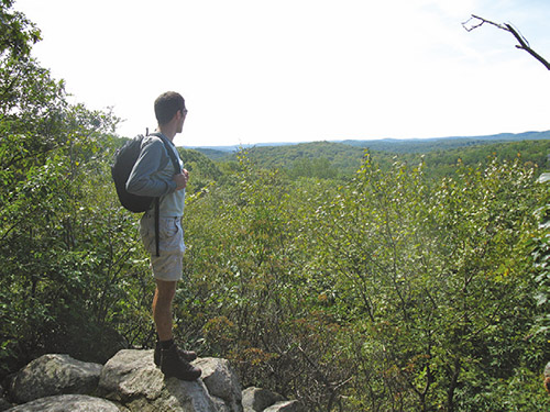
About a mile from the start, the Blue Dot Trail begins on the right. Turn right here and follow the Blue Dot Trail through deep stands of mountain laurel. In a short distance, the Yellow Dot Trail begins on the left. Keep to the right here, and continue along the Blue Dot Trail. In 250 feet, a purple-blazed side trail goes off to the left. Follow this short trail, which leads in a short distance to Lucy’s Lookout, a west-facing viewpoint from open rocks, named for Lucy Meyer, the leader of the fight to save this mountain. After enjoying the view, continue ahead on the purple-blazed trail to its end at the Blue Dot Trail, and turn left onto the Blue Dot Trail.
In less than a quarter mile, you’ll come to Tripod Rock—a huge boulder, perched on three smaller stones. Geologists explain that this boulder was deposited here by glacial action, although some believe that it may be a Native American calendar site. This unusual feature helped galvanize public support to preserve the mountain when it was threatened by development. This is a good place to take a break. When you’re ready to continue, follow the Blue Dot Trail north for 0.4 miles to a junction with the Orange Trail.
Turn left onto this trail, which goes through interesting, remote and rugged mountain scenery. In about a third of a mile, you will see a house directly ahead. Here the trail turns sharply left and climbs to the top of Eagle Cliff. After passing a huge balanced rock on the left—a glacial erratic known as Whale Head Rock—the trail bears left and begins a steep, rocky descent through mountain laurel thickets.
At the base of the descent, the trail turns right and heads north for about 0.2 miles. It then bears left, crosses a branch of Bear House Brook and reaches a junction where the White Dot Trail begins on the right. Turn left to continue along the Orange Trail, following the sign for “Visitors Center,” and cross Bear House Brook on rocks. The Orange Trail continues south, paralleling Bear House Brook, which runs through the valley below to the left and eventually widens to form Bear Swamp.
In another half mile, you’ll reach the huge Bear Rock. This massive glacial erratic, which can be said to resemble a giant bear, has been a local landmark for centuries. It was probably used as a shelter by Native Americans, and today it marks the boundary between Kinnelon Borough and Montville Township.
From Bear Rock, turn left and follow the Yellow Dot Trail across Bear House Brook on a wooden footbridge. A short distance beyond, bear right at a fork to continue along the Yellow Dot Trail. The Yellow Dot Trail climbs through a dense stand of mountain laurel to the ridge of Pyramid Mountain.
When you reach a junction with the Blue Dot Trail, turn right, briefly retracing your steps. A short distance beyond, you’ll reach a junction with the Blue Trail. Bear right and continue ahead on the Blue Trail, which gradually climbs to the highest elevation on the Pyramid Mountain ridge (934 feet), marked by a large cairn. Here, at a sign for the “Overlook,” you should turn left and head to an east-facing overlook from open rocks, with the New York City skyline visible on the horizon on a clear day.
After taking in the view, return to the Blue Trail, bear left, and follow it as it gradually descends the southwest face of the mountain on switchbacks. Near the base of the descent, the Orange Trail begins on the right at a large cairn. Follow the Blue Trail as it turns left, climbs a little, then continues to descend gradually, crossing under the power lines.
At the next intersection, bear right, continuing along the Blue Trail, which crosses a footbridge over Stony Brook and proceeds ahead to the parking area where the hike began.
This hiking article is provided by Daniel Chazin of the New York-New Jersey Trail Conference. The Trail Conference is a volunteer organization that builds and maintains over 2,000 miles of hiking trails and publishes a library of hiking maps and books. The Trail Conference’s office is at 600 Ramapo Valley Road (Route 202), Mahwah; (201) 512-9348; www.nynjtc.org. Daniel Chazin can be reached at DChazin@aol.com.