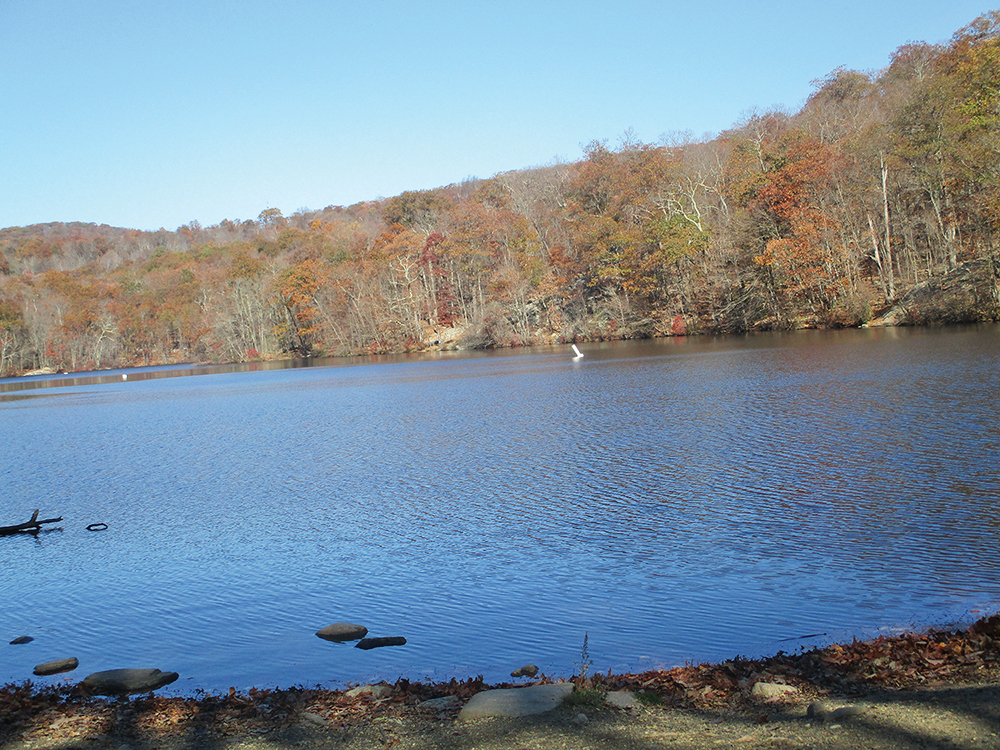
This 4.5-mile loop hike in the Ramapo Valley County Reservation is a good choice for an enjoyable fall hike not far from Teaneck. It begins by paralleling the scenic Ramapo River, then climbs along a stream with a beautiful waterfall to reach the MacMillan Reservoir. After climbing some more, the hike traverses a more remote area of the reservation. It then climbs to a viewpoint from which the New York City skyline can be seen, and it ends by following along the shore of Scarlet Oak Pond.
Rated as moderate, the hike should take about three hours. Although you’ll be climbing about 600 feet in elevation, the grades are gradual, for the most part, and there are no very steep climbs. Dogs are allowed on leash. (This park is a favorite for dog lovers, and you should expect to encounter quite a few people walking their dogs along the way.) A free trail map (without contour lines) is available online at www.nynjtc.org/map/ramapo-valley-county-reservation-brochure-map
To get there, take N.J. Route 17 North to U.S. Route 202 in Mahwah. Turn left at the bottom of the ramp, proceed south on Route 202 for 2.0 miles, and turn right into the Ramapo Valley County Reservation parking area. GPS address: 610 Ramapo Valley Road, Mahwah, NJ 07430. The trailhead is 20 miles from Teaneck, and it should take about 25 minutes to get there.
The hike begins at a kiosk in the southwest corner of the parking area. Just ahead, you’ll notice a triple-black-square-on-yellow blaze on a tree, which marks the start of the Vista Spur Trail. Follow the black-square-on-yellow blazes as they descend wooden steps, join a wide dirt road, and continue ahead to cross the Ramapo River on a steel truss bridge.
Just beyond the bridge, the orange-on-white-blazed River Loop Trail begins on the left. Turn left, leaving the wide gravel road, and follow the River Loop Trail along a narrower footpath, parallel to the shore of the Ramapo River. Since the footpath is in the floodplain of the river, it may be muddy or even flooded in places when the water is high.
Soon, you’ll reach a junction with the black-square-on-orange-blazed River Spur Trail. Turn left onto the River Spur Trail, which continues along the river. After passing a small cascade, the trail bears right, away from the river. It crosses a wet area on rocks and soon ends at a junction with the yellow-blazed Vista Loop Trail. Turn left onto the Vista Loop Trail and cross a stream on a wooden footbridge.
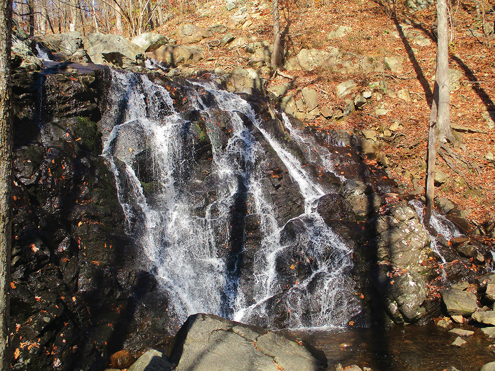
On the other side of the bridge, the trail turns sharply right and follows the cascading stream. Soon, it begins to climb on stone steps, passing an attractive waterfall along the way. This beautiful trail section was built in 2017-18 by an AmeriCorps trail crew of the New York-New Jersey Trail Conference. After passing more cascades and pools in the stream on the right, the Vista Loop Trail levels off, curves to the right, and reaches a junction with the wide park road leading to the MacMillan Reservoir.
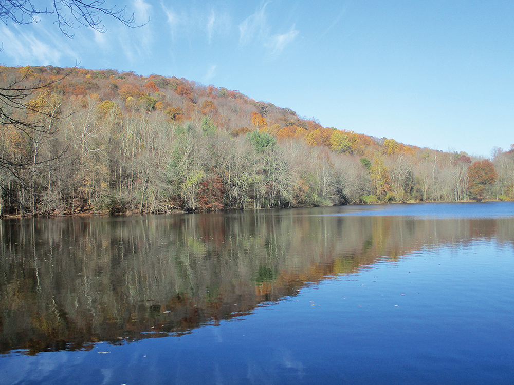
Follow the Vista Loop Trail as it turns left, joining the blue-blazed Ridge Loop Trail, and continues along a paved section of the park road. A short distance ahead, the two trails diverge. The Vista Loop Trail continues ahead (joining the pink-blazed Reservoir Loop, which begins here), but you should bear left to stay on the Ridge Loop Trail. Soon, the trail passes to the left of the concrete-and-stone dam of the MacMillan Reservoir. You’ve gone a little over a mile from the start, and this is a good place to take a break.
Continue heading uphill along the blue-blazed Ridge Loop Trail. You’ll notice triple-red and triple-pink blazes on the sides of the trail, but stay on the blue-blazed Ridge Loop Trail, which soon passes under a canopy of burning bush, an ornamental shrub that features bright red leaves in late autumn. In a third of a mile, the red-blazed Marsh Loop Trail crosses. Continue ahead on the blue-blazed Ridge Loop Trail, which crosses over a stream, descends a little, and levels off. In 750 feet, you’ll reach a fork in the road. Here, the silver-on-red-blazed Rocky Mountain Connector begins on the left, but you should take the right fork, continuing to follow the blue-blazed Ridge Loop Trail.
The Ridge Loop Trail continues to descend. After crossing a stream on two stumps and its tributary on rocks, it ascends gradually, levels off, and descends a rocky section of the road to cross another small stream. The trail now begins a steady climb, which is gradual at first, but soon steepens. As it nears the crest of the rise, the trail bends to the right and levels off, continuing along the ridge. Rocky Mountain and Drag Hill are visible through the trees on the right (when there are no leaves on the trees).
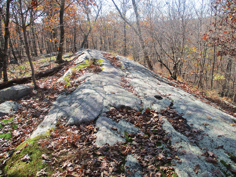
After another short climb, you’ll reach a junction where the Ridge Loop Trail turns right, leaving the road. Follow the blue blazes, which continue on a footpath. (Straight ahead, the road is marked with the purple blazes of the Havemeyer Trail.) Soon, the trail passes to the left of an exposed rock ledge and continues over undulating terrain.
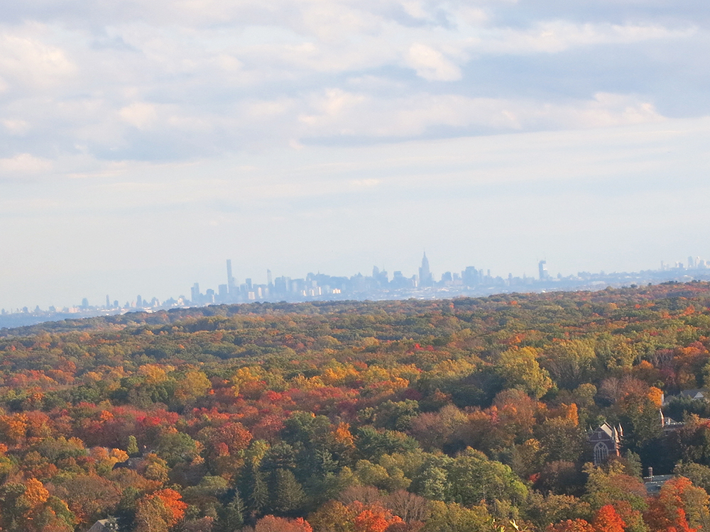
In about half a mile, at the top of a short climb, you’ll begin to see a parallel stone wall to the left. The trail then descends to reach another woods road, the route of the yellow-blazed Vista Loop Trail. Turn right, now following both blue and yellow blazes, and follow the road downhill. In another 500 feet, the yellow blazes turn right. Turn right and follow the yellow blazes for about 200 feet. When the yellow blazes turn sharply right, bear left and continue ahead for another 200 feet, following black-star-on-yellow blazes to a viewpoint over the Ramapo Valley, with Campgaw Mountain visible in the foreground on the right. On a clear day, the Manhattan skyline is visible in the distance. After taking in the view, return to the junction of the yellow and blue trails, turn right onto the blue-blazed Ridge Loop Trail (following the sign “Ramapo Reservation parking lot—1.0 mile”), and descend on a wide, rocky path.
When you reach a fork in a quarter mile, follow the blue blazes, which bear right and continue to descend to the main park road, where a triple-blue blaze marks the end of the Ridge Loop Trail. Here, you should continue ahead, now following the blue/yellow-blazed Vista-Ridge Connector downhill along the park road. On the way down, if there are no leaves on the trees, you can get a glimpse through the trees of the waterfall that you saw earlier in the hike. Near the base of the descent, the Vista-Ridge Connector curves to the right, and it ends at the base of the descent, at a sign to the “Waterfall.” Continue straight ahead on the main park road. (Do not turn right towards the waterfall.) You’re now following the black-square-on-yellow-blazed Vista Spur Trail, which passes to the right of Scarlet Oak Pond, continues across the bridge over the Ramapo River, and ends at the parking area where the hike began.
This hiking article is provided by Daniel Chazin of the New York-New Jersey Trail Conference. The Trail Conference is a volunteer organization that builds and maintains over 2,000 miles of hiking trails and publishes a library of hiking maps and books. The Trail Conference’s office is at 600 Ramapo Valley Road (Route 202), Mahwah; (201) 512-9348; www.nynjtc.org. Daniel Chazin can be reached at DChazin@aol.com.