This 3.2-mile loop hike in the Ramapo Valley County Reservation in Mahwah, Bergen County, New Jersey is a good choice for an enjoyable hike not far from Teaneck — especially if you like to hike along bodies of water. Along the way, you’ll cross a river, skirt a pond, climb to a viewpoint, descend to a reservoir, and follow a brook with cascades and a waterfall.
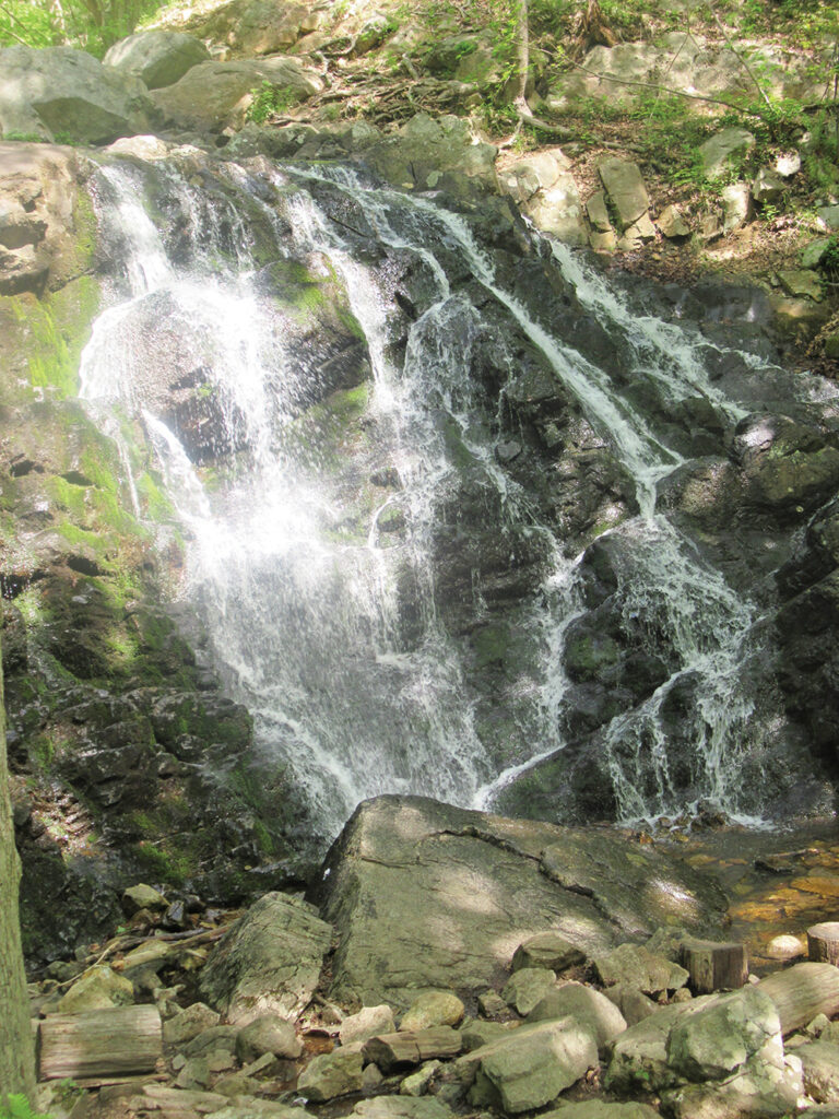
The hike begins by crossing the Ramapo River and following along the shore of Scarlet Oak Pond. You then climb to the Ridge Overlook, from which the New York City skyline can be seen on a clear day. After descending to the MacMillan Reservoir, you’ll follow a footpath along the cascading MacMillan Brook and pass a beautiful waterfall.
Rated as easy-to-moderate, the hike should take about two hours. Although you’ll be climbing about 400 feet in elevation, the grades are gradual. Dogs are allowed on leash. (This park is a favorite for dog lovers and you should expect to encounter quite a few people walking their dogs along the way.) A free trail map (without contour lines) is available online at www.nynjtc.org/map/ramapo-valley-county-reservation-brochure-map.

To get there, take N.J. Route 17 North to U.S. Route 202 in Mahwah. Turn left at the bottom of the ramp, proceed south on Route 202 for 2.0 miles, and turn right into the Ramapo Valley County Reservation parking area. GPS address: 610 Ramapo Valley Rd., Mahwah, N.J. 07430. The trailhead is 20 miles from Teaneck and it should take about 25 minutes to get there.
The hike begins at a kiosk in the southwest corner of the parking area. Just ahead, you’ll notice a triple-black-square-on-yellow blaze on a tree, which marks the start of the Vista Spur Trail. Follow the black-square-on-yellow blazes as they descend wooden steps, join a wide dirt road, and continue ahead to cross the Ramapo River on a steel truss bridge.
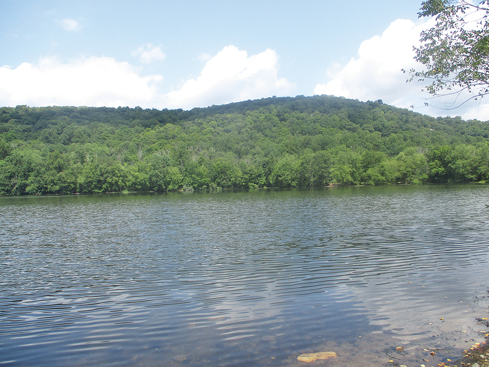
Just beyond the bridge, bear right at the fork and begin to follow the purple-on-white-blazed Pond Trail, a wide dirt path which loops around the northern end of Scarlet Oak Pond. At first, the trail runs between the pond, on the left, and the Ramapo River, on the right. After passing the northeastern end of the pond, the trail bears left, and it again curves to the left at the northwestern end of the pond.
You’ll soon notice a footbridge on the right. Here, the yellow-blazed Vista Loop Trail joins from the right, and you should continue ahead on the wide path, now following both yellow and purple-on-white blazes. At the next intersection, the Pond Loop Trail ends and the Vista Loop Trail bears left, but you should bear right and follow the blue/yellow-blazed Vista-Ridge Connector, which begins here.
The Vista-Ridge Connector curves left and climbs gradually on the main park road. In a third of a mile, you’ll notice on the left a triple blaze that marks the start of the blue-blazed Ridge Loop Trail. Continue ahead on the Ridge Loop Trail (do not turn left) and head uphill on a footpath. Just ahead, the blue blazes turn left onto a woods road, which curves to the right and ascends on a slightly steeper grade.
After curving to the left, the Ridge Loop Trail reaches a fork (with a sign: “Ramapo Reservation Parking Lot — 1.0 mile”). Turn left here and follow the yellow-blazed Vista Loop Trail for about 200 feet. When the yellow blazes turn sharply right, continue ahead, following black-star-on-yellow blazes a short distance to the Ridge Overlook, a panoramic southeast-facing viewpoint from a rock ledge. Campgaw Mountain may be seen in the foreground to the right, and on the left, the New York City skyline is visible in the distance on a clear day.
After taking in the view, retrace your steps to the yellow-blazed trail and turn left, following the trail as it descends steadily. Just before reaching a large pile of boulders, the trail turns right, descends a little, then climbs to a rocky outcrop. The trail now descends towards the MacMillan Reservoir, soon reaching another rocky outcrop (with a view of Matty Price Hill).
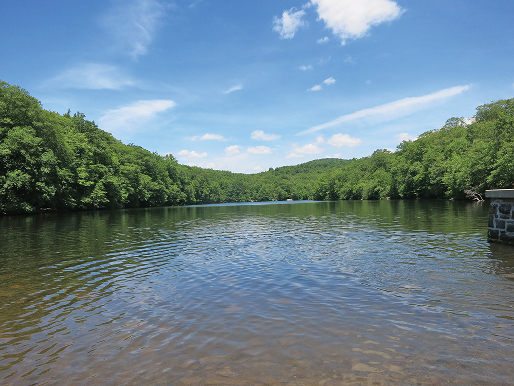
After descending a little more, you’ll emerge onto a large expanse of open rock that overlooks the reservoir. Here, the pink-blazed Reservoir Loop Trail comes in from the right. Turn left and head southeast, parallel to the shore of the reservoir, now following both yellow and pink blazes.
Soon, you’ll come to the concrete dam at the southeast corner of the reservoir (you may wish to walk to the right along the dam to get a broad view of the reservoir). Follow the joint trails downhill to a junction with the main park road. The pink-blazed Reservoir Loop Trail ends here, and the blue-blazed Ridge Loop Trail comes in from the right.
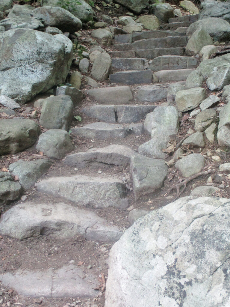
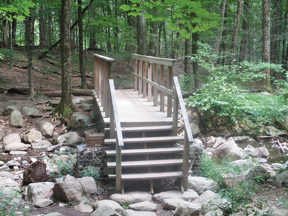
Proceed ahead along the road, now following both blue and yellow blazes. After descending a little (but before reaching a wide bridge over a stream), turn right at a sign for the “waterfall,” leaving the road. Continue to follow the yellow-blazed Vista Loop Trail parallel to MacMillan Brook, with its attractive cascades and pools. Soon, the trail begins to descend on stone steps, passing a waterfall along the way. This beautiful trail section was built in 2017-18 by an AmeriCorps trail crew of the New York-New Jersey Trail Conference. At the base of the descent, the Vista Loop Trail turns left and crosses the brook on a wooden footbridge.
Just ahead, the Vista Loop Trail bears left, as the orange/yellow-blazed River Spur Trail begins on the right. Follow the yellow-blazed trail for another quarter mile to a wide dirt road, where a triple-yellow blaze marks the end of the Vista Loop Trail. Turn right and continue along the wide dirt road parallel to the southern shore of Scarlet Oak Pond, following the black-square-on-yellow blazes of the Vista Spur Trail, then proceed across the bridge over the Ramapo River and climb steps to reach the parking area where the hike began.
This hiking article is provided by Daniel Chazin of the New York-New Jersey Trail Conference. The Trail Conference is a volunteer organization that builds and maintains over 2,000 miles of hiking trails and publishes a library of hiking maps and books. The Trail Conference’s office is at 600 Ramapo Valley Rd.,(Route 202), Mahwah; (201) 512-9348; www.nynjtc.org. Daniel Chazin can be reached at [email protected].