This 2.5-mile easy-to-moderate loop hike in Schooley’s Mountain County Park in Morris County, New Jersey, follows the cascading Electric Brook. It has several scenic waterfalls, passes a panoramic viewpoint and traverses a meadow with wildflowers. Although the park features a large picnic area, a lodge and other developed recreational facilities, the hike passes through wild and undeveloped portions of the park that are far removed from the more heavily used areas. The hike should take about two hours, and dogs are allowed on leash. The park has several large parking areas, which rarely fill up, even on weekends. A free trail map is available online at www.morrisparks.net/wp-content/uploads/2023/04/TrailMap_SM.pdf
To reach the trailhead, take I-80 West to exit 26 (Budd Lake/Hackettstown) and continue on Route 46 West. In 4.8 miles, turn left onto Naughright Road. Follow Naughright Road for 3.4 miles and turn right onto East Springtown Road. Follow East Springtown Road for half a mile to the park entrance, on the left. Continue along the park entrance road to its end, where there are parking areas to the right and left. Turn right and park in the parking area below a large picnic pavilion. GPS address: 91 East Springtown Road, Long Valley, NJ 07853. The park is about 50 miles from Teaneck, and it should take about one hour to get there.
From the kiosk at the southwestern end of the parking area, cross a grassy strip and turn left onto a paved service road. Just before reaching a restroom building on the left and a trail junction (marked by signs for the Patriots’ Path and the Grand Loop Trail), turn right onto a gravel road and descend towards George Lake, bearing right at a fork. Upon reaching the lake, turn left and continue along the lakeshore.
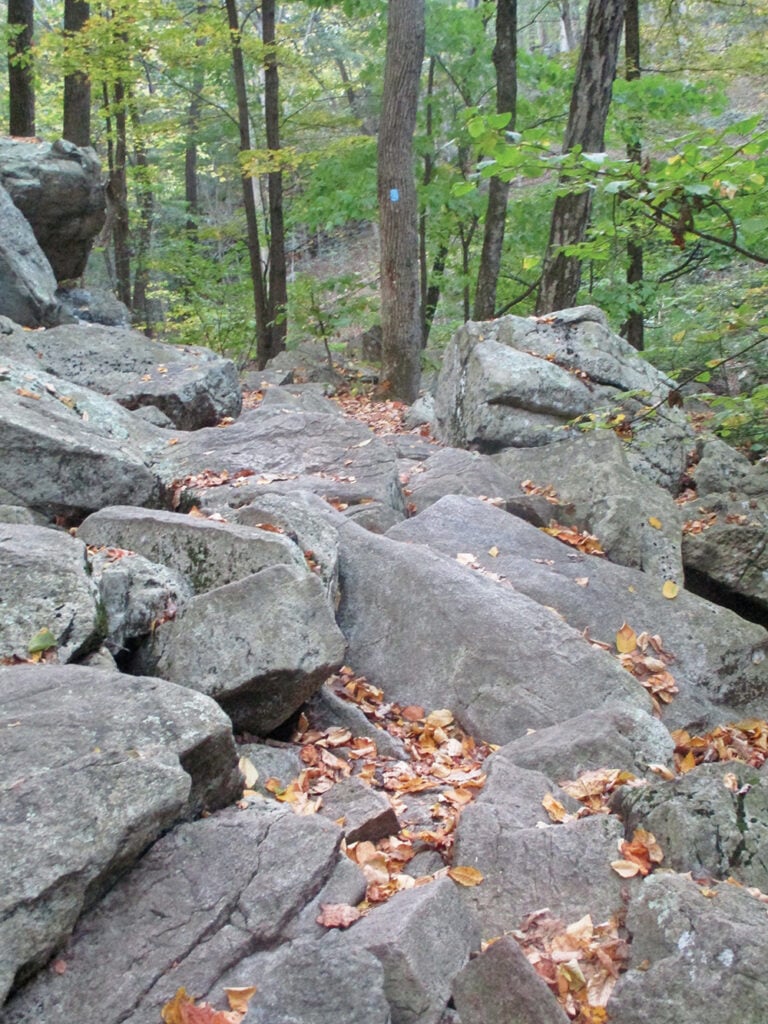
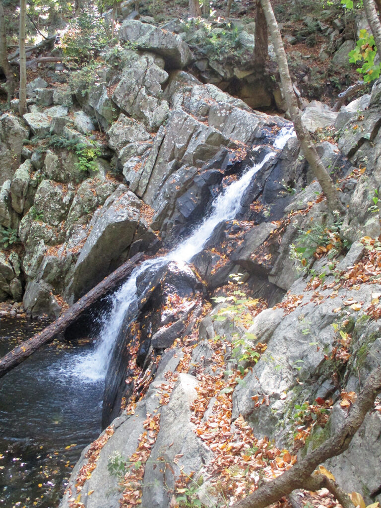
Just beyond the dam at the end of the lake, a triple-blue blaze on a tree marks the start of the Falling Waters Trail. Continue along this trail, which descends into the scenic gorge of Electric Brook, named for a long-abandoned electric generating plant which was powered by the brook (the concrete foundations of the plant are still visible just beyond a small waterfall). This section of the hike is particularly beautiful, but the trail is quite rocky in places.
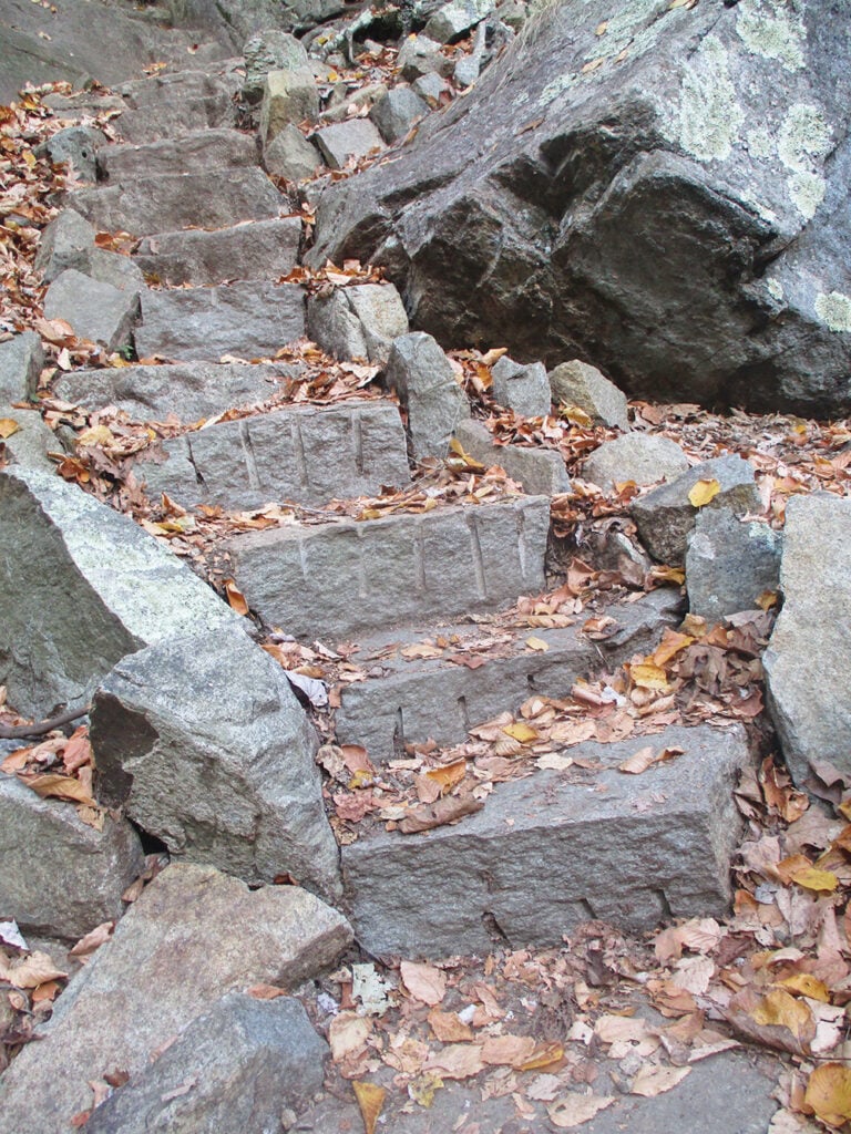
After a short descent on rock steps (built by an AmeriCorps Trail Crew of the Trail Conference in 2021) you’ll pass two attractive waterfalls. This is a good place to take a short break to appreciate the wild and spectacular scenery. A short distance beyond, the trail bears left and climbs out of the gorge, following a woods road (portions of which are severely eroded).
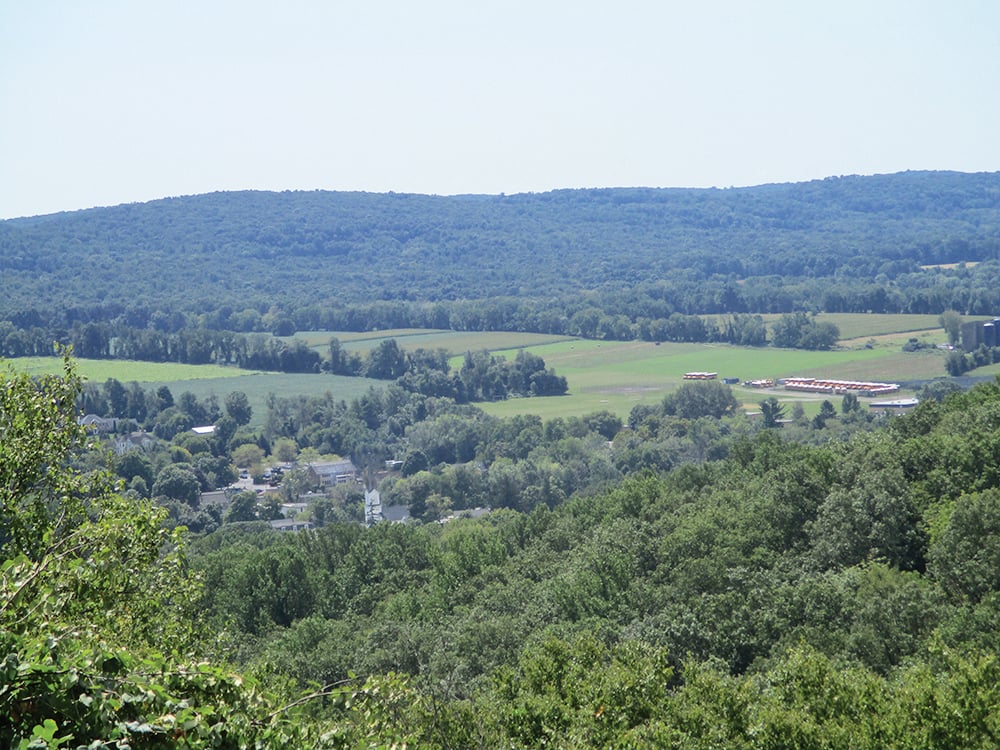
After a steeper climb on a footpath, the blue-blazed trail ends at a junction with the white-blazed Patriots’ Path and the teal-diamond-blazed Highlands Trail. Turn right and follow the Patriots’ Path/Highlands Trail for only about 50 feet. Where the trail makes a sharp left turn, bear right and continue to a south-facing overlook from a rock outcrop. The view is over agricultural lands, with some development in the foreground and hills in the background.
After taking in the view, retrace your steps and bear left onto the Patriots’ Path/Highlands Trail. Continue a short distance beyond the junction with the blue-blazed trail that you just climbed, but when the Patriots’ Path/Highlands Trail turns left at a kiosk, continue ahead on a wide gravel road with pink blazes. Follow this smooth-surfaced road through attractive woodlands to its end at a junction with the Grand Loop Trail (marked by a sign). Here, you should take a short detour on an unmarked path to the right that leads to an interesting rock outcrop, then return to the junction.
Following the arrow that points towards the parking area, turn left onto the yellow-blazed Grand Loop Trail, which soon begins a gradual climb. At the top of the climb, marked by a sign and a kiosk, turn right onto the red-blazed Highland Cut. This trail is a footpath that “cuts across” the ridge of Schooley’s Mountain. It climbs gently to the highest point in the park (elevation 1,102 feet), marked by a rock ledge on the right. Unfortunately, there are no views from this high point, which is in the midst of deep woods.
After traversing a very rocky section, the Highland Cut ends at a junction with the yellow-blazed Grand Loop Trail, here a rocky woods road. Turn left onto the Grand Loop Trail, which descends gradually. At the base of the descent, the trail turns left.
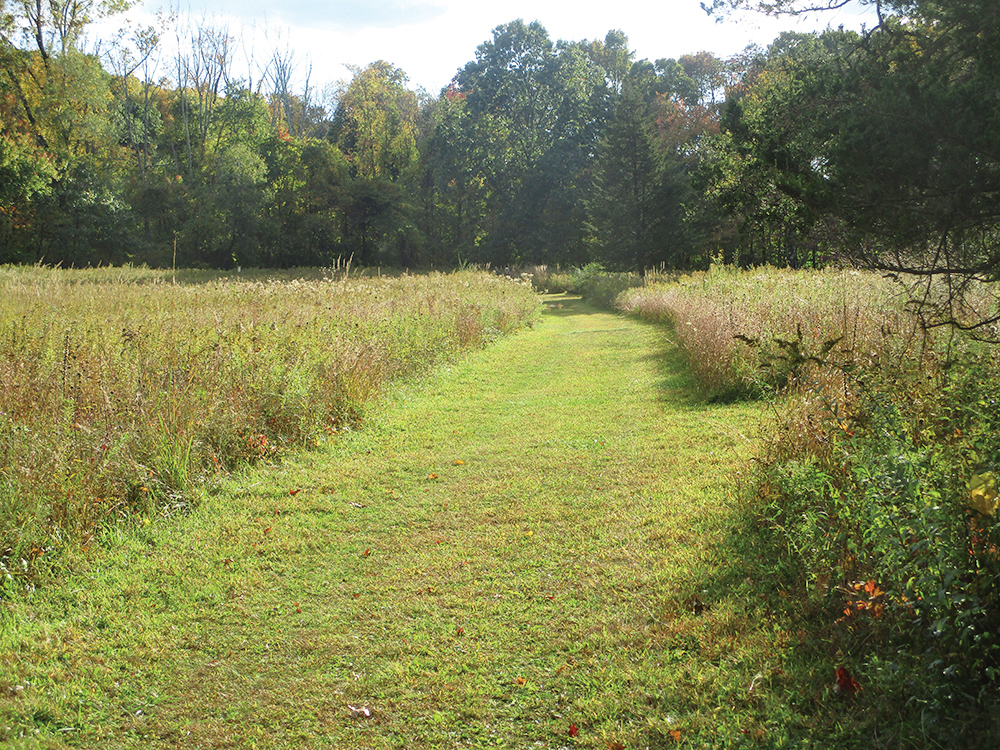
In a short distance, you’ll reach a junction with the orange-blazed Upland Meadow Trail. Turn right onto this trail, which descends on a grassy woods road through barberry thickets. After bearing left and continuing on a gravel road, the trail emerges onto a meadow. Follow a wide mowed path across the meadow, with many beautiful wildflowers in season. At the end of the first meadow, the trail cuts through a patch of woods and continues across a second meadow. Just ahead, the trail ends at the northeastern end of the main parking area. To return to your car, continue across the parking area to its southwestern end.
This hiking article is provided by Daniel Chazin of the New York-New Jersey Trail Conference. The Trail Conference is a volunteer organization that builds and maintains over 2,000 miles of hiking trails and publishes a library of hiking maps and books. The Trail Conference’s office is at 600 Ramapo Valley Road (Route 202), Mahwah; (201) 512-9348; www.nynjtc.org. Daniel Chazin can be reached at [email protected].