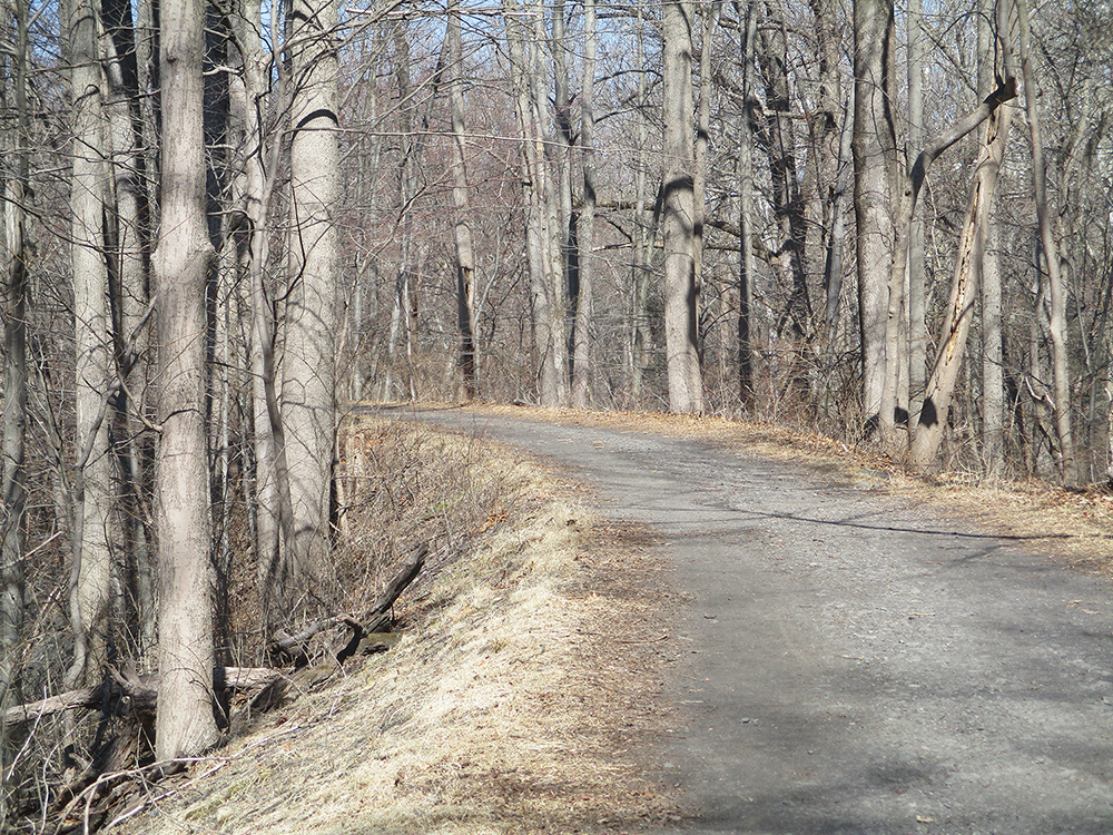
This 8.5-mile, one-way hike (with return by Metro-North train) follows the historic route of the Old Croton Aqueduct, built between 1837 and 1842 to supply water to New York City. Supplanted by two newer aqueducts, the Old Croton Aqueduct was taken out of service in 1955, and subsequently became a state historic park. Although it goes through suburban Westchester County, it follows a pleasant, tree-lined route for most of its way, and its gentle grades appeal to those who are looking for a relatively easy hike.
This hike covers a 7.5-mile section of the Aqueduct, from Tarrytown to Ossining, but including the walk down to the Ossining station and back up from the Tarrytown station, the total length of the hike is about 8.5 miles. You should allow about five hours for the hike (including the return trip by train). Except for green posts with the letters “OCA” at some road intersections and trail junctions, there are few markings along the route, so you should be careful to follow the directions below. Bicycles are permitted on the Old Croton Aqueduct, but the path is quite wide for most of the way,so there is adequate room for bicyclists to pass pedestrians. Dogs are permitted on leash.
To get there from Bergen County, take the Palisades Interstate Parkway north to Exit 4. Turn left at the bottom of the ramp onto US 9W and continue north for 6.3 miles. Bear left onto the New York State Thruway (I-287) South and cross the Governor Mario M. Cuomo Bridge (Tappan Zee Bridge). Take the first exit (Exit 9, Tarrytown). At the top of the ramp, turn right onto South Broadway (US 9). Proceed north on South Broadway for 0.9 mile, then turn right onto East Franklin Street. Find a parking space on East Franklin Street or Grove Street (the next street to the east). GPS address: 9 East Franklin Street, Tarrytown, New York 10591. The trailhead is about 27 miles from Teaneck, and it should take about 45 minutes to get there.
From Riverdale or White Plains, you can take I-87 North or I-287 West to Exit 9 of the New York State Thruway, and then follow the directions above.
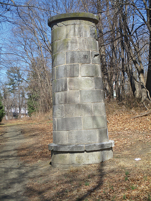
Begin the hike by proceeding north on the route of the Aqueduct, which leaves East Franklin Street a short distance east of South Broadway, and is marked by a green “OCA” post at a macadam driveway. This portion of the route passes between the backyards of adjacent homes. The route is very narrow here, but the right-of-way on which you are walking is part of the state park. After crossing several local streets, you will notice a chimney-like stone tower with the number “13.” These towers, known as ventilators, were constructed along the Aqueduct route about every mile. Their purpose was to keep the water fresh and equalize the pressure along the route.
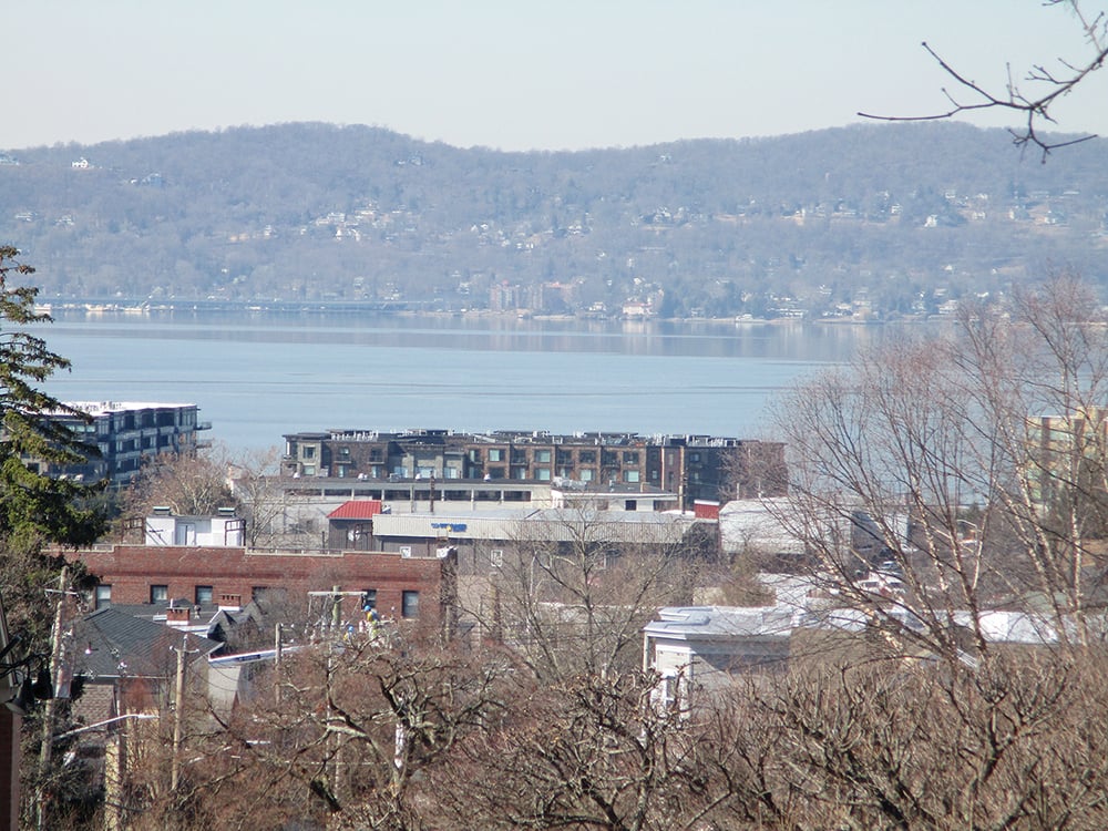
The Aqueduct continues along a high embankment, with intermittent views to the left across the Hudson River. After crossing over Andre Brook, the Aqueduct reaches the spacious grounds of Sleepy Hollow High School. The school has a breezeway across the Aqueduct, so you have to detour around the building. Turn right and follow a paved path along the southern side of the building, then turn left and head north, walking between the building and a chain link fence on the right. At the northern end of the building, turn left onto a paved road, then turn right at a “stop” sign and proceed through a parking lot, with a ballfield on the right and a wooded strip (the actual Aqueduct route) on the left. At the north end of the parking lot, continue past the gate to Bedford Road.
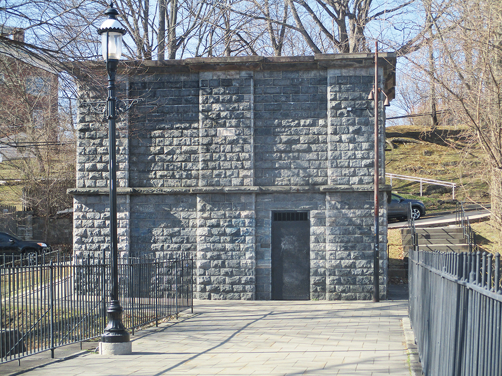
Cross Bedford Road and continue along a grassy embankment. After passing Ventilator #12 and crossing Gory Brook Road diagonally to the left, the trail enters a beautiful wooded section. Below on the left is Douglas Park of the Village of Sleepy Hollow and then the Sleepy Hollow Cemetery. At the northern end of the cemetery, the Aqueduct curves to the left and crosses the Pocantico River on a long embankment, towering 85 feet above the stream. A stone building, known as a weir (which contained large metal gates to regulate the flow of the water) is located just beyond the embankment. On the right, a trail leads into the Rockefeller State Park Preserve.
After briefly paralleling Route 9 and passing through a rock cut, the Aqueduct route is interrupted by the limited access Route 117. Here, the trail goes east along Route 117, turns left and crosses the highway on a steel bridge, then turns left again until it finally regains the Aqueduct route. The trail is bordered for most of the way by high fences, so it is not hard to follow. Upon reaching the historic Aqueduct route, the trail bears right and, in a third of a mile, passes Ventilator #11.
Soon after passing the ventilator, the trail bears left and crosses Route 9 on a steel truss bridge. This road, also known as the Albany Post Road, predates the Aqueduct, so when the Aqueduct was constructed, it passed over the road on a stone arch bridge. But when traffic began to increase, the width of the arch became inadequate, and it was removed in 1924. A new steel truss bridge was constructed in 1998.
The trail continues through a pleasant stretch of woodland walking. After crossing Country Club Lane, it passes between homes, briefly turns right onto a paved driveway, then turns left to regain the Aqueduct route. After passing Ventilator #10, it reaches River Road opposite a school. Here, the Aqueduct route is interrupted by private property.
Turn right onto River Road, then immediately turn left onto the busy Route 9 (Albany Post Road) and follow the narrow grassy shoulder along the west side of the road (facing traffic). In 0.3 mile, at a traffic light, turn right onto Scarborough Road. Continue for two blocks, then turn right onto Long Hill Road. Almost immediately, turn left onto the wide Aqueduct route, which parallels Scarborough Road. The Aqueduct recrosses Scarborough Road diagonally to the right and enters a pleasant wooded section, continuing across an embankment and passing Ventilator #9, with residential buildings below on the left. After passing taller apartment buildings, a swimming pool and tennis courts, the Aqueduct curves sharply to the left, continues through a parking lot, and climbs a macadam path to Highland Avenue (Route 9) in Ossining.
Cross the road, turn right, then bear left and follow a macadam path which skirts a ballfield in a town park. Cross the intersection of Washington and Edward streets and go through another park, with a paved path following straight along the Aqueduct route, then turn right onto Spring Street. You will notice Ventilator #8 on the school grounds to the right. This one is particularly interesting because it is inscribed with the name of the contractor who built this section of the Aqueduct and the date of the construction. Proceed ahead on Spring Street for 0.3 mile to Waller Avenue. Turn right onto Waller Avenue and then left in 50 feet, regaining the route of the Aqueduct. After crossing Maple Place, the Aqueduct route becomes a landscaped brick path. Next, you’ll cross Main Street in the commercial center of the village.
After crossing Main Street, you’ll notice interpretive signs to the left of the trail. You are approaching the Double Arch Bridge across the Sing Sing Kill — one arch carries the Aqueduct; another, below, carries Broadway over the stream. Cross the Double Arch Bridge and reach a stone weir, built in 1882.
The Aqueduct route now crosses Aqueduct Street, climbs a flight of steps, and continues on a macadam path through a park. Cross North Malcolm Street and continue to follow the Aqueduct route, passing brick-and-stone ruins on the left. At the next street (Van Wyck Street), turn left (leaving the Aqueduct route) then immediately turn left again onto Snowden Avenue and follow it downhill for 0.4 mile. At the base of the hill, turn left onto Water Street and follow it to Main Street, then turn right and continue to the Ossining Metro-North station, where southbound trains to Tarrytown leave at least every half hour (for schedules, go to www.mta.info). Be sure to sit on the right side of the train to enjoy beautiful views of the Hudson River! The train ride takes only eight minutes. When you arrive in Tarrytown, proceed to the southern end of the station and follow Franklin Street up the hill and across South Broadway to where you started the hike.
This hiking article is provided by Daniel Chazin of the New York-New Jersey Trail Conference. The Trail Conference is a volunteer organization that builds and maintains over 2,000 miles of hiking trails and publishes a library of hiking maps and books. The Trail Conference’s office is at 600 Ramapo Valley Road (Route 202), Mahwah; (201) 512-9348; www.nynjtc.org. Daniel Chazin can be reached at [email protected].