


This 2.5-mile moderate hike traverses two preserved tracts on the western slope of the Palisades—the 84-acre Rockleigh Woods Sanctuary, located in the Borough of Rockleigh, which purchased it in 1975; and the 134-acre Lamont Reserve, located in the Borough of Alpine, and purchased jointly by the County of Bergen, the Borough of Alpine and the Borough of Rockleigh in 1996. Both tracts were formerly part of Camp Alpine of the Greater New York Councils, Boy Scouts of America. The hike should take about one and one-half hours. A map is available at www.nynjtc.org/map/rockleigh-woods-lamont-reserve-trail-map.
To get there, take the Palisades Interstate Parkway to Exit 4. Turn left at the bottom of the ramp onto Route 9W (if coming from the north, turn right onto Route 9W) and proceed for 1.1 miles, entering New York. At the next traffic light, turn left onto Oak Tree Road and, in 0.2 mile, turn left onto Closter Road. In 0.5 mile, after crossing under the Parkway, you reenter New Jersey, and the road becomes Rockleigh Road. Continue for another 0.2 mile to the Rockleigh Municipal Building and turn left into the driveway. Park in the rear of the building. GPS address: 26 Rockleigh Road, Rockleigh, NJ 07647.
From the parking area, follow a handicapped-accessible path past a playground to a kiosk, which marks the start of the blue-blazed Hutcheon Trail. Follow this trail into the woods. In a short distance, you’ll notice two sets of triple yellow blazes. These mark the start of the yellow-blazed Sneden-Haring-Lamont Trail. Continue ahead, now following both yellow and blue blazes.
When the two trails diverge, turn left to continue on the yellow trail, which immediately crosses a wet area on rocks and begins to climb along an old woods road. After crossing a brook on rocks, the road becomes deeply eroded, and the trail has been relocated to a parallel route.
In about half a mile, the yellow trail rejoins the old road, passes the upper end of the red-on-white-blazed Roaring Ravine Trail, and crosses Roaring Brook on rocks. Just beyond, at a junction with the white-blazed Lamont Rock Trail, follow the yellow trail as it turns right, leaving the road. The white and yellow trails are coaligned for about 50 feet. When the trails diverge, bear left to continue along the white trail, which follows a footpath through the woods, climbing gradually. Near the crest of the rise, the white trail turns sharply right at a T-intersection and is joined by the Red Circle Trail of Camp Alpine, Greater New York Councils, Boy Scouts of America.
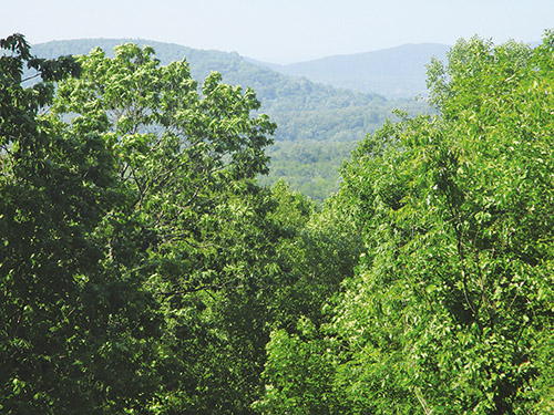
Follow the joint white and red trails as they climb rather steeply on a footpath to the highest point in the preserve (480 feet), from where there is a northeast-facing view through the trees. Here, the trails turn left and begin to descend. Just before passing Lamont Rock (a huge boulder) on the right, the Red Circle Trail leaves to the left, but you should bear right and continue to follow the white trail, which descends steadily.
Further down the hill, the white trail passes between two old stone cisterns. Just beyond the second cistern, the trail turns sharply right and descends to a T-intersection. Here, the white trail turns right, but you should turn left onto the yellow-blazed Sneden-Haring-Lamont Trail, which soon approaches the southern boundary of the sanctuary. The yellow trail now curves to the right and descends gradually, crossing a brook along the way. In a short distance, it bears right again and begins to head north.
The yellow trail parallels the sanctuary’s boundary, crossing several small brooks on rocks. When it reaches the wider Roaring Brook, it turns right, parallels the brook for a short distance, then turns left and crosses the brook on rocks. The blue trail briefly joins here, but you should continue ahead on the yellow trail, which makes several turns. When the yellow trail ends at a triple blaze, turn left and follow the blue trail back to the parking area where the hike began.
This hiking article is provided by Daniel Chazin of the New York-New Jersey Trail Conference. The Trail Conference is a volunteer organization that builds and maintains over 2,000 miles of hiking trails and publishes a library of hiking maps and books. The Trail Conference’s office is at 600 Ramapo Valley Road (Route 202), Mahwah; (201) 512-9348; www.nynjtc.org. Daniel Chazin can be reached at [email protected].