


This 5.4-mile moderate-to-strenuous hike, in the southern section of Harriman State Park, parallels several cascading streams and passes many interesting rock formations. It also climbs to a few viewpoints, and on a clear day you can even see the New York City skyline. There are several steep climbs, and the total elevation gain is over 800 feet. Dogs are permitted on leash. The hike should take about four hours.
To get there, take N.J. Route 17 north to the New York State Thruway and take the first exit, Exit 15A (Sloatsburg). Turn left at the bottom of the ramp onto N.Y. Route 17 north, and continue through the Village of Sloatsburg. Just past the village, turn right at the traffic light, following the signs for Harriman State Park and Seven Lakes Drive. Cross an overpass over railroad tracks and continue along the Seven Lakes Drive, passing under the Thruway overpass, and soon entering Harriman State Park. Proceed for another mile (from the Thruway overpass) to the Reeves Meadow Visitor Center, on the right side of the road. Park in the Visitor Center’s parking lot. If the parking lot is full, you can park in another lot about 500 feet further along Seven Lakes Drive, or along the eastern shoulder of the road. (Make sure that your car is entirely beyond the white line on the side of the road.) GPS address: 100 Seven Lakes Drive, Sloatsburg, NY 10974. The trailhead is 25 miles from Teaneck, and it should take about 30 minutes to get there.
From the parking lot, head east (left when facing the woods) on the broad red-on-white-blazed Pine Meadow Trail, passing the Visitor Center on the left. In about 300 feet, you’ll notice a white-blazed trail that begins on the right. Turn right onto this trail, known as the Reeves Brook Trail, which follows a woods road uphill. Soon, the trail begins to parallel Reeves Brook, which is to the left.
In half a mile, another woods road leaves to the right. A short distance beyond, follow the white-blazed trail as it bears left and begins a steeper climb on a footpath, passing attractive cascades in the brook (when the water is high). After a level section, the trail bears left and continues to climb through mountain laurel thickets. It next proceeds over undulating terrain, climbing gradually (but steeply in places), with several short descents, and continuing to parallel the brook.
About a mile and a half from the start, you’ll notice a steep escarpment just ahead. Here, you’ll cross the blue-on-white-blazed Seven Hills Trail and continue ahead on the white-blazed Reeves Brook Trail, which now runs parallel to the escarpment. After a short descent, the Reeves Brook Trail ends at a junction with the black-on-white-blazed Raccoon Brook Hills Trail.
Turn left onto the Raccoon Brook Hills Trail, which briefly descends to cross a stream on rocks and then steeply climbs the escarpment. The trail continues along the ridge and soon reaches a southwest-facing viewpoint from a rock ledge over the Torne Valley, with the New York Thruway beyond. After a short climb, the trail emerges onto another rock ledge, with several pitch pines. This ledge—with a large rock that juts out, known as The Pulpit—also affords a southwest-facing view. After a short descent, the trail climbs to reach a junction with the orange-blazed Hillburn-Torne-Sebago Trail on an open rock ledge.
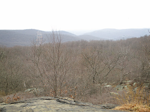
Continue ahead on the Raccoon Brook Hills Trail, which continues to climb more gradually to a wooded area on the crest of the ridge. The elevation here is about 1,230 feet above sea level, and you’ve climbed about 800 feet to reach this ridge—the highest point on the hike. On a clear day, you can see the New York City skyline in the distance from a rock ledge to the right of the trail.
The trail descends to cross the route of a gas pipeline and climbs to regain the ridge. After a level stretch, it begins a rather steep descent. At the base of the descent, the trail bears right and climbs gently through dense stands of mountain laurel. It then descends gradually to a junction with the white-blazed Kakiat Trail.
Turn left at the junction and follow the Kakiat Trail, which descends gradually, passing through more dense stands of mountain laurel and then paralleling Raccoon Brook, on the right. In about half a mile, you’ll pass the northern trailhead of the Raccoon Brook Hills Trail on the right. Continue ahead on the Kakiat Trail, which soon widens into a woods road.
Soon, you’ll reach a junction with the Seven Hills Trail (blue on white) and the Pine Meadow Trail (red on white), which come in from the right. Here, the Kakiat Trail turns right, but you should leave the Kakiat Trail and continue straight ahead on the joint Seven Hills/Pine Meadow Trails. (Do not cross the bridge over Pine Meadow Brook.) When the Seven Hills Trail leaves to the left, continue ahead on the red-on-white-blazed Pine Meadow Trail. You will take the Pine Meadow Trail all the way back to the parking area.
A short distance beyond, the orange-blazed Hillburn-Torne-Sebago Trail briefly joins. Continue ahead on the Pine Meadow Trail. Soon, you’ll reach a section where the woods road has eroded, and the trail has been relocated onto a footpath to the left.
After crossing a gas pipeline and then Quartz Brook on a wooden bridge, the Pine Meadow Trail reaches a junction where the yellow-blazed Stony Brook Trail begins on the right. Continue to follow the Pine Meadow Trail as it bears left and begins to run close to Stony Brook, with its attractive cascades. To bypass a wet spot at the crossing of a tributary stream, the trail has been relocated to the hillside on the left, where it crosses another wooden bridge. Just beyond, you’ll come to the Reeves Meadow Visitor Center and the parking lot where the hike began.
This hiking article is provided by Daniel Chazin of the New York-New Jersey Trail Conference. The Trail Conference is a volunteer organization that builds and maintains over 2,000 miles of hiking trails and publishes a library of hiking maps and books. The Trail Conference’s office is at 600 Ramapo Valley Road (Route 202), Mahwah; (201) 512-9348; www.nynjtc.org. Daniel Chazin can be reached at [email protected].