
This 4.7-mile moderate-to-strenuous loop hike in Harriman State Park (Rockland County, New York) climbs to two panoramic viewpoints—Almost Perpendicular and Claudius Smith Rock, passing through an interesting rock crevice along the way. The hike, which should take about three and one-half hours, involves an elevation gain of about 800 vertical feet, and there are places where you will need to use both your hands and your feet to climb over rocks. Dogs are permitted on leash.
To reach the trailhead from Teaneck, take NJ Route 4 West to NJ Route 17, and continue on Route 17 North to the New York State Thruway. Bear left at the fork (following I-87 towards “Albany”) and take the first exit, Exit 15A (Sloatsburg). Turn left at the bottom of the ramp onto NY Route 17 North, and continue for 2.5 miles through the Village of Sloatsburg. Just past the village, turn right at the traffic light, following the sign for Seven Lakes Drive/Harriman State Park. Cross an overpass over railroad tracks and continue along Seven Lakes Drive for 0.7 mile, passing under the Thruway overpass. Just before a sign indicates that you are entering Harriman State Park, turn left, then immediately turn right onto Johnsontown Road. Proceed for 1.2 miles to the end of the road and park at the cul-de-sac. GPS address: 200 Johnsontown Road, Sloatsburg, NY 10974. The trailhead is about 25 miles from Teaneck, and it should take about 40 minutes to get there.
To begin the hike from the cul-de-sac, walk back on Johnsontown Road, crossing a bridge over a stream. About 100 feet west of the bridge, you will see three blue-on-white blazes on a tree, which mark the start of the Blue Disc Trail. Turn right and follow this trail up a paved road, passing a huge boulder on the left and crossing the route of a gas pipeline.
Soon, you’ll notice on the right a pumping station for the pipeline. Here, the Blue Disc Trail turns left onto a footpath and begins to climb parallel to the pipeline. Soon, it bears left onto a woods road. Then, in another 0.3 mile, the Blue Disc Trail bears right at a fork and continues along a narrower woods road. Just ahead, the white-blazed Kakiat Trail joins for a short distance, but you should continue to follow the blue-on-white blazes.

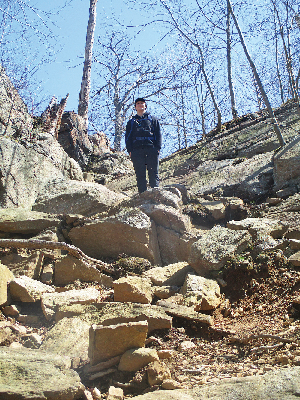
The Blue Disc Trail now begins a steep climb along the woods road. On the way up, it climbs rock steps, crosses an intermittent stream, and bears right. Further along, it crosses a wider stream on rocks, then turns right and climbs even more steeply. Finally, the trail reaches the top of the cliff known as Almost Perpendicular, with panoramic views. You can see Seven Lakes Drive directly below, and the Ramapo Mountains are in the background.
You’ll want to rest here from your steep climb and enjoy the views. When you’re ready to continue, bear left and follow the blue-on-white trail northward. After a level stretch and a slight descent, the trail climbs steeply up Pound Mountain and continues along the summit ridge. It crosses the route of another gas pipeline and soon begins to descend.
At the base of the descent, the trail crosses a woods road and a stream, and it begins to run along the foot of a rock ledge. After going through a narrow passage between rocks (this passage can easily be bypassed to the left), the trail passes by a large overhanging rock, begins to parallel a stream on the left, and proceeds through a narrow rock crevice known as the “Elbow Brush.”
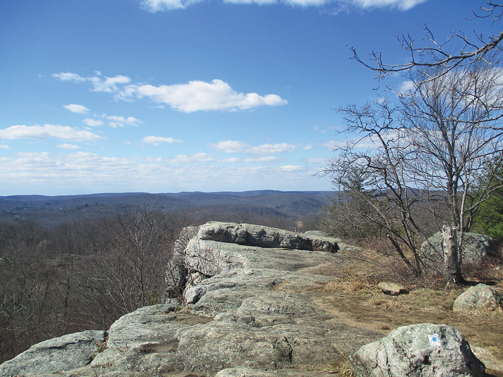
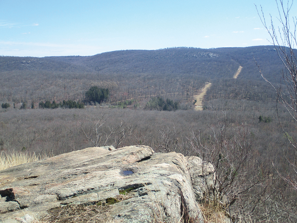
The Blue Disc Trail passes to the right of a swamp and climbs to intersect the red-dash-on-white-blazed Tuxedo-Mt. Ivy Trail. Continue ahead, still following the blue-on-white blazes, and you’ll soon reach the top of another dramatic cliff—Claudius Smith Rock. Claudius Smith, after whom this rock formation is named, was a thief who was reputed to have used the caves at its base as a hideout during the Revolutionary War. He was captured by an officer of the Continental Army and hanged at the jail in Goshen in 1779. The view from the top of Claudius Smith Rock extends west to the village of Tuxedo. You’ve now hiked for two miles, and this is another good place to stop and take a break.
After taking in the view, retrace your steps to the junction with the Tuxedo-Mt. Ivy Trail, and turn left (east), following the red-dash-on-white blazes. Just ahead, the White Cross Trail begins on the left, but you should continue ahead on the Tuxedo-Mt. Ivy Trail. The trail descends gradually, making a horseshoe turn at the base of the descent to skirt a swamp to the left of the trail. It then climbs over a low ridge and descends through a rocky area to cross several branches of Spring Brook and reach a junction with the White Bar Trail, which comes in from the left.
Continue ahead on a woods road, now following both the red-dash-on-white blazes of the Tuxedo-Mt. Ivy Trail and the horizontal white blazes of the White Bar Trail. After passing a marsh on the right, the Tuxedo-Mt. Ivy Trail leaves to the left, but you should continue ahead along the woods road, following the White Bar Trail.
After descending through mountain laurel, the White Bar Trail turns right just before reaching Seven Lakes Drive. Take care to follow the horizontal white blazes, which briefly join several woods roads. After once again approaching Seven Lakes Drive, the trail bears right and joins the Old Johnsontown Road—once an extension of the paved road on which you drove to the trailhead, but abandoned in 1962 when the parallel Seven Lakes Drive was completed. You’ll soon notice a stone wall on the left—a remnant of a former farm. The Kakiat Trail also has blazed white crosses, but you should continue along the dirt road, following the horizontal white blazes of the White Bar Trail. In a third of a mile, you’ll reach the cul-de-sac where you began the hike.
This hiking article is provided by Daniel Chazin of the New York-New Jersey Trail Conference. The Trail Conference is a volunteer organization that builds and maintains over 2,000 miles of hiking trails and publishes a library of hiking maps and books. The Trail Conference’s office is at 600 Ramapo Valley Road (Route 202), Mahwah; (201) 512-9348; www.nynjtc.org. Daniel Chazin can be reached at [email protected].


