This 4.1-mile lollipop-loop hike climbs to the summit of High Mountain in Wayne, New Jersey, the highest mountain along the east coast (south of Maine) from which the Atlantic Ocean can be seen. High Mountain is part of the Preakness Range of the Second Watchung Mountain, which is formed of basalt rock of volcanic origin. Its summit offers panoramic views over northeastern New Jersey, with the New York City skyline on the horizon. Much of this moderate hike follows woods roads. The hike should take about two and a-half hours, and dogs are permitted on leash.
A trail map is available at www.nynjtc.org/sites/default/files/HighMountain_TNCtrailmap2017.pdf
To reach the trailhead, take N.J. Route 4 West to Route 208 North. Follow Route 208 for 4.5 miles to the second Goffle Road exit (towards Hawthorne/Paterson) and turn right at the end of the ramp. At the next light, just beyond the intersection with Goffle Hill Road, turn right onto North Watchung Drive. In 0.4 mile, at a stop sign at the top of the hill, turn sharply right onto Rea Avenue Extension, which becomes North Haledon Avenue and then Linda Vista Avenue. At a T-intersection with Terrace Avenue, turn right, then bear left to continue on Linda Vista Avenue. After crossing High Mountain Road, the name of the street changes to Overlook Avenue. Continue ahead into William Paterson University (Entry 6). At the next “stop” sign, turn right and continue for 0.4 mile to a small parking area on the right, with a sign “High Mountain Park.”

GPS address: 100 University Drive, Wayne, NJ 07470. The trailhead is about 15 miles from Teaneck, and it should take about 25 minutes to get there.
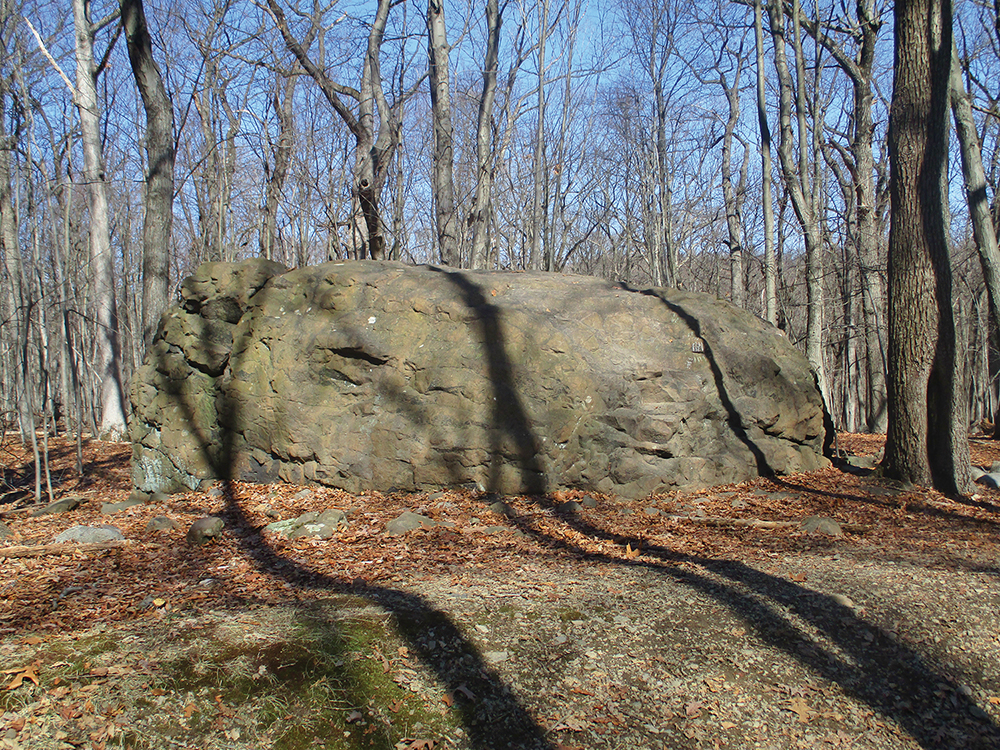
From the kiosk near the entrance to the parking lot, follow a gravel path across an open area that heads northeast, parallel to University Drive. At the edge of the woods, you’ll notice a brown post which marks the start of the red-blazed Woodland Trail. Follow the trail into the woods. The trail soon reaches a junction where it bears right, passing a huge boulder on the left. Just beyond, the Woodland Trail reaches a T-intersection, where it turns left onto another woods road.
In another half mile, you’ll reach a high point on the trail, where a bench has been placed. Here, a sign and a triple-yellow blaze on a tree mark the start of the yellow-blazed Summit Trail (This point is also marked by a green sign as Location 2.) Turn right onto the Summit Trail, which descends to a T-intersection, where you turn right. After crossing a small stream on rocks, the trail turns left at a sign for Location 3. It now begins to head north, passing just west of the low ridge known as Mt. Cecchino.
At a sign for Location 4, the trail bears right at a fork. Then, after following the Summit Trail for about two-thirds of a mile, the trail curves sharply to the left, crosses a small stream, and begins a steady climb to the summit of High Mountain along a rocky woods road. Near the top, the trail bears left onto a footpath, bypassing an eroded section of the road.
Just below the summit, the footpath rejoins the woods road at the Star of Hope (maintained by the Borough of North Haledon). Here, on the right, there is a panoramic east-facing viewpoint. On the horizon, beyond the suburban sprawl of northeastern New Jersey, you can see the New York City skyline. Through the trees on the right, you may be able to see the Verrazano-Narrows Bridge and even a corner of the Atlantic Ocean. Continue up to the summit, which resembles a grassy southern bald, with a few large exposures of basaltic bedrock.

When you’re ready to continue, head northwest across the broad summit, following the yellow blazes on rocks, and continue downhill on the Summit Trail. Be careful to follow the yellow blazes, as several paths and woods roads lead down the mountain. The Summit Trail crosses a secondary summit, levels off, then bears left at a fork (at a sign for Location 6) and descends steeply on an eroded woods road.
Near the base of the descent, be alert for a sharp left turn (Location 7) where the yellow blazes turn left, leaving the woods road, and continue on a footpath. The Summit Trail now descends to a stream, bears left to parallel it, then bears right and crosses the stream on rocks. About 250 feet beyond the stream crossing, you’ll reach a woods road (with a sign providing trail mileages, as well as a green sign marking Location 8).
Turn left onto the road, the route of the red-blazed Woodland Trail, and head south. You’ll pass through an area which is often wet, but the trail route soon becomes drier. Further down the road, the trail passes several clusters of cedar trees, and it descends over slabs of exposed basalt.
After about a mile on the Woodland Trail, the white-blazed Brookside Trail begins on the right at a sign. You should continue ahead on the red-blazed Woodland Trail. Then, in another 400 feet, you’ll reach the junction with the Summit Trail that you encountered earlier in the hike. Continue ahead on the Woodland Trail (now retracing your steps) and follow it back to the parking lot where the hike began.
This hiking article is provided by Daniel Chazin of the New York-New Jersey Trail Conference. The Trail Conference is a volunteer organization that builds and maintains over 2,000 miles of hiking trails and publishes a library of hiking maps and books. The Trail Conference’s office is at 600 Ramapo Valley Road (Route 202), Mahwah; (201) 512-9348; www.nynjtc.org. Daniel Chazin can be reached at [email protected].


