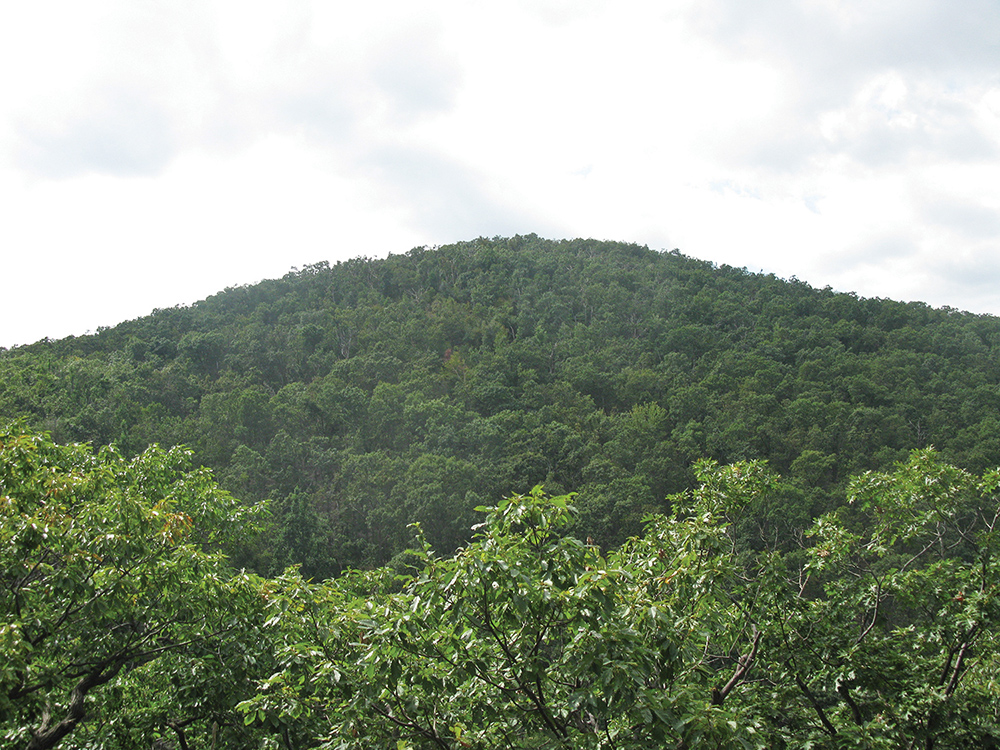
This five-mile moderate-to-strenuous loop hike climbs to the summit of Black Rock Mountain, with panoramic views over Schunemunk Mountain and the Hudson River. The hike also passes by the scenic Aleck Meadow Reservoir and follows along the cascading Black Rock Brook.
Although no part of the hike is particularly difficult, it involves a total ascent of over 1,000 vertical feet. The 3,920-acre Black Rock Forest traversed on the hike is owned and managed for field research and education by a non-profit consortium. The hike should take about three hours, and leashed dogs are permitted. A free trail map is available online at www.blackrockforest.org/trail-map
To get there from Bergen County, take the Palisades Interstate Parkway north to its terminus at the Bear Mountain Circle and continue north on US 9W for 8.8 miles. About half a mile after passing a parking area marked with a blue sign, turn right onto Mountain Road. Immediately turn right again and proceed through a very narrow underpass beneath US 9W (large vehicles may not fit). Continue ahead for 0.2 mile to a parking area for Black Rock Forest on the right.
There is a $5 parking fee (payable at a kiosk in the parking area). GPS address: 70 Reservoir Road, Cornwall, NY 12518. The trailhead is about 50 miles from Teaneck, and it should take about 60 minutes to get there.
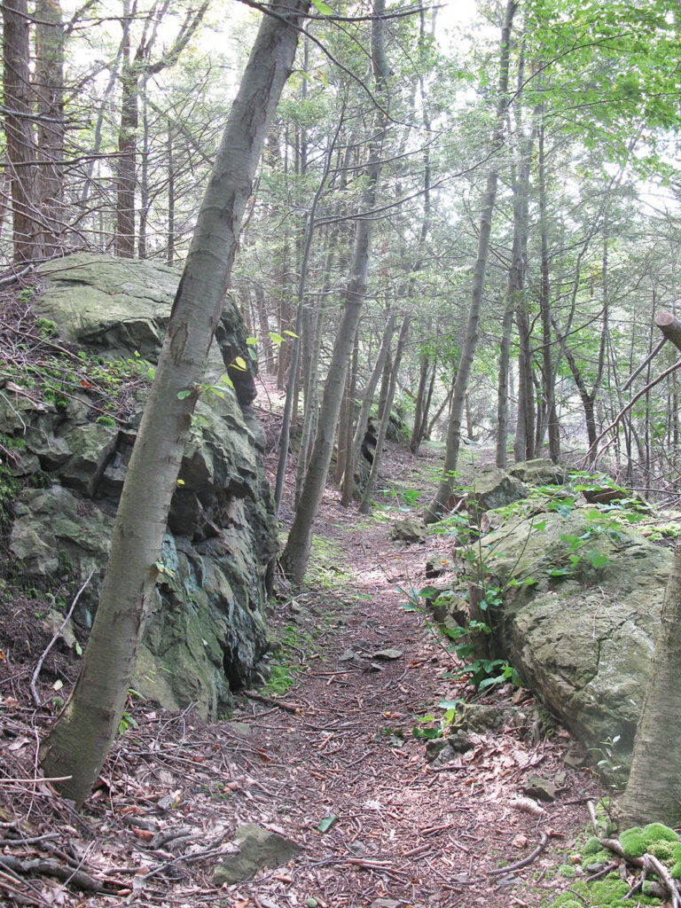
From the kiosk at the end of the parking area, proceed ahead on the unmarked Sybil’s Path. This well-graded path climbs gently, parallel to the entrance road, reaching its terminus at the Mailley’s Mill Bridge in 0.6 mile. Along the way, you’ll pass a panoramic north-facing viewpoint on the right side of the trail.
When you arrive at the end of Sybil’s Path, bear right, cross Mailley’s MiIl Bridge, and soon reach a junction with the blue-blazed Reservoir Trail. Continue straight ahead on the white-blazed Honey Hill Trail, which climbs steadily. In a third of a mile, you’ll reach the crest of the rise, marked by a radio antenna (a repeater station) on the right. The trail now begins to descend. A short distance ahead, a directional sign marks a viewpoint from a rock ledge to the right of the trail, with the view partially obstructed by the trees. Directly ahead is Black Rock Mountain (which you will soon climb).
The Honey Hill Trail continues to descend. After a short switchback, it turns left onto a level footpath—the route of a pipeline. You’ll notice that rock walls have been provided to support sections of the pipeline.
After crossing a boardwalk over a wet area, the white-blazed Honey Hill Trail ends at a junction with the joint Stillman (yellow) and Highlands (teal diamond) Trails at the base of the Aleck Meadow Reservoir dam. Turn right onto the Stillman/Highlands Trail, which crosses a concrete bridge below the dam. At the end of the reservoir, there is a panoramic view on the left over the reservoir. Here, the trail bears right and begins to climb. Bear left at a junction with the white-blazed Black Rock Hollow Trail, then (in 350 feet)—with White Oak Road visible on the left—turn sharply right and climb, first gradually, then more steeply, to the summit of Black Rock Mountain (elevation 1,410 feet).
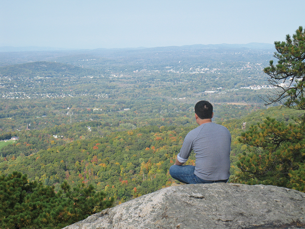
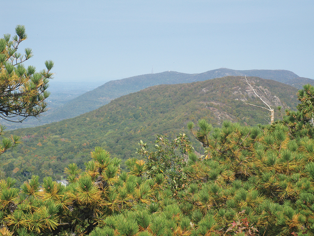
The summit affords a panoramic view, with Schunemunk Mountain and the Metro-North Railroad’s Moodna Viaduct to the west, the Hudson River (crossed by the Newburgh-Beacon Bridge) to the northeast, and the Shawangunk Mountains on the northwest horizon. You’ll want to take a break to rest from the climb and savor the view. The best views are from a rock ledge on the east side of the summit.
When you’re ready to continue, return to the trail, bear right, and descend steeply, continuing to follow the yellow and teal diamond blazes. The grade soon moderates and, in about half a mile, you’ll reach a wide gravel road.
Turn right and follow this road, known as Hulse Road, downhill. The road briefly climbs a little but then resumes a steady descent, rather steeply in places. Continue along this pleasant road for 1.4 miles until it ends at a junction with the white-blazed Black Rock Hollow Trail. Route 9W is ahead, just across Black Rock Brook, so (unfortunately) you will hear the noise of traffic.
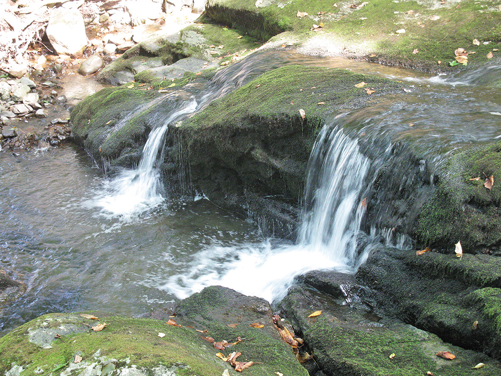
Turn right and follow the white-blazed trail along another gravel road which heads gently uphill, with Black Rock Brook on the left. You’ll pass an old stone dam on the brook and some attractive cascades. Gradually, Route 9W moves away from the brook and the trail, and the noise level decreases.
In half a mile, you’ll reach a water filtration plant. Here, the Black Rock Hollow Trail turns right and starts to climb more steeply, but you should bear left, skirting the filtration plant, and continue on the blue-blazed Reservoir Trail, which begins here. Just beyond the filtration plant, it crosses the brook on a bridge.
A short distance ahead, you’ll come to a junction where the Reservoir Trail turns right to recross the brook. Do not cross the brook or follow an unmarked trail on the left. Rather, turn very sharply left onto the red-blazed Duggan Trail and follow it back to the parking area where the hike began.
This hiking article is provided by Daniel Chazin of the New York-New Jersey Trail Conference. The Trail Conference is a volunteer organization that builds and maintains over 2,000 miles of hiking trails and publishes a library of hiking maps and books. The Trail Conference’s office is at 600 Ramapo Valley Road (Route 202), Mahwah; (201) 512-9348; www.nynjtc.org. Daniel Chazin can be reached at DChazin@aol.com.


