


This four-mile relatively easy lollipop-loop hike in nearby Ramapo Mountain State Forest goes around the shore of scenic Ramapo Lake, with many views of the lake. The 0.6-mile route from the parking area to the lake is somewhat rugged (although not exceptionally difficult), while the remainder of the hike follows an easy, level route around the lake. The hike should take about two hours. Dogs are allowed on leash. A map may be downloaded at www.nynjtc.org/sites/default/files/documents/NYNJTC_RamapoMountain_ChangesComplete-Fall2020.jpg
To reach the trailhead, take N.J. Route 4 West to Route 208 North, and follow Route 208 to its end. Continue ahead on I-287 South, and take Exit 57 (Skyline Drive). Bear right at the fork and proceed north on Skyline Drive for a short distance. Just ahead on the left is the lower Ramapo Mountain State Forest parking area. Turn left into the parking area. NOTE: This parking area may fill up on weekends, so it is preferable to do this hike on a weekday.
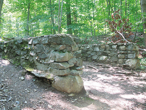
At the southern end of the parking area, a triple black-square-on-blue blaze marks the start of the Ramapo Lake Spur. Follow the trail into the woods, passing stone ruins. After going up a steep pitch, the trail continues to climb on a wide, rocky path, paralleling a cascading brook (particularly attractive after heavy rains).
As you approach the crest of the rise, you’ll cross a stream on rocks. A short distance beyond, the white-blazed Castle Loop joins from the right. Just ahead, the trails bear left at a fork and descend to a trail junction at Ramapo Lake, where the Ramapo Lake Spur ends. (There are street signs at the junction for South Shore Drive, North Shore Drive and Rye Cliff Road.) Here, you should turn left, crossing the dam of Ramapo Lake.
On the other side of the dam, a triple blue-on-white blaze marks the start of the Ramapo Lake Loop. You will be following this trail in a clockwise direction around the lake. Just ahead, the red-on-white-blazed LeGrande Hill Loop begins on the left, and for the next 500 feet, the route is co-blazed with red-on-white markers. Continue to follow the blue-on-white blazes along the wide gravel road, which runs close to the lakeshore, with views across the lake. To the north, atop a hill with several pines, you can see the ruins of Foxcroft, a mansion built in 1910 which fell into disrepair in the 1950s. (The Castle Loop, which leads to the ruins of this mansion, is another great hike in this area.)
The road proceeds through dense vegetation, crosses a causeway over an arm of the lake, and passes a swamp on the left and several interesting rock outcrops. It then moves away from the lakeshore but continues to parallel it, with views over the lake through the trees.
Just past the southern end of the lake, about a mile from the dam, the road reaches a T-intersection. Here, the red/blue LeGrande-Lake Connector begins on the left, but you should turn right to continue on the Ramapo Lake Loop. Then, in another 300 feet, bear right at a Y-intersection where the Cannonball Trail, marked by white-“C”-on-red blazes, joins from the left.
You’re now heading north through dense vegetation, paralleling the western shore of Ramapo Lake. At first, the road runs some distance from the water, but after a while, the lake can be seen through the trees. In half a mile, you’ll pass a building on the hillside to the left (formerly used as a ranger station) and, a short distance beyond, a rock ledge to the right of the trail offers a pleasant view of the lake.
Soon, another gravel road joins from the left. Follow the road ahead, crossing a stone causeway that isolates a quiet pond on the left from the main body of the lake. Next, you’ll reach another Y-intersection. Here, the Cannonball Trail turns left onto an intersecting gravel road, but you should bear right and continue to follow the blue-on-white blazes. A short distance ahead, you’ll notice a triple-blue blaze on the right. Follow this blue-blazed side trail for 500 feet to a rock outcrop overlooking the lake. After taking in the view, return to the Ramapo Lake Loop and turn right.
After passing a small, abandoned stone building on the right, you’ll come to another intersection. Here, you should bear right, once more joining the white-blazed Castle Loop.
Follow the white- and blue-on-white-blazed gravel road that runs close to the shore along the northern end of the lake, passing a viewpoint over the lake from a rock ledge on the right. Soon, you’ll pass a private residence on a ledge to the left. At the end of the lake, a triple blue-on-white blaze marks the end of the Ramapo Lake Loop. Continue ahead to a T-intersection with street signs, proceed through a gap in the guardrail at a sign for the Castle Loop Trail and the Ramapo Lake Spur Trail, and continue along the black-square-on-blue-blazed Ramapo Lake Spur, retracing your steps back to the parking area where the hike began.
This hiking article is provided by Daniel Chazin of the New York-New Jersey Trail Conference. The Trail Conference is a volunteer organization that builds and maintains over 2,000 miles of hiking trails and publishes a library of hiking maps and books. The Trail Conference’s office is at 600 Ramapo Valley Road (Route 202), Mahwah; (201) 512-9348; www.nynjtc.org. Daniel Chazin can be reached at [email protected].
By Daniel Chazin


