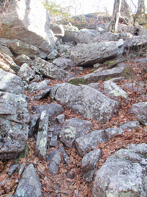
This 4.4-mile moderate-to-strenuous hike in Abram S. Hewitt State Forest is one of the most spectacular hikes in the New Jersey-New York metropolitan area. Although it begins with a fairly strenuous 600-foot climb, the rest of the hike does not involve any major elevation changes. There are, however, many short but steep ups and downs, some of which require you to use your hands as well as your feet. The hike should take about four hours. Dogs are permitted on leash; however, you may have to carry your dog up and down some of the very steep spots along the trail. You should not attempt this hike if the trails are covered with snow or ice.
To get there, take N.J. Route 4 West and continue on NJ Route 208 West, which becomes I-287 South. Take Exit 57 and bear right onto Skyline Drive. Continue on Skyline Drive to its northwestern terminus at Greenwood Lake Turnpike (County Route 511). Turn right and proceed for 8.1 miles to an intersection with Lakeside Road. Turn right and follow Lakeside Road (still designated County Route 511) for 2.5 miles to the Greenwood Lake Marina, just south of the New Jersey-New York boundary. Turn left (uphill) onto a dirt access road and park on the left side of the road, west of Lakeside Road. Do not park on the private property of the Greenwood Lake Marina on the east side of Lakeside Road. GPS address: 538 Lakeside Road, Hewitt, NJ 07421. The trailhead is about 35 miles from Teaneck, and it should take about 45 minutes to get there.
From the kiosk at the end of the parking area, bear left onto the blue-on-white-blazed State Line Trail, which follows a wide, rocky footpath up Bearfort Mountain. The ascent is moderate at first, and the trail soon levels off. With a private home visible ahead on the left, the trail turns right and soon begins to climb more steeply. Along the way, a switchback has been constructed by Trail Conference volunteers to ease the grade.
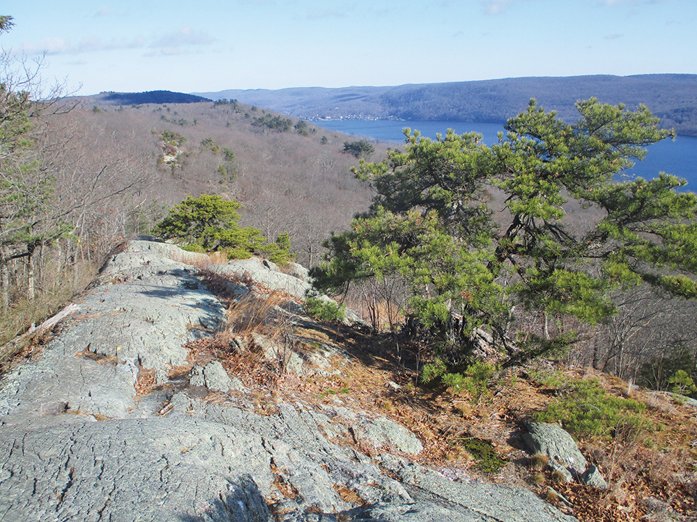
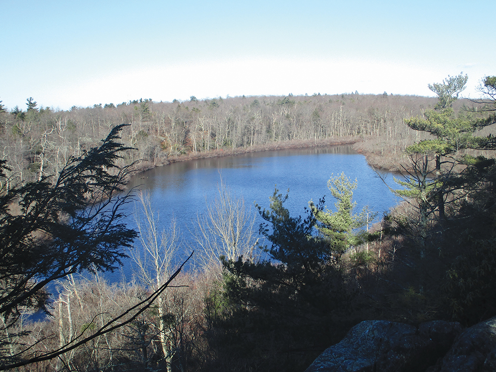
In about a mile, you’ll notice young hemlocks growing along the trail. Just ahead, you’ll reach an intersection with the yellow-blazed Ernest Walter Trail. Bear left and follow the yellow-blazed trail uphill. Soon, you begin to traverse a long, glacially-smoothed outcrop of Schunemunk Conglomerate “puddingstone” rock. This unusual reddish-matrix conglomerate rock—studded with pebbles of pink sandstone and white quartz—is characteristic of the Bearfort Ridge. As you climb along the rock outcrop, views open up over Greenwood Lake to the east.
Continue to the top of the outcrop, which offers a panoramic view over the six-mile-long lake, 650 vertical feet below. The hills of Sterling Forest are in the background and, on a clear day, you can see the Sterling Forest Fire Tower in the distance. You’ll want to spend some time here, taking in the magnificent view and resting from the steep climb.
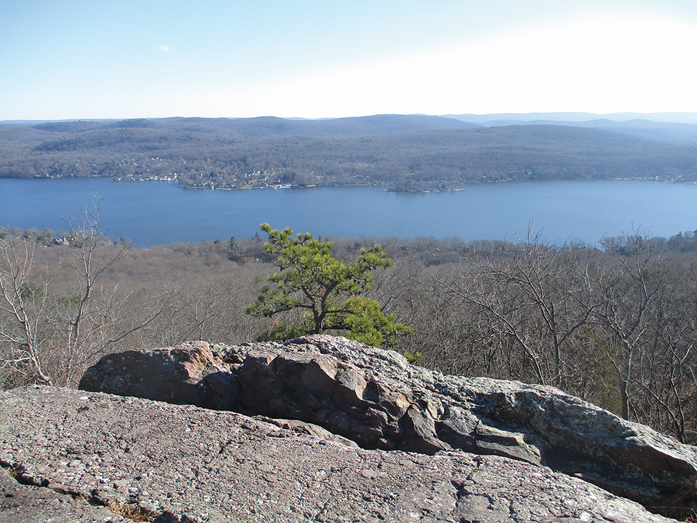
When you’re ready to resume the hike, continue along the Ernest Walter Trail, which passes through an area studded with pitch pines and then comes out on another long conglomerate outcrop, with more views over Greenwood Lake. After traversing another area covered with pitch pines, the trail climbs steeply to a third long conglomerate outcrop, then bears right and descends through the woods to cross the outlet of a wetland to the right of the trail. A short distance beyond, it reaches the eastern shore of pristine, spring-fed Surprise Lake (just to the right of the trail). You’ll want to stop here to experience the beauty of this wilderness lake.
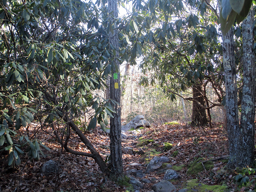
The yellow trail heads south from the lake, immediately reaching a junction with the green-blazed Bearfort Ridge Loop. You should bear right to continue along the Ernest Walter Trail, now coaligned with the Bearfort Ridge Loop. In a short distance, you’ll begin to pass through a dense rhododendron grove. In several places, the thick rhododendrons actually form a canopy over the trail!
After descending a little, the trail crosses Cooley Brook, the outlet of Surprise Lake, on rocks. This crossing may be difficult if the water is high. The trail now climbs to reach an east-facing viewpoint from a rock outcrop studded with pitch pines. The hills of Sterling Forest and the Wyanokie Plateau are directly ahead, with an arm of the Monksville Reservoir beyond. On a clear day, you can see the skyscrapers of Manhattan in the distance.
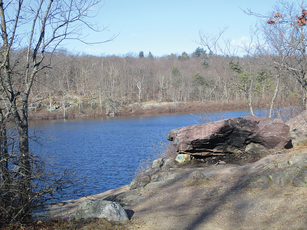
Here, the green-blazed Bearfort Ridge Trail leaves to the left, but you should continue along the yellow-blazed Ernest Walter Trail, which heads west, crossing many sharp ridges of the mountain. This section of trail is particularly rugged, with many short but steep ups and downs. At the bottom of the second steep descent, you’ll come to a T-intersection. Turn right, following a black-star-on-yellow blaze on a tree, and continue for about 150 feet to a rock outcrop overlooking pristine West Pond. You’ll want to spend a little time at this special spot, enjoying the view.
When you’re ready to continue, retrace your steps to the trail junction and continue ahead, heading west along the Ernest Walter Trail. You’ll soon come to a third, very steep descent, at the base of which the trail crosses Green Brook, the outlet stream of West Pond, on rocks. The trail now proceeds through an attractive forest of hemlocks, pines and deciduous trees, with an understory of mountain laurel.
After some more ups and downs, you’ll reach a junction with the pink-blazed West Ridge Trail, which begins on the left. Bear right at the junction to continue on the yellow-blazed Ernest Walter Trail, which now heads north, with views of West Pond through the trees to the right. This section of the trail, which is relatively level, goes across several long, narrow rock outcrops. Along the way, the trail crosses a small stream, the outlet of a wetland on the left. Just beyond, a short unmarked trail on the left leads to a rock outcrop with an unusual huge split boulder that affords a view over the wetland.
A little over half a mile from the junction with the West Ridge Trail, the Ernest Walter Trail turns right and descends to end at a junction with the white-blazed Appalachian Trail (A.T.). Turn right onto the Appalachian Trail, which almost immediately climbs a steep ledge. You’re now heading east, again crossing several sharp ridges. At a limited viewpoint to the east, from which the New York City skyline can be seen, the trail turns left and heads north.
After about a third of a mile on the A.T., the trail crosses an open rock ledge with pitch pines. The A.T. now descends a long, sloped rock and reaches a junction with the blue-on-white-blazed State Line Trail (the junction is marked by paint blazes on a rock). Turn right and follow the State Line Trail, which crosses several ridges. In about half a mile, the trail descends through hemlocks and mountain laurel to reach the junction with the yellow-blazed Ernest Walter Trail that you encountered earlier in the hike. Continue along the State Line Trail, which descends steadily, now retracing your steps to the parking area on Lakeside Road where the hike began.
This hiking article is provided by Daniel Chazin of the New York-New Jersey Trail Conference. The Trail Conference is a volunteer organization that builds and maintains over 2,000 miles of hiking trails and publishes a library of hiking maps and books. The Trail Conference’s office is at 600 Ramapo Valley Road (Route 202), Mahwah; (201) 512-9348; www.nynjtc.org. Daniel Chazin can be reached at DChazin@aol.com.


