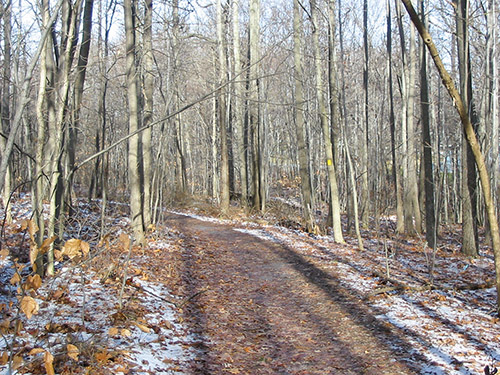


Now that the snow is melting and spring is approaching, it’s a great time to return to hiking. This two-mile hike loops around the Flat Rock Brook Nature Center in Englewood, New Jersey. The hike is relatively easy (although it does involve some uphill walking) and should take about one hour. Please note that dogs are not allowed on the trails at Flat Rock Brook. A free trail map is available from a kiosk at the trailhead.
To reach Flat Rock Brook, take N.J. Route 4 to the Jones Road exit in Englewood. Turn right at the top of the ramp, and continue to the first stop sign, which is Van Nostrand Avenue. Turn right onto Van Nostrand Avenue and continue past the “dead end” sign to the parking area by the Nature Center at the top of the hill.
From the parking area, head downhill towards the Nature Center building. Find the trailhead of the White Loop Trail, marked by a triple white blaze on a kiosk, directly opposite the front entrance to the Nature Center building. Head north on this trail, which follows a wide path. The Red Loop Trail soon crosses, but you should continue ahead on the White Loop Trail, which gradually ascends the hill on switchbacks. At the top of the hill, you’ll reach a T-intersection. Turn right, now following the joint White and Red Loop Trails.
Soon, the Purple Trail begins on the left. Continue along the joint White and Red Loop Trails, but when the White Loop Trail turns sharply left, proceed straight ahead on the Red Loop Trail for about 50 feet to a southwest-facing overlook, marked by a rock parapet. On a clear day, you can see the First Watchung Mountain in the distance. You can also hear the sounds of traffic on I-95 below.
Retrace your steps to the junction and turn right to continue on the White Loop Trail. Just ahead, at a T-intersection, the White Loop Trail turns right and joins the Blue Loop Trail. A short distance beyond, the Purple Trail also joins. Soon, the Purple Trail and then the White Loop Trail leave to the right, but you should continue straight ahead on the Blue Loop Trail. Follow the Blue Loop Trail as it loops around, first to the east (passing a gate in the fence that leads to Adele Court), then to the north. The trail runs close to the fenced-in perimeter of the Nature Center property, with private residences visible through the trees.
At the top, a short side trail to the right leads to a gate in the fence that provides access to Summit Street. The Blue Loop Trail now begins to descend, and it is soon joined by the Purple Trail, which comes in from the left. When the Purple Trail leaves to the left, continue ahead on the Blue Loop Trail, which soon curves to the left and climbs a little to reach a T-intersection with the Red Loop Trail. Turn right and follow the Red Loop Trail, which begins a gentle descent. After passing through a gate in the fence, the Red Trail bears left, but you should proceed ahead on the Yellow Trail, which continues to descend a little more steeply. The Yellow Trail then curves to the left and levels off.
When the Yellow Trail makes a sharp right turn, adjacent to a yellow “B.C.U.A.” sign, continue straight ahead, now following the Green Trail. To the right is Flat Rock Brook, which soon widens into MacFadden’s Wetland, named for the physical culturist Bernarr MacFadden (1868-1955), who lived nearby in the early 1900s.
At the end of the wetland, you’ll notice (on the right) a wooden bridge over a concrete dam. This bridge is known as the “Mystery Bridge” because it mysteriously appeared over one weekend. Just below the bridge, you may observe attractive cascades if the water level in the brook is high.
Continue ahead downhill, now following the Red Loop Trail (do not cross the bridge). At first, the trail has been routed away from the brook, but it soon moves closer to the brook and descends wooden steps. This is the most scenic portion of the hike, with the brook tumbling over rocks to your right. Beyond the steps, the trail levels off and continues to run alongside the brook.
When you reach a junction where the Orange Trail begins, turn left (following the sign for the “Nature Center”), go through the gate in the fence and continue to follow the Red Loop Trail. Just ahead, the trail begins a steady climb. After passing a gate on the right at the end of a residential street, the trail bends to the left, and the climb steepens. At the top of the climb, turn right onto the wide White Loop Trail, and continue ahead to the paved road. With the Nature Center building directly in front of you, turn left to return to the parking area where you began the hike.
This hiking article is provided by Daniel Chazin of the New York-New Jersey Trail Conference. The Trail Conference is a volunteer organization that builds and maintains over 2,000 miles of hiking trails and publishes a library of hiking maps and books. The Trail Conference’s office is at 600 Ramapo Valley Road (Route 202), Mahwah; 201-512-9348; www.nynjtc.org. Daniel Chazin can be reached at [email protected].
By Daniel Chazin


