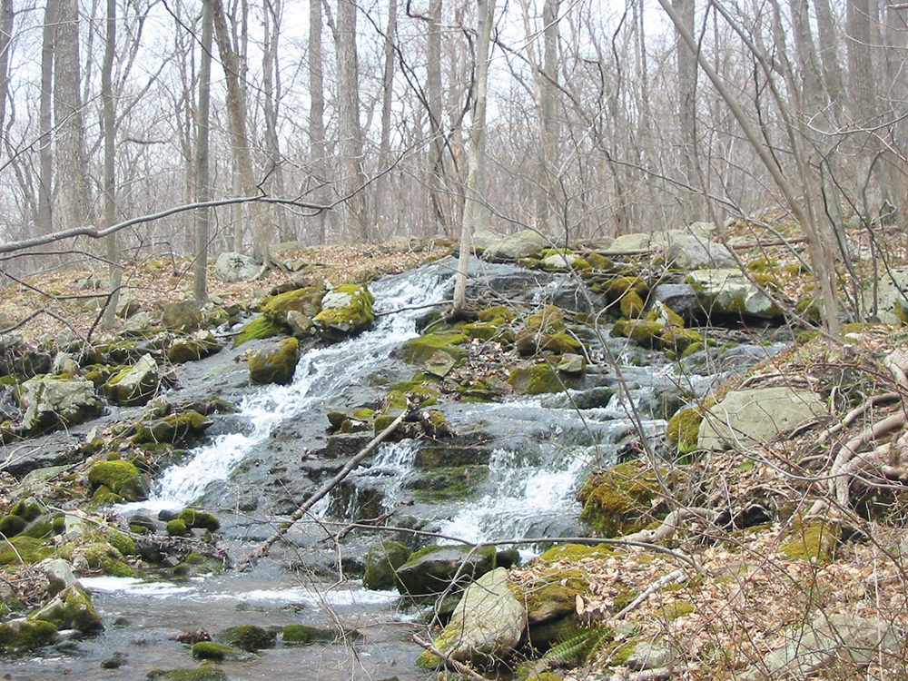
This easy-to-moderate 2.9-mile hike, near the New Jersey-New York state line, loops around Cupsaw Mountain in Ringwood State Park. The hike begins at the scenic Shepherd Lake (a popular destination for swimming in the summer) and passes attractive cascades in Cupsaw Brook. Although not exceptionally difficult, the hike includes two climbs and part of the hike involves walking on a rocky footpath. It should take about two hours to complete the loop and dogs are permitted on leash.
To reach the trailhead from Teaneck, take N.J. Route 4 West and continue on Route 208 West, which becomes I-287 South. Take Exit 57 and turn right onto Skyline Drive. Continue on Skyline Drive to its northwestern terminus at Greenwood Lake Turnpike (County Route 511). Turn right, continue for 1.5 miles, and turn right onto Sloatsburg Road. Continue for 2.1 miles and turn right onto Morris Road. In 1.3 miles, just before the entrance to the Skylands section of Ringwood State Park, turn left onto Shepherd Lake Road and proceed for 0.8 mile to Shepherd Lake.
Past the entrance booth, bear left and park in the designated parking area (a parking fee is charged from Memorial Day weekend to Labor Day). The trailhead is about 30 miles from Teaneck and it should take about 40 minutes to get there. NOTE: Some GPS programs may direct you to the trailhead from Sterling Mine Road in New York State via Shepherd Lake Road. The section of Shepherd Lake Road in New York State is a private road not open to the public and the trailhead cannot be reached via this road.
To start the hike, walk back toward the entrance booth but turn right, just before reaching the booth, at a small parking area for “Official Vehicles Only.” Just ahead, you’ll pass a sign that marks the start of the Ringwood-Ramapo Trail, marked with red-on-white metal blazes (and occasional solid red blazes on brown plastic wands).
The trail enters the woods on a wide woods road, immediately crossing a seasonal stream on a wooden footbridge. You may hear gunshot sounds in the distance. These come from the Thunder Mountain Shooting Range, located less than half a mile south of the Shepherd Lake parking area (you’ll be heading west and north, away from the range). Unfortunately, though, the sounds of gunfire can often be heard for much of the hike.
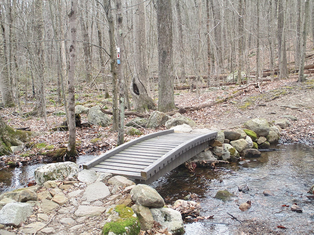
In a short distance, follow the red-on-white blazed trail as it bears right, leaving the road, and descends on a rocky footpath toward Cupsaw Brook, the outlet of Shepherd Lake. As you reach the base of the descent, you’ll notice an interesting cascade to the right, just off the trail. The trail bears left, parallels the brook, then crosses it on a sturdy wooden bridge (built in 2006 as an Eagle Scout project).
Just beyond the bridge, the blue-blazed Cupsaw Brook Trail joins from the right. Continue ahead, now following both red-on-white and blue blazes on a relatively level footpath. Soon, you’ll cross a seasonal stream on rocks.
In another quarter mile, you’ll come to a T-intersection with a woods road — the route of the white-blazed Crossover Trail. Turn right, now following white, blue and red-on-white blazes, and immediately cross another tributary stream on a wooden footbridge. Just beyond, you’ll reach another junction,where the trails diverge. The Crossover Trail turns left and the Cupsaw Brook Trail continues ahead on the woods road, but you should turn right, now once again following only the red-on-white blazes of the Ringwood-Ramapo Trail.
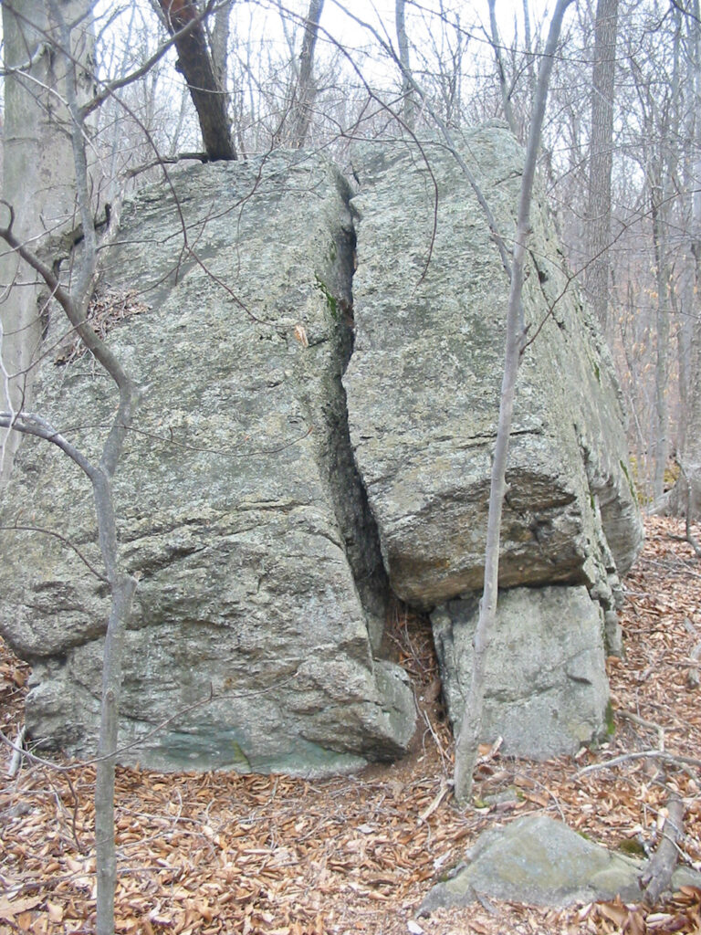
After crossing yet another tributary stream, you’ll pass an interesting cracked boulder to the left of the trail. The trail continues along a rocky footpath and soon begins to climb steadily. After passing some interesting boulders on the right, the trail briefly dips into a hollow, then continues to climb rather steeply to the top of the ridge of Cupsaw Mountain.
Atop the ridge is a wooden shelter, built by the “Hiking, Eating, Arguing and Puzzle-Solving Club of the Cooper Union.” The land on which the shelter is located, purchased by the state of New Jersey in 1978, was formerly part of the Green Engineering Camp of the Cooper Union for the Advancement of Science and Art of New York City. Camping is no longer permitted at the shelter and it is in very poor condition.
After resting from the climb, continue ahead on the Ringwood-Ramapo Trail. In 400 feet, you’ll reach a junction with the yellow-blazed Cooper Union Trail, which follows a wide path along the crest of the ridge. Turn right and follow the Cooper Union Trail, which climbs a little and then begins to descend, first on a woods road, then on switchbacks, with views of the mountains to the west through the trees when the leaves are down. As you descend, you can see and hear the traffic on Sloatsburg Road below.
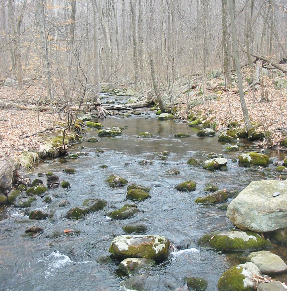
As the trail curves sharply to the left near the base of the descent, be alert for a triple-blue blaze on a tree to the right, which marks the start of the Cupsaw Brook Trail. Turn right and follow this blue-blazed trail, which climbs back up the ridge of Cupsaw Mountain, then descends rather steeply to a T-intersection with a woods road and turns right onto the road, which levels off.
The trail briefly approaches Cupsaw Brook, then moves away from it. After some more level walking, you’ll return to the junction where the Cupsaw Brook Trail intersects the red-on-white-blazed Ringwood-Ramapo Trail. Turn left onto the Ringwood-Ramapo Trail and retrace your steps, crossing the wooden bridge over Cupsaw Brook and following the red-on-white blazes back to the parking area where the hike began.
This hiking article is provided by Daniel Chazin of the New York-New Jersey Trail Conference. The Trail Conference is a volunteer organization that builds and maintains over 2,000 miles of hiking trails and publishes a library of hiking maps and books. The Trail Conference’s office is at 600 Ramapo Valley Rd. (Route 202), Mahwah; (201) 512-9348; www.nynjtc.org. Daniel Chazin can be reached at [email protected].