This 7.5-mile lollipop-loop hike through Ken Lockwood Gorge in Hunterdon County follows an abandoned railroad right-of-way that has been converted into a rail trail and a scenic road that parallels the cascading South Branch of the Raritan River. Despite its length, this hike is rated “easy,” as it is nearly level for its entire distance. It should take about three-and-a-half hours to complete the hike. Dogs are permitted on leash.
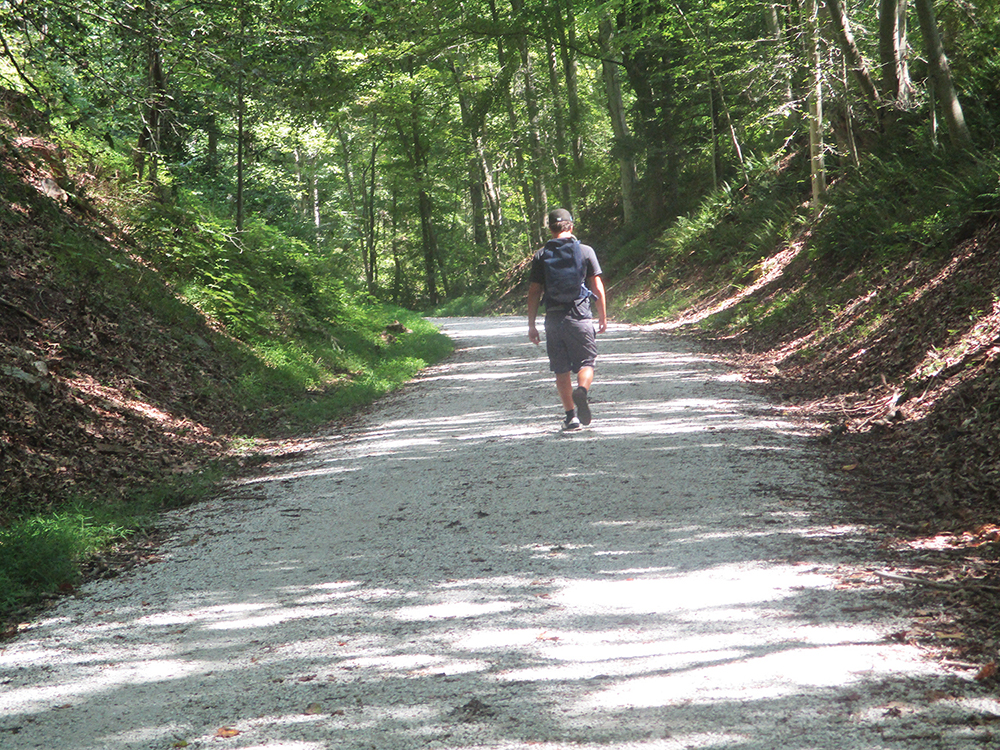
For part of the way, the hike follows the Columbia Trail along the right-of-way of the former High Bridge Branch of the Central Railroad of New Jersey. Built in 1876, primarily to transport iron ore from mines located in Morris County to the north, the line also carried passengers to resorts at Schooley’s Mountain and Lake Hopatcong. Passenger service ended in the 1930s, and the line was abandoned in 1976. In the 1990s, the Columbia Gas Transmission Company installed a gas pipeline along the right-of-way (hence the name “Columbia Trail”), but the surface rights to the railbed were acquired by the Hunterdon County Department of Parks and Recreation and the Morris County Park Commission. The railbed has been surfaced with fine gravel and is smooth for its entire length. Although frequented by bicyclists, the trail is wide enough to easily accommodate both bicyclists and hikers.
To get there, take I-80 West to Exit 43 and continue on I-287 South. Take Exit 21B and proceed west on I-78. Take Exit 18 (Annandale) and proceed ahead for 0.2 mile. Turn right onto West Street, which becomes Annandale-High Bridge Road and then Dewey Avenue. In 1.8 miles, turn left onto Washington Avenue, which becomes Mill Street. In 0.5 mile, turn left onto Church Street. At the next intersection, turn left onto Main Street, then make the first right at a sign for The Commons, and park in the parking area just ahead. GPS address: 79 Main Street, High Bridge, NJ 08829. The trailhead is about 60 miles from Teaneck, and it should take about 70 minutes to get there.
From the parking area, walk back to Main Street and head east on a paved right-of-way, the route of the Columbia Trail. A sign on the left gives the history of the High Bridge Branch. After crossing Mill Street and Taylor Street, the trail reaches a kiosk, where the surface changes to gravel. The trail goes under Thomas Street and soon passes on the left a post that indicates that you have hiked ¼ mile. These markers, which have been placed every quarter-mile along the trail, indicate how far you have walked.
A short distance beyond, you’ll notice on the right a sign for the Taylor Steelworkers Historical Greenway, which gives the history of the Taylor-Wharton Iron & Steel Company, formerly of High Bridge, considered to be the longest continually operating iron and steel company in the United States. Continue along the Columbia Trail, which soon crosses a private driveway and continues along a high embankment.
After going through a rock cut but just before reaching the 1¼-mile marker, bear left, leaving the Columbia Trail, and descend on a wide path to Cokesbury Road. Turn right, go under the bridge (note the original stone abutments), and head downhill. After crossing a bridge over the South Branch of the Raritan River, turn left onto Stone Mill Road (shown as Raritan River Road on Google Maps) and head north, parallel to the river. This section of the hike follows a wide, paved road for half a mile, but there is very little traffic, as the road leads to a dead-end at a parking area. After passing several homes on the right and reaching the parking area, the paving ends.
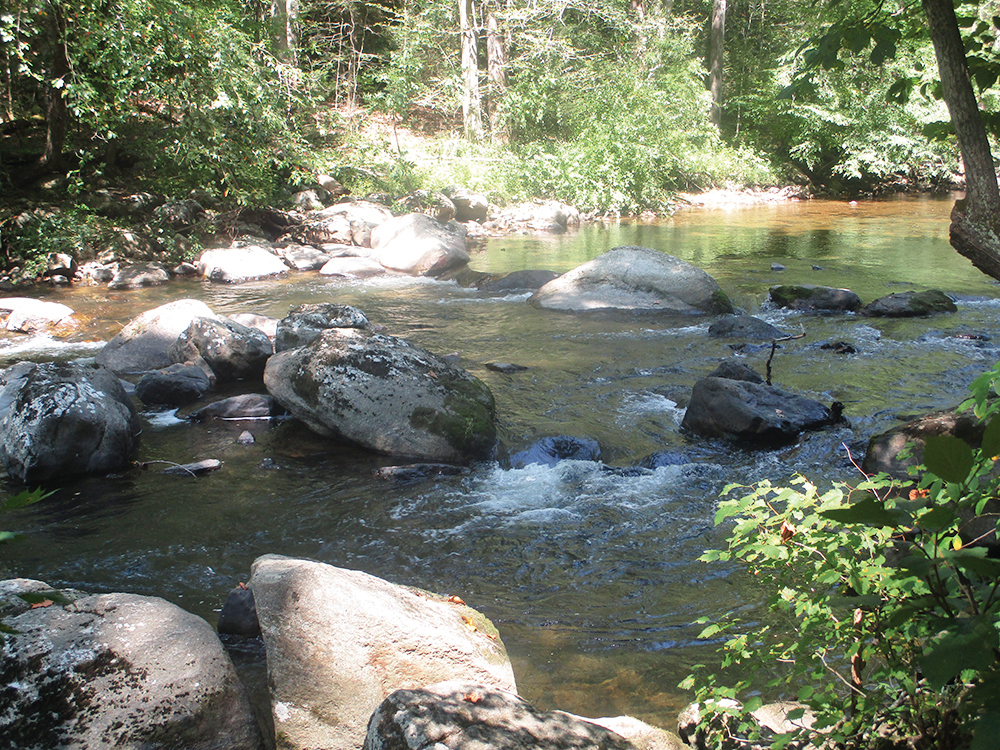
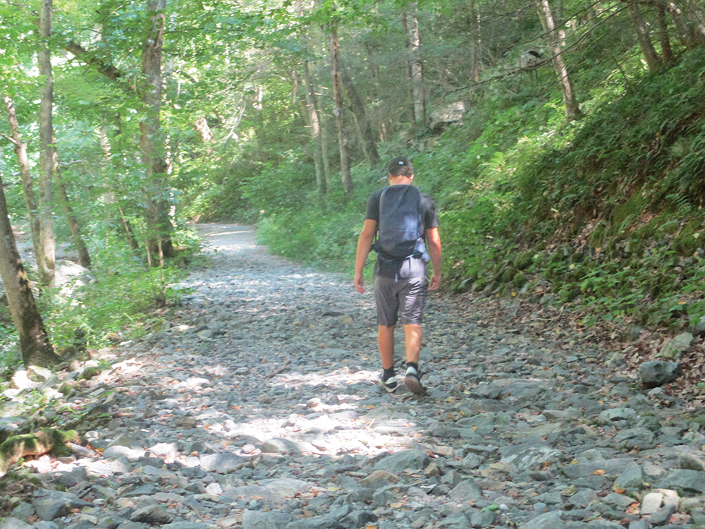
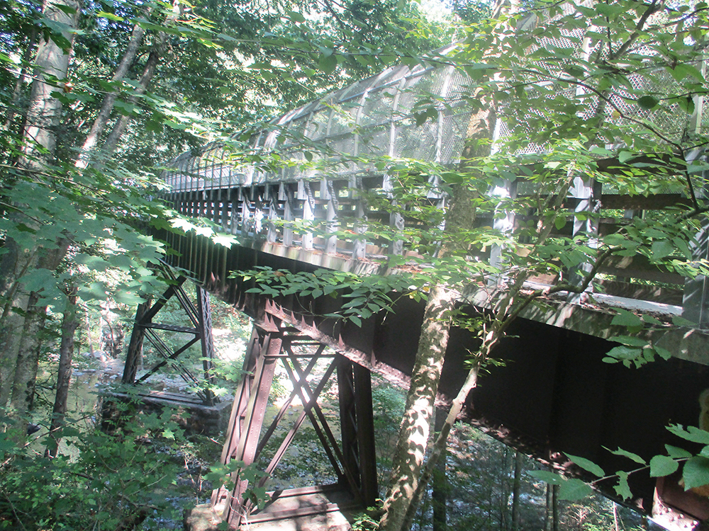
For the next 1.5 miles, you’ll be following a gravel road along the cascading stream. Unlike the Columbia Trail, sections of this gravel road are eroded and rocky, but the road is relatively level. This section of the road is frequented by fishermen, and you might want to take a break and rest on a rock along the riverbank. Along the way, you’ll pass underneath the Ken Lockwood Gorge Bridge, which carries the Columbia Trail over the river. You’ll be crossing over this bridge along your return route to High Bridge.
About half a mile after you pass under the bridge, you’ll reach another paved section of the road, with several homes. Continue along the paved road for 0.3 mile to Hoffmans Crossing Road. To the left, the road crosses the river on an historic one-lane truss bridge, built in 1898. You should turn right and follow the road uphill for about 300 feet (this is the steepest climb on the entire hike!) to the Columbia Trail, marked by a bicycle crossing sign and a crosswalk. Turn right onto the Columbia Trail, which you will be following back to the start of the hike. This is the halfway point of the hike.
Soon, you’ll pass a marker that indicates that you are 3½ miles from the start of the hike (the mileages from High Bridge are on the southern side of the signs). Through the trees on the right, you can see the river below. Benches are provided along the way if you’d like to stop for a break.
After about a mile, you’ll cross the Ken Lockwood Gorge Bridge. A sign at the southern end of the bridge relates the story of a train wreck at this location in 1885, when the wooden bridge that then spanned the river collapsed under the weight of a 46-car freight train. (Ironically, the name of the engine that pulled that train was Columbia.) South of the bridge, the trail goes through a rock cut, and the river is soon visible below on the left.
On the way back to High Bridge, you’ll go through some more rock cuts and traverse more embankments. Just after crossing the bridge over Cokesbury Road, you’ll pass the 1¼-mile marker. This is where you left the Columbia Trail towards the start of the hike, and you’ll now retrace your steps along the trail to the parking area where the hike began.
This hiking article is provided by Daniel Chazin of the New York-New Jersey Trail Conference. The Trail Conference is a volunteer organization that builds and maintains over 2,000 miles of hiking trails and publishes a library of hiking maps and books. The Trail Conference’s office is at 600 Ramapo Valley Road (Route 202), Mahwah; (201) 512-9348; www.nynjtc.org. Daniel Chazin can be reached at DChazin@aol.com.


