This easy two-mile hike loops around the 157-acre Mills Reservation in Cedar Grove, Essex County, New Jersey. It runs above an old quarry and affords panoramic views of the New York City skyline. Situated atop the Watchung mountain range, the park is maintained in its natural state, with a network of woods roads and footpaths.
The hike loops around the reservation on footpaths, following the yellow-blazed Lenape Trail for most of the way and returning on the blue-blazed Eastview Trail. It should take about 90 minutes and dogs are allowed on leash. A map is available online at bit.ly/millsresmap (please note that the Mills Loop Trail and the Mills Gate Trail are not blazed on the ground with the colors indicated on the map).
To get there, take Route 4 West to the Garden State Parkway South and follow the Parkway south to Exit 154 (Clifton). Bear left after the toll booths, following the sign to Route 46, and continue west on Route 46. In 1.2 miles, take the exit for Great Notch Road. Bear right at the fork and turn right onto Great Notch Road. At the traffic circle at the bottom of the hill, turn right onto Valley Road. Proceed south on Valley Road for 1.1 miles. Just beyond the entrance to Montclair State University, turn right (at a traffic light) onto Normal Avenue. Cross the railroad tracks, continue uphill for another 0.3 mile, and turn left into the parking area for Mills Reservation at the top of the hill, just past the intersection with Granite Drive. GPS address: 31 Normal Ave/, Cedar Grove, New Jersey. The park is about 15 miles from Teaneck and it should take about 25 minutes to get there.
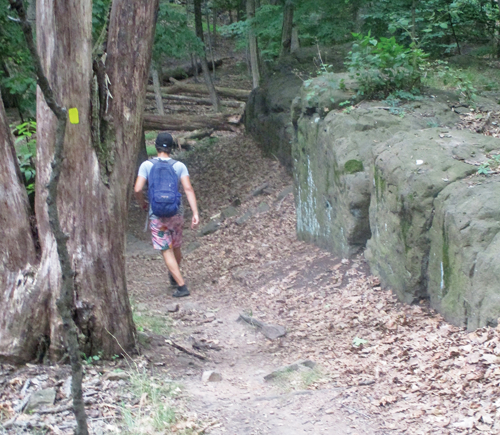
On the west sign of the parking area, you’ll notice a signpost for the Lenape Trail, with black-square-on yellow blazes. Follow this connector trail (known as the Lenape Link Trail), which heads west. In about 500 feet, the connector trail ends at a junction with the yellow-blazed Lenape Trail. Turn left onto the Lenape Trail (be careful not to turn left onto an unmarked trail that heads downhill just before the junction). You’ll immediately pass interesting outcrops of basaltic rock.
Continue to follow the yellow-blazed Lenape Trail for the next mile through the reservation. Along the way, you’ll cross red-blazed and purple-blazed trails, as well as several woods roads. In each case, continue ahead on the Lenape Trail, which is well marked with yellow blazes. The trail proceeds through a wooded area in the center of the reservation, away from the noise of traffic on adjacent roads.
Near the southern end of the reservation, you’ll reach a kiosk, where the blue-blazed Eastview Trail begins. Continue to follow the yellow-blazed Lenape Trail. In another 500 feet, the blue trail joins from the right. Proceed ahead, now following both yellow and blue blazes.
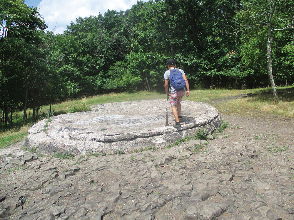
In 250 feet, you’ll emerge onto an open area, with an abandoned circular concrete slab that formerly supported a water tower. You are at Quarry Point, named for the abandoned quarry that once operated directly below. Here, a large outcrop of the igneous basalt rock that forms the Watchung mountain range affords south-facing views. The skyline of the city of Newark is visible from another rock outcrop just to the south.
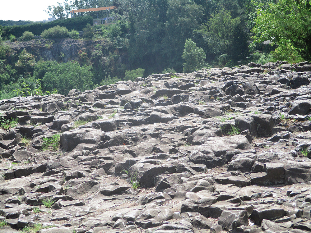
This is a good place to examine the interesting volcanic igneous rock that forms the Watchung mountain range. This rock, known as basalt, was formed when molten lava extruded out onto the earth’s surface and cooled rapidly. It is completely different from the metamorphic rock found in the nearby Highlands (and also distinguishable from the igneous rock of the Palisades, known as diabase, which cooled more slowly underground).
When you’re ready to continue, follow the joint yellow and blue trails, which head north on a woods road. When the blue trail leaves to the left, continue ahead on the yellow trail. Just ahead, the yellow trail approaches the edge of the cliffs on the right. Bear right here, head toward the cliff line, and turn left onto an unmarked trail that runs along the top of the cliffs. A short distance ahead, you’ll reach a panoramic viewpoint over the New York City skyline. Take care as you follow this footpath, as it runs close to the edge of the cliffs.
A short distance beyond, follow the unmarked footpath as it bears left and descends to the yellow-blazed Lenape Trail. Turn right and head north on the Lenape Trail, soon reaching a complex intersection of woods roads and trails with a kiosk. Here, the yellow-blazed Lenape Trail leaves to the right, but you should head north on the blue trail, which follows a footpath.
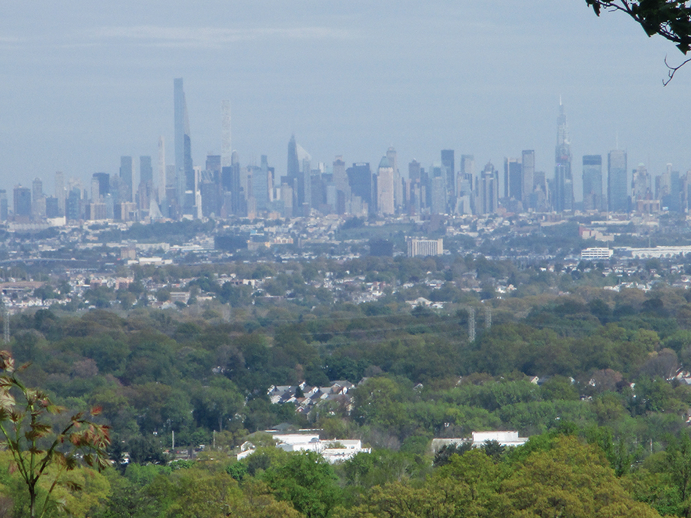
For the rest of the way, the blue trail meanders through the woods, twice crossing a gravel road along the way. Beyond the second crossing of the gravel road, you’ll catch another glimpse of the New York City skyline through the trees. As the trail bends to head westward, it begins to descend, and it approaches Normal Avenue and parallels it. After passing a driveway with stone walls that leads down to Normal Avenue and crossing a stone wall, the blue trail ends at the parking area where the hike began.
This hiking article is provided by Daniel Chazin of the New York-New Jersey Trail Conference. The Trail Conference is a volunteer organization that builds and maintains over 2,000 miles of hiking trails and publishes a library of hiking maps and books. The Trail Conference’s office is at 600 Ramapo Valley Rd. (Route 202), Mahwah; (201) 512-9348; www.nynjtc.org. Daniel Chazin can be reached at dchazin@aol.com.