


This moderate loop hike traverses a magnificent section of the Shawangunk Ridge, following a portion of the joint Long Path/Shawangunk Ridge Trail. Both ends of the hike follow the Red Trail from a parking area on Cox Road, which makes possible a loop hike that covers some of the most amazing and spectacular scenery in the area. The hike is about 3.3 miles long and should take about 2½ hours. Dogs are permitted on leash.
To get to the trailhead, take N.J. Route 4 West to N.J. Route 17 and head north on Route 17 to the New York State Thruway. Continue on the Thruway north (toward “Albany”) and take the first exit (Exit 16). Continue on N.Y. Route 17 west for about 25 miles and get off at Exit 115. Turn left at the end of the ramp onto Roosa Gap Road and continue for 5.0 miles. When you reach an intersection where Frey Road begins on the right, bear left to continue on Pleasant Valley Road, and cross a bridge. In another 0.2 mile, turn left onto Cox Road, and follow it for 1.6 miles to a parking area on the left for the Shawangunk Ridge State Forest (the sign at the entrance to the parking area is currently missing). The trailhead is about 70 miles from Teaneck, and it should take about an hour and 20 minutes to get there. The trailhead GPS coordinates are 41.646293, -74.401399.
From the kiosk at the parking area, head uphill on the Red Trail, which follows a woods road. Almost immediately, a wooden post marks a branch of the trail that goes to the right. This will be your return route, but for now, continue ahead on the woods road, following the red blazes.
In 0.4 mile you’ll cross a stream on large stepping stones. Soon the Red Trail begins to climb more steeply and narrows to a footpath.
After passing cliffs on the right and going through an interesting passage between rocks you’ll reach a junction with the Long Path/Shawangunk Ridge Trail at the crest of the ridge. Turn right onto the Long Path/Shawangunk Ridge Trail, which you’ll be following for the next 1.2 miles.
The ridge that you’re following was burned in a forest fire in May 2015. Low vegetation was destroyed in the fire, and many small trees were burned, but the trunks of larger trees remained unscathed. The vegetation has begun to regenerate, but many small dead trees scarred by the fire can still be seen.
Soon, you’ll come to a broad west-facing viewpoint from open slabs of Shawangunk conglomerate rock. The trail moves to the east side of the ridge, shifts back to the west side, then returns to the east side. You’ll notice some fascinating rock formations on the east side of the ridge, with the trail in places running near the edge of steep 30-foot-high cliffs.
The trail begins a gradual climb to the high point on the ridge (1,791 feet). Just beyond there is a panoramic north-facing view over Bear Hill. The trail now begins to descend over slabs of conglomerate rock dotted with pitch pines, with views of the Catskill Mountains to the northwest. As you approach the base of the descent, there are panoramic west-facing views.
After pausing to admire the spectacular views, follow the trail as it bears right and heads into the woods. In a short distance, you’ll come to a junction with the northern leg of the Red Trail. Turn right, leaving the Long Path/Shawangunk Ridge Trail, and begin once again to follow the red blazes.
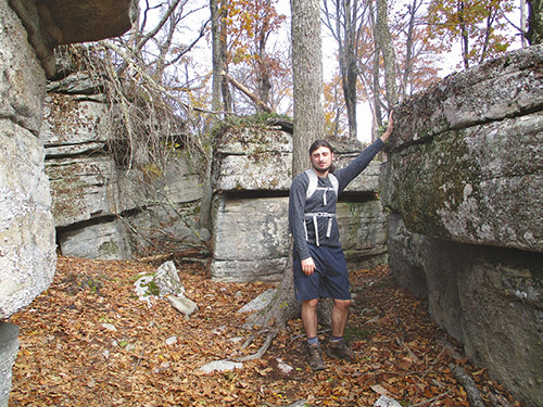
You’ll soon emerge into an area with dramatic cliffs and overhanging rocks on the right. You’re now directly paralleling the route you followed along the open slabs of conglomerate rock, but you’re following the cliffs that support these open rock slabs! Toward the end of this section, the trail has been routed through a narrow passage, with cliffs on one side and huge boulders on the other.
At the end of this spectacular section the trail turns left and begins to descend. It soon joins a woods road, which it follows all the way back to a junction with the other branch of the Red Trail. Turn left at this junction and continue for a short distance to the parking area where the hike began.
This hiking article is provided by Daniel Chazin of the New York-New Jersey Trail Conference. The Trail Conference is a volunteer organization that builds and maintains over 2,000 miles of hiking trails and publishes a library of hiking maps and books. The Trail Conference’s office is at 600 Ramapo Valley Road (Route 202), Mahwah; (201) 512-9348; www.nynjtc.org. Daniel Chazin can be reached at [email protected].
By Daniel Chazin