This easy four-mile hike loops around the property of the Tenafly Nature Center and the adjacent Lost Brook Preserve, owned by the Borough of Tenafly and leased to the Nature Center. In the early 1970s, what is now the 230-acre Lost Brook Preserve was owned by a private company that proposed building a 1,780-unit housing development on the land. Local residents were outraged by the plan, and litigation that went all the way to the New Jersey Supreme Court ensued. With the aid of a Green Acres grant and other donations, the tract was acquired by the Borough of Tenafly in 1976 and has been preserved in its natural state.
The hike, which is nearly level for its entire length, should take about two hours. Please note that dogs (as well as other pets) are not permitted on the property of the Tenafly Nature Center, and there is a $2 fee for non-members. If the trails are covered with snow and/or ice, it’s a good idea to wear traction devices (such as StableIcers or MicroSpikes) on your boots. Trail maps are posted at the trailhead and at most intersections, and are available online at https://tenaflynaturecenter.org/trail-map/
To get to the trailhead, take N.J. Route 4 East to the exit for Grand Avenue (North) in Englewood. Turn right onto Rockwood Place, then turn right again onto Grand Avenue and follow it north for 3.9 miles to Hudson Avenue (along the way, the name of the road changes to Engle Street). Turn right onto Hudson Avenue and follow it uphill to the parking area for the Tenafly Nature Center (at the end of the road). GPS address: 313 Hudson Avenue, Tenafly, NJ 07670. The nature center is about seven miles from Teaneck, and it should take about 15 minutes to get there.
From the parking area, turn right on the Main Trail, a wide gravel path, and head east. You’ll pass a kiosk with a donation box. To help support the costs of maintaining the property, non-members are requested to pay a small fee to hike through the nature center property ($2 per person or $10 per family, payable either in cash or by scanning a QR code). Continue along the Main Trail for 200 feet beyond the kiosk, then turn right onto the Red Trail (blazed with red triangles). Follow the Red Trail as it heads south and then loops around to the north.
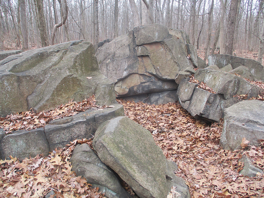
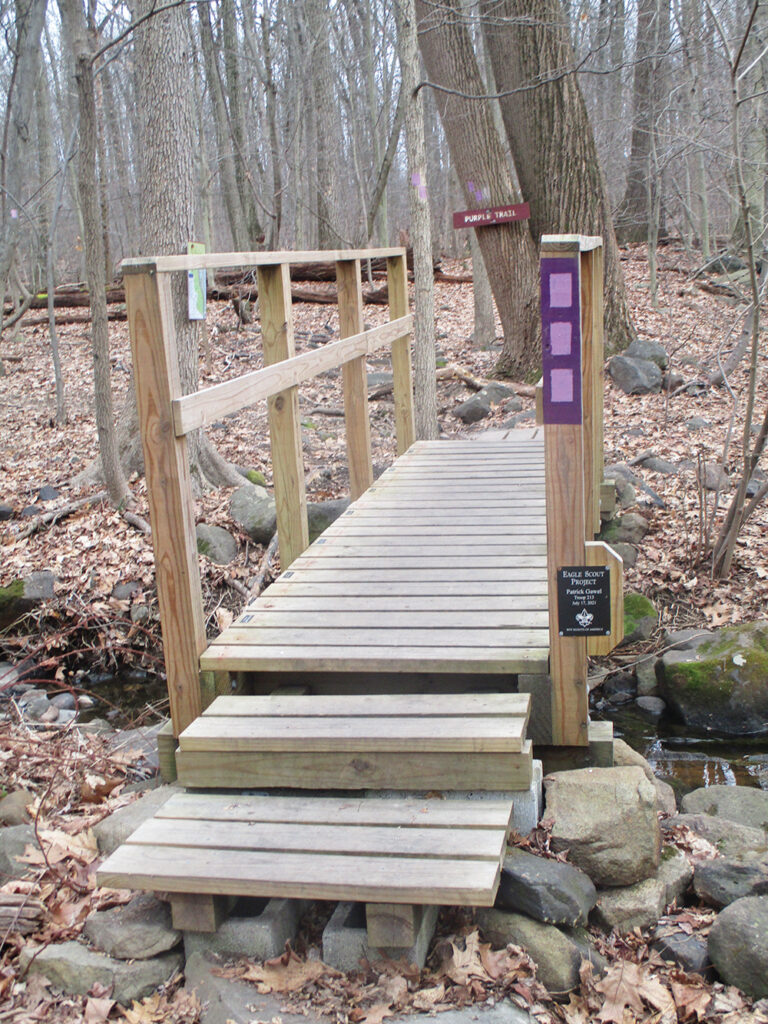
After crossing a wet area on puncheons, you’ll reach a trail junction at several huge fallen trees. Here, the Purple Trail begins. Turn right onto the Purple Trail, which immediately crosses a brook on a footbridge. In half a mile, after passing some interesting rock formations, you’ll reach an intersection where the Blue Trail begins on the right. Bear left to continue on the Purple Trail. After crossing a brook on a footbridge, the Purple Trail ends at a T-intersection with the yellow-blazed Allison Trail. Turn right onto the Allison Trail.
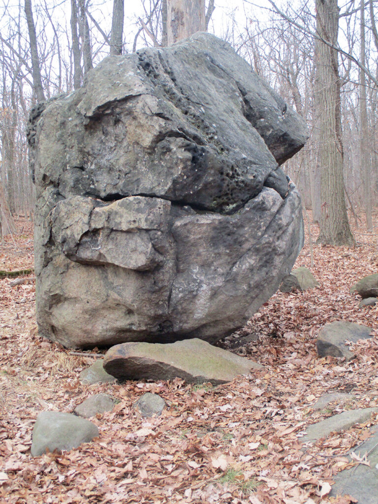
A short distance ahead, where the trail bends left, there is an interesting rock formation (named “Little Rock Den” on the trail map) to the left of the trail. In another 500 feet, you’ll reach a junction with the orange-blazed Haring Rock Trail, which begins on the right. Turn right and continue south on the Haring Rock Trail, which follows a winding footpath and eventually widens to a woods road.
As you approach East Clinton Avenue, the southern boundary of the nature center, you’ll notice a large boulder on the left. This is the Haring Rock, after which the trail is named. Turn left here and follow the yellow/orange-blazed Seely Trail, which heads southeast, parallel to East Clinton Avenue. After crossing the Green Brook on a footbridge, the Seely Trail ends at a junction with the yellow-blazed Allison Trail.
Turn left and head north on the Allison Trail, which follows a mossy woods road. In a third of a mile, you’ll reach a junction. Continue to follow the yellow-blazed Allison Trail as it turns left, joining the red-blazed Little Chism Trail. Both trails cross the Green Brook on a footbridge, then turn right and parallel the brook.
In 750 feet, you’ll reach another junction. Here, the Little Chism Trail leaves to the right, but you should continue ahead on the yellow-blazed Allison Trail.
When you reach the junction with the orange-blazed Haring Rock Trail, continue ahead on the yellow-blazed Allison Trail, now covering an 0.3-mile section of trail that you previously hiked in the reverse direction. When you reach the junction with the Purple Trail, bear right to continue along the Allison Trail, now once again proceeding along a section of trail that you have not covered previously on this hike. A third of a mile beyond, the yellow-blazed Allison Trail ends at the Main Trail, a wide dirt road.
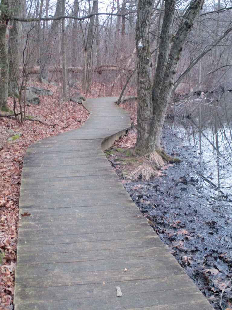
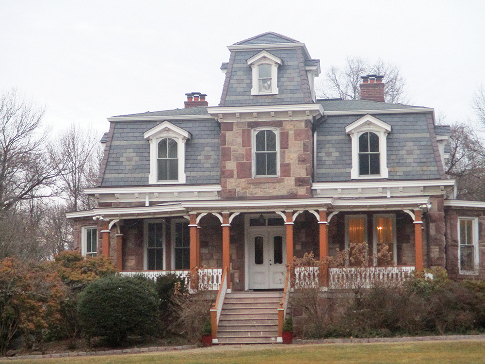
Turn left onto the Main Trail, passing the historic Lambier House, a private residence that dates back to the 1870s. Beyond the house, the road narrows to a wide gravel path. As the path approaches a stone wall, the White Trail (marked with white triangles) begins on the right. (On the park map, this trail is designated as the Di Filippi Trail.) Turn right, leaving the Main Trail, and follow the White Trail. When you reach a junction with the red/white-blazed Bischoff Trail, turn left to continue along the White Trail, which soon begins to run along the shore of Pfister’s Pond. Sections of the trail that traverse wet areas are built on boardwalk.
Just beyond a wooden shelter used for programs (camping is not permitted), the White Trail ends at the Main Trail (the junction is marked by a stone monument to Dr. Joseph A. De Filippi). Turn right onto the Main Trail and follow it back to the parking area where the hike began.
This hiking article is provided by Daniel Chazin of the New York-New Jersey Trail Conference. The Trail Conference is a volunteer organization that builds and maintains over 2,000 miles of hiking trails and publishes a library of hiking maps and books. The Trail Conference’s office is at 600 Ramapo Valley Road (Route 202), Mahwah; (201) 512-9348; www.nynjtc.org. Daniel Chazin can be reached at [email protected].


