This four-mile, moderate-to-strenuous hike loops around Norvin Green State Forest, crossing a number of interesting rock outcrops, and climbs to the summit of Wyanokie High Point, with panoramic views. The hike should take about three hours. For most of the way, the hike is of no more than moderate difficulty, but the climb of (and descent from) Wyanokie High Point is quite steep. Dogs are permitted on leash.
To reach the trailhead, take N.J. Route 4 West to Route 208 North, and follow Route 208 to its end. Continue ahead on I-287 South, and take Exit 57 (Skyline Drive). Bear right at the fork and take Skyline Drive to its northwestern end at Greenwood Lake Turnpike (County Route 511). Turn left and proceed south for 1.6 miles, then turn right onto West Brook Road and cross the Wanaque Reservoir on a causeway. At the next T-junction, turn left, then take the second left onto Snake Den Road. Continue for 0.6 miles to a large dirt parking area on the right, just before the entrance to the New Weis Center. GPS address: 150 Snake Den Road, Ringwood, NJ 07456. The parking area is about 27 miles from Teaneck, and it should take about 40 minutes to get there.
From the southwestern end of the parking area, head uphill on paved Snake Den Road, following the light green blazes of the Otter Hole Trail. In 0.3 miles, the pavement ends and you continue on a dirt and gravel road. In 200 feet, you’ll reach the Richard N. Warner kiosk on the left. The joint Mine (yellow-on-white) and Hewitt-Butler (blue) Trails, which begin here, will be your return route, but for now, continue ahead on the road, following the Otter Hole Trail. A short distance ahead, the trail crosses Blue Mine Brook at the stone abutments of a former bridge. The bridge is gone, so hikers need to cross the brook on rocks.
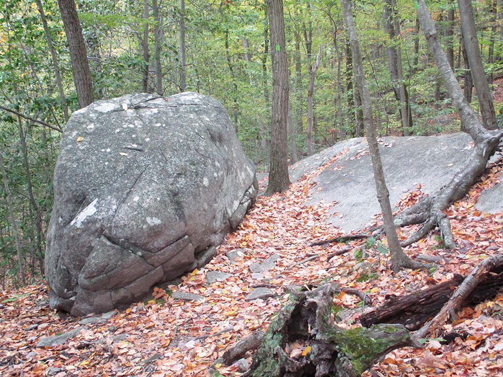
Beyond the brook, the trail begins to climb. Watch carefully for a double blaze, which indicates a turn to the right. Here, the green-blazed Otter Hole Trail bears right, leaving the road, which is wet and eroded ahead. For the next third of a mile, the trail follows a footpath along the base of cliffs, passing along the way a large boulder on the left and crossing an open rock outcrop.
After rejoining the dirt-and-gravel Snake Den Road, the Otter Hole Trail reaches a junction, where it bears left to continue on another woods road. The trail now crosses a stream on rocks. Just beyond, you’ll pass on the left the trailhead of the white-blazed Macopin Trail, but continue ahead on the green-blazed Otter Hole Trail, which climbs on a rocky woods road.
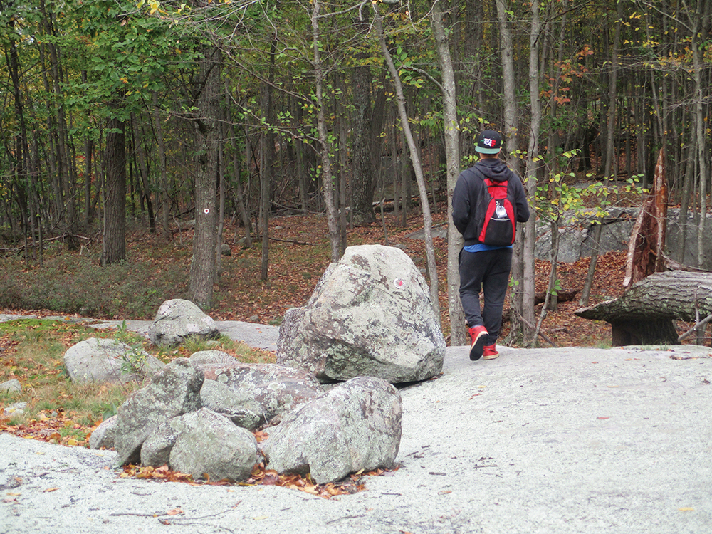
In a third of a mile, you’ll reach a junction with the red-on-white-blazed Wyanokie Circular Trail (marked by a large cairn). Turn left, leaving the Otter Hole Trail, and follow the Wyanokie Circular Trail uphill on a footpath through dense mountain laurel thickets. On the way up, an unmarked side trail on the left leads to a large open rock outcrop, with several boulders. You might want to visit this interesting feature and take a short break here.
At the crest of the rise, you’ll come to a junction with the orange-blazed Outlaw Trail, which continues ahead. Here, you should turn left to continue on the red-on-white-blazed Wyanokie Circular Trail. The trail proceeds on a relatively level footpath through mountain-laurel thickets and crosses several open rock outcrops. Two of the outcrops offer limited south-facing views through the trees.
In about half a mile, the Wyanokie Circular Trail begins a steady descent. At the base of the descent, it reaches a junction with the blue-blazed Hewitt-Butler Trail (also the route of the teal-diamond-blazed Highlands Trail). Turn left (in the direction of the “Hi-Point” sign), now following the route of three trails (Wyanokie Circular, Hewitt-Butler and Highlands). After crossing a stream, the trails begin a rather steep climb.
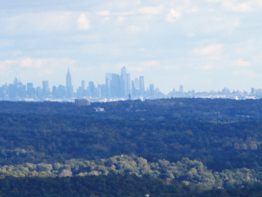
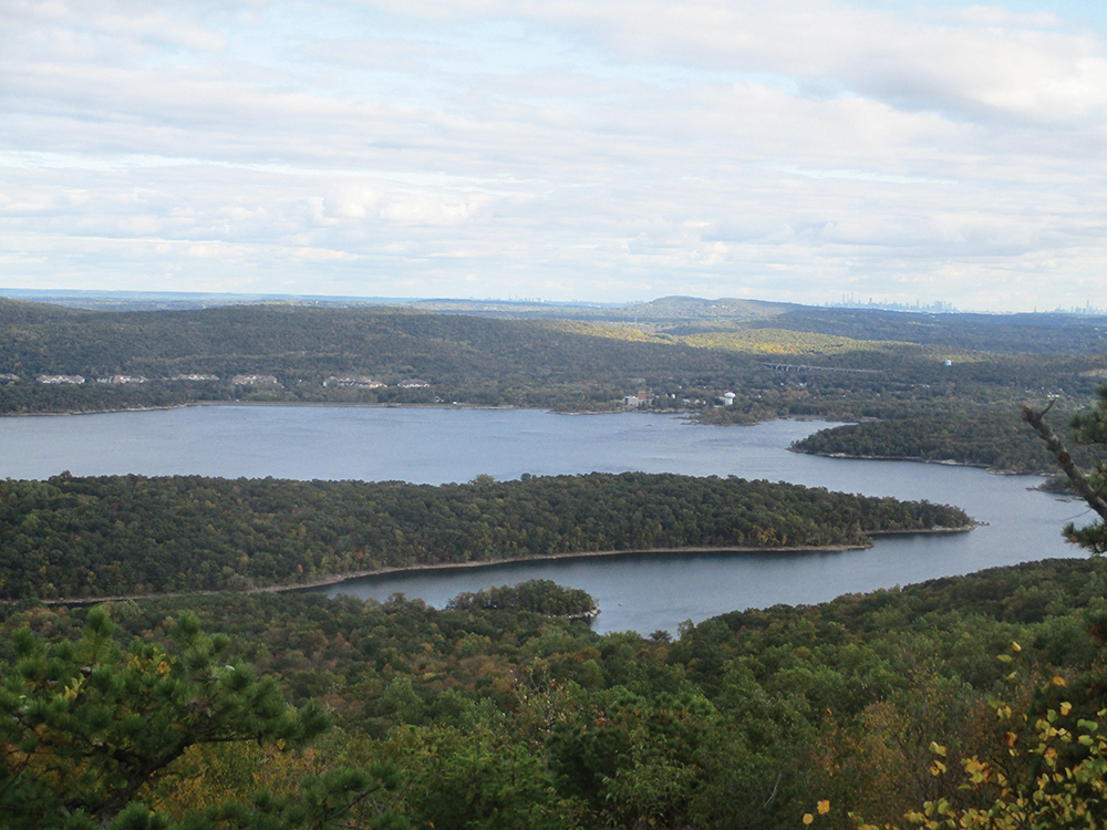
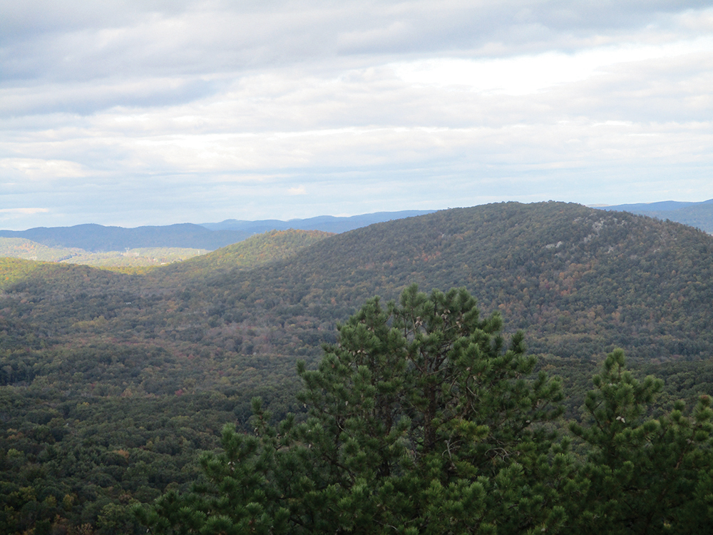
At the next junction, turn right, again following the sign to “Hi-Point” (painted on a huge boulder). You’re now following the red-on-white blazes of the Wyanokie Circular Trail and the teal diamond blazes of the Highlands Trail, which climb steeply through mountain-laurel thickets and across open rock ledges. In a short distance, you’ll reach the summit of Wyanokie High Point, marked by a bolt drilled into the rock. The summit features a panoramic view, with the Wanaque Reservoir below, and the New York City skyline visible to the east on a clear day. To the north and west, one can see Saddle, Assiniwikam and Buck Mountains.
After spending some time savoring the views from this magnificent location, surrounded by pitch pines, retrace your steps to the junction, following the red-and-white blazes as they descend very steeply over bare rock (do not continue to head east on the Wyanokie Circular Trail). Extreme care is required here if the rocks are wet. When you reach the junction with the Hewitt-Butler Trail, turn right (in the direction of the sign to the “New Weis Center”) and follow the blue blazes.
After a short, gradual climb, the trail reaches a balanced boulder on a rock ledge, with views to the south and west. It then descends slightly to a mountain-laurel thicket, where the white-blazed Macopin Trail leaves to the left. Continue ahead on the blue trail, which soon arrives at a rock ledge (on the left) surrounded by pitch pines, with a view over Saddle Mountain to the north and Assiniwikam Mountain to the west. A short distance ahead, there is another viewpoint from a rock ledge just to the left of the trail.
The trail now begins a steep descent on a wide path. The descent eventually moderates, and the trail reaches a junction with the Mine Trail in a mountain-laurel thicket. Bear left here, now following both blue and yellow-on-white blazes, and descend steeply to Snake Den Road (here a dirt-and-gravel road) at the Richard N. Warner kiosk. The Hewitt-Butler and Mine Trails end here. You should turn right and follow the green-blazed Otter Hole Trail along Snake Den Road back to the parking area where the hike began.
This hiking article is provided by Daniel Chazin of the New York-New Jersey Trail Conference. The Trail Conference is a volunteer organization that builds and maintains over 2,000 miles of hiking trails and publishes a library of hiking maps and books. The Trail Conference’s office is at 600 Ramapo Valley Road (Route 202), Mahwah; 201-512-9348; www.nynjtc.org. Daniel Chazin can be reached at DChazin@aol.com.


