


It may be cold outside, but a relatively short, invigorating hike is always welcome. This easy 3.2-mile hike loops around the northern section of the Tenafly Nature Center. The hike, which is nearly level for its entire length, should take about two hours. Please note that dogs (as well as other pets) are not permitted on the property of the Tenafly Nature Center, and there is a $2 fee for non-members. If the trails are covered with snow and/or ice, it’s a good idea to wear traction devices (such as StableIcers or MicroSpikes) on your boots.
To get to the trailhead, take N.J. Route 4 East to the exit for Grand Avenue (North) in Englewood. Turn right onto Rockwood Place, then turn right again onto Grand Avenue and follow it north for 3.9 miles to Hudson Avenue. (Along the way, the name of the road changes to Engle Street.) Turn right onto Hudson Avenue and follow it uphill to the parking area for the Tenafly Nature Center (at the end of the road). GPS address: 313 Hudson Avenue, Tenafly, NJ 07670. The nature center is about 7 miles from Teaneck, and it should take about 15 minutes to get there.
From the parking area, follow the signs to the “Trail Entrance.” You’ll pass in front of the visitor center and reach a table with a donation box. To help support the costs of maintaining the property, non-members are requested to pay a small fee to hike through the nature center property ($2 per person or $10 per family). Beyond the visitor center, follow the trail as it bears right and passes enclosures for a red-tailed hawk, a black vulture and a barred owl. Turn right at the next intersection (following the sign for the Picnic Area) and continue past the picnic area on the Yellow Trail (blazed with yellow triangles). When the Yellow Trail ends at the Main Trail (a wide gravel path), turn left and continue for 100 feet, then turn right onto the Red Trail (blazed with red triangles). Follow the Red Trail as it heads south and then loops around to the north.
After crossing a wet area on puncheons, you’ll reach a trail junction at several huge fallen trees. Here, the Purple Trail begins. Turn right onto the Purple Trail, which immediately crosses a brook on a footbridge. In half a mile, you’ll reach an intersection where the Blue Trail begins on the right. Bear left to continue on the Purple Trail. After crossing a brook on a footbridge, the Purple Trail ends at a T-intersection with the yellow-blazed Allison Trail. Turn right onto the Allison Trail.
A short distance ahead, where the trail bends left, there is an interesting rock formation (named “Little Rock Den” on the trail map) to the left of the trail. In another 500 feet, you’ll reach a junction with the orange-blazed Haring Rock Trail, which begins on the right. Continue ahead on the yellow-blazed Allison Trail.
Soon, you’ll reach another junction, marked by a cairn. Turn left, leaving the yellow-blazed trail, and continue along the red-blazed Little Chism Trail, which soon approaches U.S. Route 9W. The Little Chism Trail roughly parallels this busy road, which can often be seen on the right through the trees.
After turning away from Route 9W, the red-blazed trail again approaches it at a junction marked by a cairn and a sign for the Long Path. Here, the short red-and-yellow-blazed Sweet Gum Trail leads to Route 9W at the entrance to the Greenbrook Sanctuary. Continue ahead on the red-blazed Little Chism Trail, which crosses a brook on a footbridge. A short distance beyond, you’ll notice an interesting rock outcrop on the left. This formation is made up of igneous rock, known as diabase, formed when molten lava cooled underground. The Palisades cliffs (just to the east) are formed of diabase.
The Little Chism Trail once again approaches Route 9W and then turns away from it. When the Little Chism Trail ends at unpaved Hudson Avenue, cross the road and continue on the red-and-white-blazed Bischoff Trail, which soon begins to parallel a stone wall on the left.
Before reaching the paved Montammy Road, the Bischoff Trail turns left, goes through a gap in the stone wall, and passes to the left of a small pond. The trail then approaches Montammy Road and turns left to parallel the road. It soon crosses another stone wall, with buildings of the Montammy Country Club visible on the right, and the historic Lambier House (built in the 1870s) visible through the trees on the left. After crossing a third stone wall and briefly paralleling it, the Little Chism Trail ends at a junction with the De Filippi Trail (blazed with white triangles).
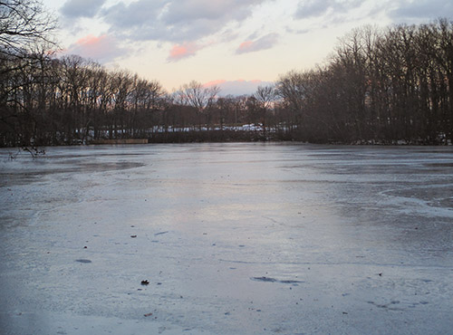
Turn right onto the De Filippi Trail and descend to Pfister’s Pond. The trail bears left and follows the shoreline of the pond, with portions of the trail routed onto boardwalks. Along the way, you’ll pass a wooden shelter (for day use only) facing the pond. When the De Filippi Trail ends at a junction with a wide gravel road (the Main Trail), turn right and follow the road back to the parking area where the hike began, passing a viewpoint over the pond along the way.
This hiking article is provided by Daniel Chazin of the New York-New Jersey Trail Conference. The Trail Conference is a volunteer organization that builds and maintains over 2,000 miles of hiking trails and publishes a library of hiking maps and books. The Trail Conference’s office is at 600 Ramapo Valley Road (Route 202), Mahwah; (201) 512-9348; www.nynjtc.org. Daniel Chazin can be reached at [email protected].


