This easy three-mile hike loops around the northern section of Holmdel Park in Monmouth County, following trails that are for hiking only. The hike should take about 90 minutes, but it can be combined with a visit to the adjacent Longstreet Farm, a living historical farm that interprets the agricultural activities in Monmouth County’s rural past, focusing on the breeds of animals and crops raised at this site in the 1890s. Interpreters in period dress explain both daily and seasonal agricultural and domestic activities at the farm. For more information on Longstreet Farm, go to www.monmouthcountyparks.com/page.aspx?Id=2530.
The trails in Holmdel Park are identified by colors, but the colors refer to the difficulty of the trail and are not unique to a particular trail. Trails blazed green are considered “easy,” while trails blazed blue are considered “moderate.” (The ratings were developed with bicyclists, rather than hikers, in mind.) You will notice some green and blue markers, most with the name of the trail, at intersections, but the trails are not blazed for their entire length. The Beech Glen, Marsh and Ridge Walk Trails are green trails, while the Cross Country and High Point Trails are blue trails.
A trail map is available online at www.co.monmouth.nj.us/documents/130/Holmdel-6-Panel-2021-Web.pdf
To get there, take the New Jersey Turnpike South to Exit 11 and continue onto the Garden State Parkway South. Take Exit 116 and, at the end of the ramp, turn right. In 0.3 mile, turn left onto Crawfords Corner Road, and in 0.4 mile, turn right onto Longstreet Road. Continue for 0.7 mile, turn right into Holmdel Park, and proceed to the Forest Edge parking area. GPS address: 44 Longstreet Road, Holmdel, NJ 07733. The park is about 45 miles from Teaneck, and it should take about 50 minutes to get there.
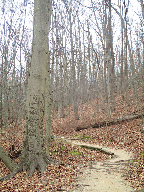
From the western end of the Forest Edge parking area, climb steps to a kiosk (where trail maps are available), then head uphill towards the woods on a wide gravel path, with a playground on the left and a brick restroom building on the right. Almost immediately, you’ll notice a signpost for the Beech Glen Trail on the left. Turn left onto the Beech Glen Trail, which begins to descend. Bear right at the next intersection to continue on the Beech Glen Trail. (You’ll notice a green blaze on a tree to the right.) The trail passes through a beech grove and parallels a stream, below on the left. (Unfortunately, many of the beech trees have been scarred by graffiti.)
After bearing right and climbing away from the stream, the Beech Glen Trail ends at the gravel Cross Country Trail. Turn left and follow this trail, which runs parallel to the main park road, to the Hill Top Parking Area. Along the way, you will pass several “fitness stations,” where walkers are encouraged to do various fitness exercises. The trail turns left to skirt the parking area, briefly parallels a park service road, then bears left and heads west towards Holmdel Road. It bears right, away from the paved road, parallels a split-rail fence, and soon crosses the park service road.
On the opposite side of the road, the Beech Glen Trail turns left, following a wide gravel path that runs between a grassy area and fields on the left and woods on the right. Soon, the path makes a sharp bend to the right and descends. At the base of the descent, turn right and cross a wooden bridge over a stream, then turn left onto the High Point Trail, which parallels the stream.
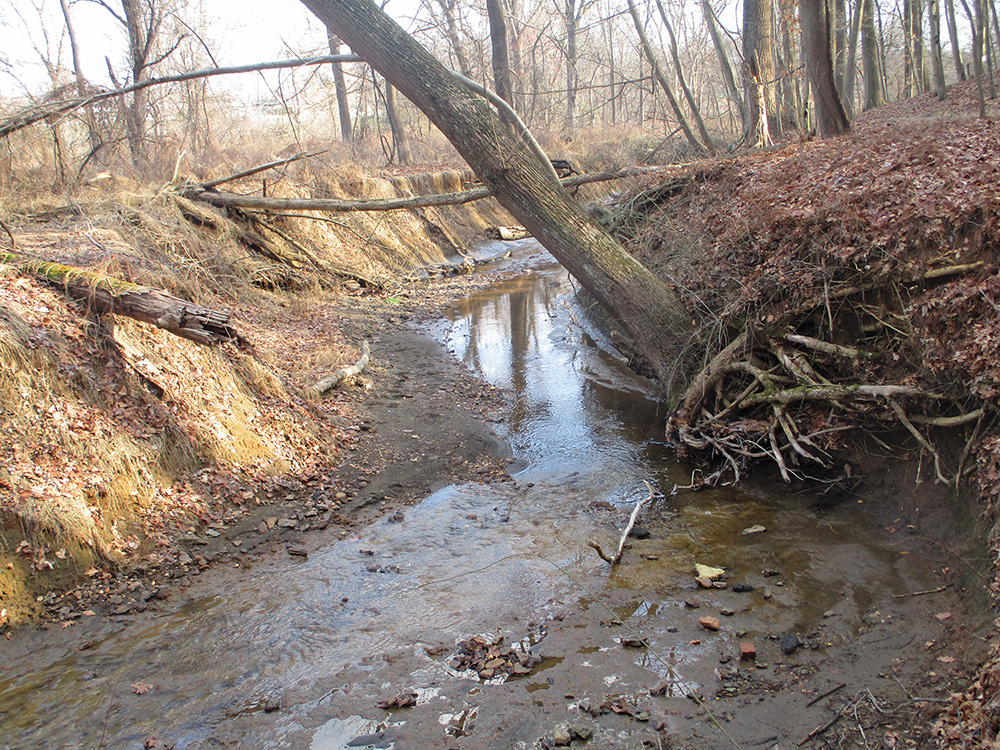
After descending a little, you’ll reach a junction where the High Point Trail turns right and heads uphill. Continue straight ahead, now following the Marsh Trail (marked by a green blaze), which continues to descend. At the base of the descent, the trail turns right and begins to parallel an eroded stream channel on the left.
At the next intersection, the High Point Trail leaves to the right, but you should continue ahead on the Marsh Trail, which crosses a stream on a wooden bridge and follows a long boardwalk across a wet area. A spur of the boardwalk goes off to the left, but you should continue ahead on the main boardwalk.
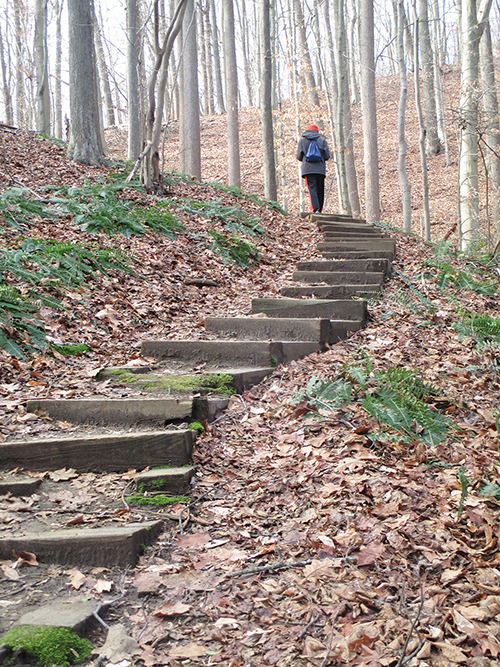
Soon after the main boardwalk ends, you’ll cross two streams on wooden bridges. Just beyond, turn right onto a narrower footpath that heads uphill, climbing part of the way on wooden steps. At the top of the hill, turn right, then immediately bear left at a fork. You’re now following the Ridge Walk, which begins to descend.
At the base of the descent, you’ll reach a four-way intersection. Continue ahead and cross a stream on a wooden bridge, then begin to climb. At the top of the climb, you’ll pass through an evergreen grove.
At a T-intersection at the end of the evergreen grove, turn left and follow the trail to the edge of the woods, where it crosses a stream on a wooden bridge. Here, a green blaze indicates that the trail turns right, but you should continue ahead, following a dirt footpath across a grassy field. As the footpath disappears, you’ll pass a picnic area on the right. Turn right just beyond the picnic area, cross the park entrance road at a crosswalk, and follow a concrete sidewalk to the Forest Edge parking area, where the hike began.
This hiking article is provided by Daniel Chazin of the New York-New Jersey Trail Conference. The Trail Conference is a volunteer organization that builds and maintains over 2,000 miles of hiking trails and publishes a library of hiking maps and books. The Trail Conference’s office is at 600 Ramapo Valley Road (Route 202), Mahwah; (201) 512-9348; www.nynjtc.org. Daniel Chazin can be reached at [email protected].