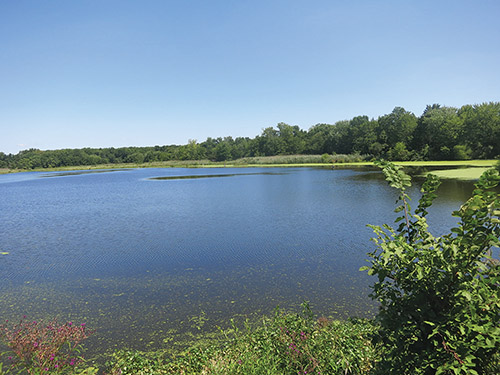

If you’re looking for a short, easy hike near home, this hike is perfect for you. It covers only one mile, and the route is completely flat. Yet the Celery Farm Natural Area in Allendale is a magnificent oasis that allows one to experience the beauty of nature while looping around a scenic pond. The dense vegetation surrounding the pond largely obscures the view of the surrounding homes, and it is indeed hard to believe that you are in the midst of a developed community! Because of its short length and easy terrain, this is an ideal hike for families with young children. Dogs are not allowed, however. For a map of the Celery Farm, go to www.fykenature.org/cfmap.php.
To reach the Celery Farm Natural Area, take N.J. Route 4 West to N.J. Route 17 North and continue for about 8 miles to the Allendale exit. Proceed west on East Allendale Avenue for 0.8 miles to Cottage Place. Turn right on Cottage Place and follow it to its end at Franklin Turnpike. Turn right on Franklin Turnpike and proceed for about 500 feet to a small parking area on the right (just past Allison Court, on the left) with a sign for the “Borough of Allendale—Celery Farm Nature Preserve.” (If the parking area is full, cars may be parked on Pittis Avenue, the next street on the left.)
What is now known as the Celery Farm Natural Area was owned in the 1800s by Henry J. Appert, who cultivated onions and celery on land surrounding what was then known as Wolf Lake. The area remained a working farm until the 1950s. The land was subsequently purchased by the New Jersey Conservation Foundation, and in 1981, 60 acres were acquired by the Borough of Allendale through Green Acres funding. Subsequent donations from developers and residents have increased the total acreage to 107 acres. The property is jointly managed by the Borough of Allendale and the Fyke Nature Association.
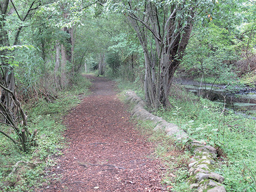
From the kiosk at the parking area, cross a bridge over a drainage ditch and proceed ahead on a footpath. A short distance ahead, you’ll cross another wooden bridge and come to a T-intersection. Turn left to reach a wooden observation platform with a panoramic view over the pond, now known as Lake Appert. The area is a bird sanctuary, and over 250 species of birds have been recorded here.
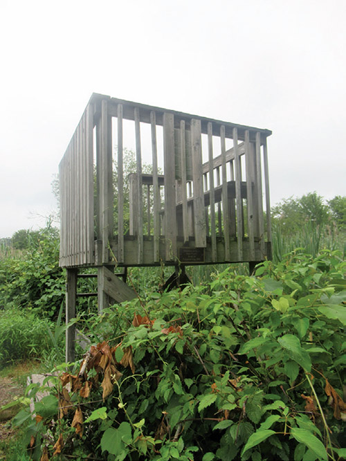
After taking in the view, retrace your steps to the intersection and continue ahead, looping around the pond in a counter-clockwise direction. You’ll pass another viewpoint (with a bench) at the south end of the pond and then head north between the pond (on your left) and a wide ditch (on your right). Along the way, you’ll pass two more viewpoints along the eastern shore. The first viewpoint has a bench; the second viewpoint has a raised observation platform, known as the Pirie-Mayhood Tower. When you reach the northeast corner of the pond, you’ll come to a fork, where you should bear left to follow the main trail around the pond. The area on the right has been fenced in to exclude deer and thereby protect the native vegetation.
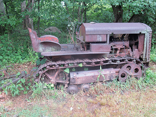
Bear left again at the next fork. After crossing a marsh on a footbridge and passing another observation platform, you’ll cross an area of cattails and come to the northwest corner of the pond. Here, a trail to the right leads into the Pauline Oxnard Butterfly Garden. At the junction, there is an interesting old piece of farm machinery. Bear left and head south along the trail which, after several turns, begins to parallel Franklin Turnpike. You’ll cross a boardwalk over a wet area and, a short distance beyond, reach the footbridge on the right that leads to the parking area where the hike began.
This hiking article is provided by Daniel Chazin of the New York-New Jersey Trail Conference. The Trail Conference is a volunteer organization that builds and maintains over 2,000 miles of hiking trails and publishes a library of hiking maps and books. The Trail Conference’s office is at 600 Ramapo Valley Road (Route 202), Mahwah; 201-512-9348; www.nynjtc.org. Daniel Chazin can be reached at [email protected].