


This easy-to-moderate hike loops around Tallman State Park, with several panoramic views over the Hudson River, the Tappan Zee Bridge and the Piermont Marsh. Much of the hike is nearly level, but there are several steep descents where caution must be exercised. The hike is about 4.5 miles long and should take about three hours. Dogs are permitted on leash.
To get to the trailhead, take the Palisades Interstate Parkway to Exit 4, and proceed north on U.S. 9W for about one mile to the traffic light at the intersection of Oak Tree Road/Washington Spring Road. Continue north on U.S. 9W for another 0.25 mile. After passing The Market on the right, turn right into a parking area on the east side of the road. A small sign (not easily seen from Route 9W) identifies the parking area as part of Tallman Mountain State Park.
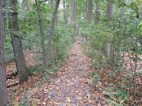
From the parking area, proceed east on a level gravel road, following the aqua blazes of the Long Path. In 0.3 mile, you’ll notice the ruins of a brick-and-concrete building on the right. Follow the Long Path as it turns left here, leaving the road. After crossing a wet area on plank bridging, the trail begins to run along an elevated mound of earth known as a “berm.” The berms in this area were built by the Standard Oil Company in the 1920s to retain seepage from an oil tank farm that they planned to establish here. Fortunately, the project was abandoned.
The trail follows the berm for about a third of a mile, passing a pond on the right and wetlands on both sides. When the wide berm abruptly ends, the Long Path turns right onto a narrower berm which crosses another wet area.
About a mile from the start of the hike, the Long Path crosses a wide gravel road, the route of the Tallman Bike Path. This will be your return route, but for now you should continue ahead, following the aqua blazes of the Long Path. After crossing the road, the trail curves to the left and begins to head north along the top of the Palisades Escarpment, with limited views through the trees of the reed-covered Piermont Marsh directly below. After crossing a small stream on rocks, the trail follows an old road, with a rough stone wall on the left.
About half a mile from the Bike Path crossing, the Long Path bears right at a fork and descends. With a gated road visible on the left, the Long Path bears right again and soon passes a stone comfort station (closed in the winter) and a large group of picnic tables on the left. Just beyond, it bears right at a fork, descends a slope, and briefly continues ahead along a stone-lined road. The trail bears right, leaving the road, and continues to descend more steeply on a footpath and stone steps. Use caution here, as the steps are uneven and may be slippery. At the bottom of the steps, the trail turns sharply right and descends on a switchback.
The Long Path turns right at the base of the descent and crosses a stream on a wooden bridge. Just ahead, the park swimming pool is visible below on the right, with the Piermont Marsh and the Hudson River beyond. A bench has been placed here, and you might want to pause to enjoy the view.
When you’re ready to continue, follow the Long Path as it turns sharply left and climbs a paved path to a traffic circle. The marked trail bears right and crosses the park road leading down to the river. On the other side of the road, it goes up wooden steps and continues to climb rather steeply to the North Picnic Area. At the top, it turns right and follows the paved park road that runs close to the edge of the escarpment.
After passing a stone picnic shelter on the left, the Long Path reaches a viewpoint over the Hudson River from an open area on the right, with several benches. The Tappan Zee Bridge spans the river to the north, Piermont Marsh is directly below, and the villages of Irvington and Dobbs Ferry may be seen across the river.
Continue ahead along the paved road. In another 200 feet, as the road bends to the left, follow the aqua blazes that leave the road and continue ahead to a panoramic viewpoint, again with several benches. This one looks north along the Hudson, with the village of Piermont directly below and Hook Mountain jutting into the river in the distance. The Long Path now bears right and steeply descends to the river level on rough, uneven rock steps. Use caution here, especially when you reach the very steep section at the end of the descent.
At the bottom, leave the blazed Long Path and turn right onto an unmarked gravel road (the Tallman Bike Path) which curves to the right and begins to parallel the Piermont Marsh. When the gravel road ends at a barrier of wooden posts, bear right and continue uphill on the paved park road. When you reach the traffic circle, turn left at the end of the guardrail and then immediately bear right on an unmarked footpath that heads uphill into the woods. (Do not turn left on the paved path that descends to the left.) Follow this unmarked path, which levels off and heads south, parallel to the park road. After crossing an open area, it joins a moss-covered paved path that comes in from the left and soon ends at a park road that leads to the South Picnic Area.
Turn left onto this paved road, then bear right at the fork, following the green “Bike Route” sign. Continue along the road for about 500 feet. When you reach a barricade of wooden posts on your right, turn right onto another paved road, closed to vehicular traffic (but open to bicycles). When the pavement ends at the top of the hill, continue ahead on the Bike Path for another 0.3 mile and turn left onto the aqua-blazed Long Path when it crosses the Bike Path.
Continue on the Long Path for about 300 feet until you come close to the cliff edge, and you’ll notice an unmarked footpath that comes in from the right. Turn sharply right onto this footpath and head south, with views of the Hudson River to the left through the trees. In about half a mile, you’ll reach an open rock ledge on the left that affords spectacular views over the river, the Piermont Marsh below and the Tappan Zee Bridge to the north.
After taking in the view, continue south along the unmarked trail. In about 500 feet, just before reaching a deep ravine, the trail turns right and begins to head west. Just beyond, bear right at a fork. (This turn can easily be missed, as the left fork is more distinct.) The unmarked trail heads uphill and soon ends at the gravel road followed by the Bike Path. Turn left onto this road and follow it back to the parking area where the hike began.
This hiking article is provided by Daniel Chazin of the New York-New Jersey Trail Conference. The Trail Conference is a volunteer organization that builds and maintains over 2,000 miles of hiking trails and publishes a library of hiking maps and books. The Trail Conference’s office is at 600 Ramapo Valley Road (Route 202), Mahwah; (201) 512-9348; www.nynjtc.org. Daniel Chazin can be reached at [email protected].