This three-mile, easy-to-moderate hike loops around the northwestern section of Ringwood State Park in Passaic County (New Jersey), passing the historic Ringwood Manor house and a cemetery where many soldiers of the Revolutionary War are buried. The hike should take about two hours, and dogs are permitted on leash.
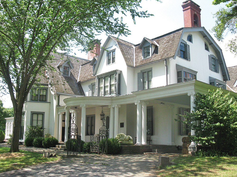
Iron mining and smelting began in the Ringwood area as early as 1740, and Ringwood Manor was the home of a number of prominent iron masters. The oldest part of the 51-room manor house dates back to 1807, but the manor was significantly enlarged, beginning in 1864, by the Hewitt family of New York City, who used the property as a summer estate. The manor and the surrounding property were donated to the State of New Jersey in 1936. Tours of the manor house are available (tours begin at the side entrance to the house, which you pass along the way), and you may wish to take a tour before or after your hike (a fee is charged for tours). For information on the availability of tours, call 973-962-2240.
To reach the trailhead from Teaneck, take NJ Route 4 West and continue on Route 208 West, which becomes I-287 South. Take Exit 57 and turn right onto Skyline Drive. Continue on Skyline Drive to its northwestern terminus at Greenwood Lake Turnpike (County Route 511). Turn right, continue for 1.5 miles, and turn right onto Sloatsburg Road. In 2.5 miles, as the road curves to the right, bear left and enter Ringwood Manor. Follow the road past the entrance kiosk and turn left into the parking area. GPS address: 1304 Sloatsburg Road, Ringwood, NJ 07456. Ringwood Manor is about 25 miles from Teaneck, and it should take about 35 minutes to get there.
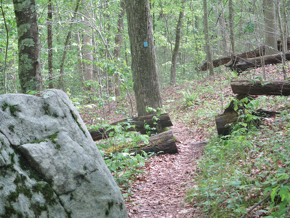
From the parking area, follow the footpath that leads along the rear of the manor house. Near the end of the house, turn right and climb the stone steps. At the top of the steps, turn left on a wide dirt road. You now begin to follow the blue blazes of the Manor Trail, which will be your route for most of the rest of the hike.
In another 300 feet, you’ll reach a Y-intersection where the Manor Trail divides into two routes. Bear right onto a grassy woods road to follow the loop in the counterclockwise direction. After a gradual climb, you’ll reach another Y-intersection. The White Trail begins on the right, but you should bear left to continue on the blue-blazed Manor Trail. After passing through an area where the thick understory forms a canopy overhead, the trail bears right, leaving the road. It continues on a footpath through a rocky, wet area, crossing several small tributary streams and then a wider stream on rocks. Just beyond, you’ll notice a flooded 30-foot-wide excavation on the right.
The Manor Trail now traverses undulating terrain, with several minor ups and downs. After leveling off, it crosses the yellow-blazed Hasenclever Iron Trail, then bears left at a fork and descends to cross another wide stream (the crossing can be a little tricky if the water is high). It turns right and briefly parallels the stream, passing several cascades and crossing a tributary stream on rocks, then bears left, away from the stream, and ascends gradually on a rocky footpath.
At the top of the climb, the trail reaches a woods road. Turn right and follow the woods road a short distance to reach a west-facing viewpoint, with power lines in the valley below. The hills across the valley are part of the section of Sterling Forest purchased by Passaic County in 1990 as a county park. The northern end of the valley was once the site of several iron mines, including the Hope and Peters Mines. The Peters Mine was opened around 1740 and produced iron ore for over 200 years. You have now reached the midpoint of the hike.
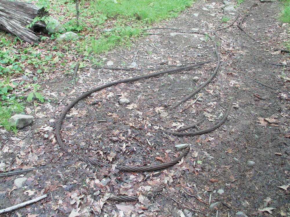
After taking in the view, retrace your steps to the trail and turn right onto the woods road (do not continue ahead on the route of the gas pipeline). Soon, the trail begins a gradual descent. In half a mile, the trail approaches Margaret King Avenue, and the sounds of the traffic can be clearly heard. As the trail bends to the left, you will notice long strands of one-inch-thick twisted-strand wrought iron cables embedded in the trail. These iron cables are remnants of mining activity during the nineteenth century at the nearby Hope and Peters Mines. It is possible that they were intended for use in a gravity conveyor system for the iron ore, constructed in 1858 but apparently never put into successful operation.
In a short distance, the trail swings to the left, away from this busy road. Soon, the trail passes a house on the right and continues along a wide gravel road. After passing tennis courts (visible on the right through the trees), you’ll reach a Y-intersection. The road on the right leads out to the Ringwood Municipal Building, but you should take the left fork and go around a locked gate.
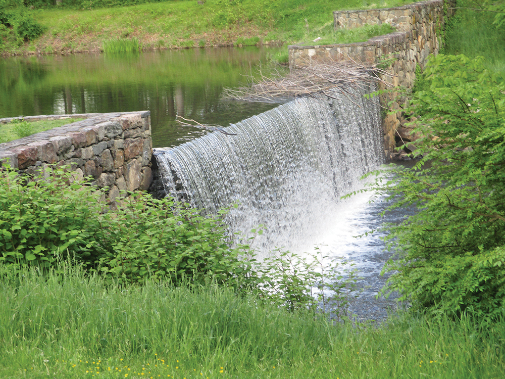
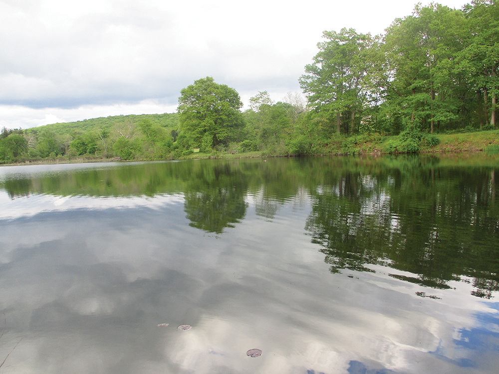
Just ahead, the trail passes a grassy area on the right, with the dam and spillway of Sally’s Pond beyond. This pond, created in 1895 to provide a scenic body of water in the landscape, was named after one of Abram Hewitt’s three daughters.
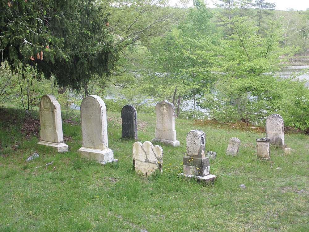
A short distance ahead, you’ll pass a cemetery on the right. The two large graves nearest the trail are those of Robert Erskine and his assistant. Erskine, a Scottish engineer, was hired to run the local mines in 1771, and he sided with the Colonies during the American Revolution, serving as Surveyor General to the Continental Army. Near the pond are the graves of members of the Hewitt family, owners of the manor house in the late nineteenth century. An iron gate adjacent to the trail marks the graves of the Morris family.
Beyond the cemetery, the trail crosses a bridge over a stream. You crossed this stream, which leads to Sally’s Pond, earlier in the hike. Just beyond, in a grassy area, turn right onto the yellow-blazed Hasenclever Mine Trail. Follow the yellow-blazed trail past a historic wrought-iron gate, and continue along the trail as it passes in front of Ringwood Manor. At the end of the manor house, where a triple-yellow blaze marks the terminus of the Hasenclever Mine Trail, turn left on a footpath, then turn right to return to the parking area where the hike began.
This hiking article is provided by Daniel Chazin of the New York-New Jersey Trail Conference. The Trail Conference is a volunteer organization that builds and maintains over 2,000 miles of hiking trails, and publishes a library of hiking maps and books. The Trail Conference’s office is at 600 Ramapo Valley Road (Route 202), Mahwah; (201) 512-9348; www.nynjtc.org. Daniel Chazin can be reached at [email protected].