


This two-mile “lollipop”-loop hike traverses the 147-acre Marshlands Conservancy in Rye, Westchester County, New York. Most of the shoreline of Long Island Sound in this area is developed, but the Marshlands Conservancy—a Westchester County park—has preserved a pristine section of land that faces the Sound. The hike follows a beautiful meadow down to the shore, makes a short loop, passing several views over salt marshes and the Sound, and returns on a footpath through a deciduous forest. There are some minor changes in elevation, but the hike is relatively easy. Allowing ample time to stop and appreciate the scenery, the hike should take about one and one-half hours. Dogs are not allowed in the Conservancy (except for service animals). A trail map is available at https://marshlandsconservancy.org/plan-your-visit.
To reach the trailhead from Bergen County, cross the George Washington Bridge and continue on I-95, which becomes the Cross Bronx Expressway and then the New England Thruway. Take Exit 18A of the New England Thruway (Fenimore Road) and turn right onto Fenimore Road. In 0.7 mile, turn left onto Boston Post Road and continue for 1.9 miles to the entrance to Marshlands Conservancy, on the right. Follow the entrance road for 0.2 mile to the parking area. GPS address: 220 Boston Post Road, Rye, NY 10580. The park is about 25 miles from Teaneck, and it should take about 45 minutes to get there.
From New Rochelle, take I-95 North to Exit 18A and follow the above directions. From White Plains, take I-287 East to I-95 South. Continue on I-95 South to Exit 19 (Playland Parkway). Take the first right off the exit ramp, immediately turn left, and continue for 500 feet to Old Post Road. Turn right onto Old Post Road (which becomes Boston Post Road) and continue for 1.1 miles to the entrance to Marshlands Conservancy, on the left.
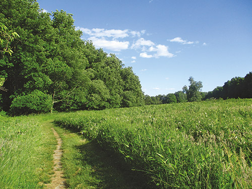
To begin the hike from the parking area, head west on a gravel path that passes a fenced-in area on the right. At the end of the fenced-in area, turn left onto a mowed path and head south, with a meadow on the right and woods on the left. After passing several paths that lead to the left, you’ll reach a fork in the trail. Bear left and, in 50 feet, you’ll reach a viewpoint over a salt marsh, with houses visible in the distance.
After taking in the view, return to the main path and turn left. The trail now descends to water level. It follows a causeway between two bodies of water and reaches a peninsula known as Marie’s Neck. Here, the trail reaches a fork, which is the start of a loop. Bear right to follow the loop in the counterclockwise direction.
The trail follows a narrow path through high grasses. At the end of the peninsula, there is a view over Hen’s Island, with the Long Island Sound beyond. To the left, you can see the boats moored in Milton Harbor. A short distance ahead, you’ll begin to follow a beach along the shore. Waterfowl frequent this area, and you may see ducks and other waterfowl in the water. Just before reaching an old stone chimney, turn left onto a footpath. You’ll soon reach the fork where the loop began. Continue ahead, retracing your steps up to the viewpoint over the salt marsh. Proceed ahead for a short distance along the trail, then turn right and cross a long wooden bridge over a wet area, entering a deciduous forest.
At the end of the bridge, turn right onto the Green Trail, which you will follow for the remainder of the hike. (As of this writing, the trail is not well blazed, but there are a number of green markers to guide you along the trail.) The trail meanders through the woods, passing many fallen trees. In a quarter mile, an unmarked trail on the right leads a short distance to another view over the salt marsh (this unmarked trail is not shown on the map). A short distance beyond, follow the Green Trail as it turns sharply left and soon descends to cross a stream on rocks.
After passing an intersection with a white-blazed trail that begins on the left, the Green Trail descends to a T-intersection with a gravel-covered trail. To the right, the gravel-covered trail leads to more views over the salt marsh. To continue along the Green Trail, turn left at the intersection and bear right at the next fork.
After climbing a little, the Green Trail goes through a gap in a stone wall, crosses a woods road, and goes through an opening in a chain-link fence. A short distance beyond, the Green Trail ends at the entrance road to the preserve. Turn left and follow the entrance road to the parking area, where the hike began.