This six-mile, easy-to-moderate hike loops around the southeastern section of the 4,315-acre Ward Pound Ridge Reservation—the largest park in Westchester County—which was opened in 1938. Over 30 farms were acquired for the park, and old stone walls, which once marked the boundaries between the various farms, crisscross the reservation. Most intersections are marked by numbered signs posted on trees. These numbers are shown on the park map and referred to in the description below. Since the trail system in the park is complex, hikers should obtain a copy of the free map of the reservation (available online at https://bit.ly/3SCKwDF) before beginning the hike.
Along the route of the hike, you’ll pass four of the six special “rock” features of the reservation: Indian Rock Shelter, Raven Rocks viewpoint, Dancing Rock and Bear Rock Petroglyph. The hike should take about three-and-a-half hours, and it follows woods roads for most of the way, but several sections are on narrower footpaths. Dogs are permitted on leash.
To reach the trailhead from Bergen County, cross the Tappan Zee Bridge and continue onto the Saw Mill River Parkway North for about 18 miles to its end at I-684. Take Exit 6 (Route 35, Cross River), turn right at the end of the ramp, and follow Route 35 for 3.7 miles to Route 121. Turn right onto Route 121, cross a bridge over the Cross River, then immediately turn left to enter the reservation. Continue for 0.7 mile to the tollbooth (a $10 parking fee is charged on weekends, daily in the summer). Make the first right beyond the tollbooth onto Michigan Road and continue for 0.7 mile to a parking area just before a turnaround circle at the end of the road (if this parking area is full, additional parking is available uphill to the left). The reservation is about 50 miles from Teaneck, and it should take about one hour and 10 minutes to get there.
If coming from Riverdale, take the Saw Mill River Parkway North to its end at I-684 and follow the directions above. The reservation is about 40 miles from Riverdale, and it should take about 50 minutes to get there.
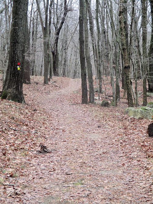
From the circle at the end of Michigan Road, bear right and follow a road blocked by a gate. Just beyond, you’ll pass a kiosk on the right and come to a fork at junction #70. Bear left onto a woods road with red and yellow blazes, but at the next fork (junction #24) bear right, now following only the Yellow Trail.
Before reaching the crest of the rise, you’ll notice a kiosk on the left (junction #23). Turn left and follow a white-blazed trail, which goes through the site of a Civilian Conservation Corps camp (Camp Merkel) from the 1930s. You’ll follow an old concrete sidewalk and pass an old stone water fountain on the left. A side trail on the right leads to the remains of the lavatory used by the CCC boys. When the white-blazed trail ends at a kiosk, descend stone steps and turn right onto a woods road—the route of the Yellow and Red Trails.
In 0.6 mile, bear right at junction #11, but at the following junction (#50), turn right onto a white-blazed trail, which begins to climb, first rather gently, then more steeply. After a level stretch, this white-blazed trail ends at junction #20. Turn left here and follow the co-aligned Yellow, Red and Rocks Trails. (The Rocks Trail is blazed with “RT”-on-white blazes.)

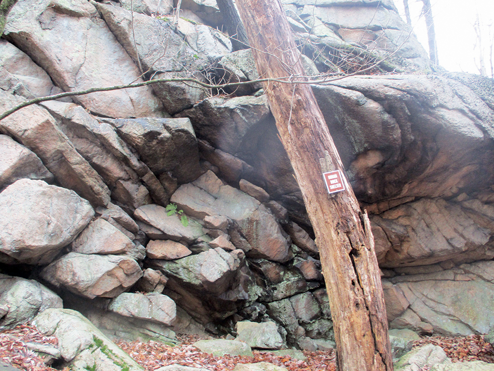
At the next junction (#19), bear right, leaving the woods road (and the Red and Yellow Trails), and continue to follow the Rocks Trail, which descends on a footpath. After crossing two footbridges and passing cliffs on the right, the Rocks Trail climbs through mountain laurel thickets to reach the Indian Rock Shelter, frequented by Native Americans because the overhanging rocks offered protection from the rain.
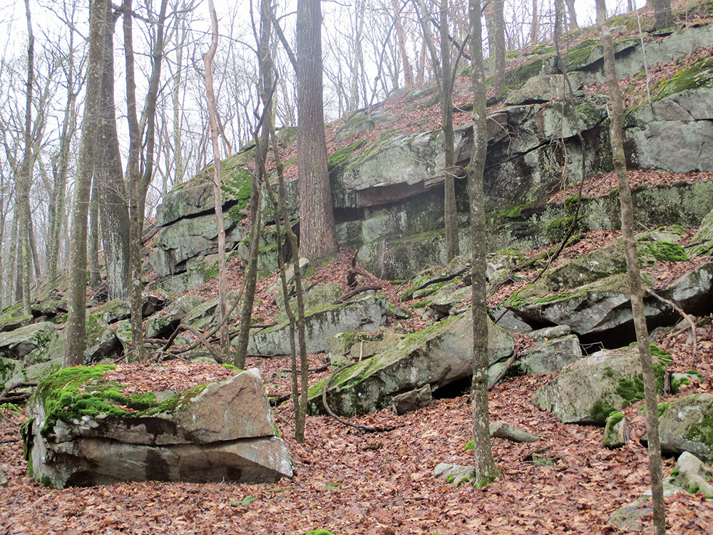
Just beyond, at junction #18, turn right onto a white-blazed trail, which passes jagged cliffs on the right and a vernal pool on the left. When the white-blazed trail ends at junction #21, turn left onto the Red Trail, which follows a woods road through dense mountain laurel thickets, climbing over a rise. A short distance beyond, at junction #48, you’ll notice a white-blazed trail on the left. Turn right onto this white-blazed trail and follow it a short distance downhill to Raven Rocks (junction #68), a spectacular unobstructed overlook over the Stone Hill River valley. A bench is provided if you’d like to take a break to admire the view.
After taking in the view, turn right (when facing the view) and head southwest on the Rocks Trail (marked by “RT”-on-white blazes) until you reach junction #62, where a white-blazed trail begins on the right. Turn right onto the white-blazed trail and, in a short distance (at junction #61), turn left onto the Red Trail, which soon begins a steady descent through mountain la. Bear right at junction #47 and continue to follow the Red Trail, which climbs briefly and then descends gradually, passing through a valley.

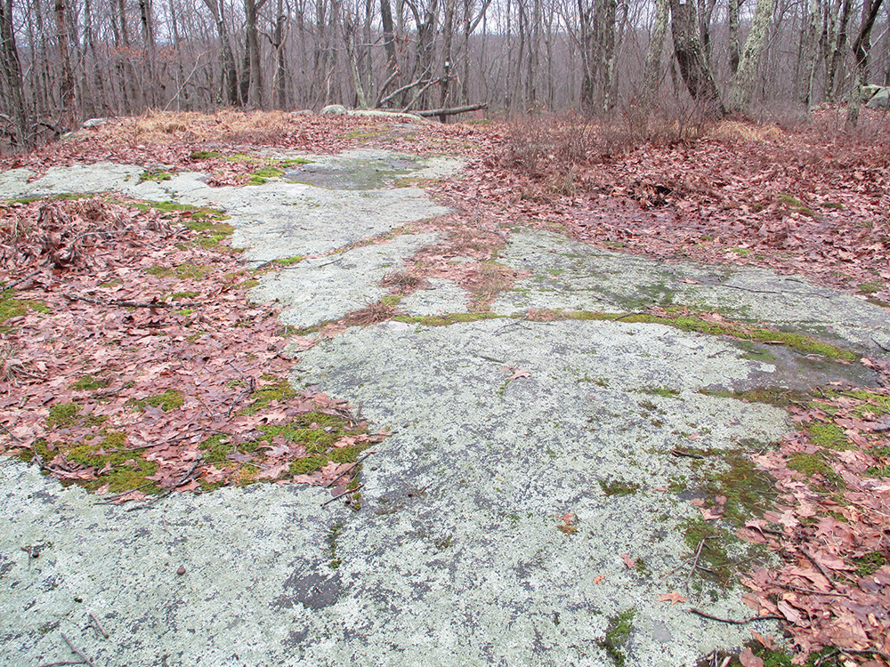
When you reach junction #36, follow the Red Trail as it turns left, joining the Rocks Trail, but just ahead (at a fork) leave the Red Trail and bear left to continue along the Rocks Trail. At the next junction (#37), turn left and follow a white-blazed trail up to Dancing Rock—a flat rock where farmers used to dance to celebrate the completion of the harvest. Continue ahead on the white-blazed trail, which passes stone ruins, then loops around and descends to end at another junction with the Rocks Trail (junction #60).
Turn left onto the Rocks Trail, which goes under power lines and descends to the Bear Rock Petroglyph (on the right)—a rock carving attributed to Native Americans in the shape of a bear. At the next junction (#39), turn right onto a white-blazed trail, which recrosses under the power lines, follows a smooth-surfaced woods road, and ends at junction #38, where you turn left onto the Green and Red Trails.
Continue ahead at junction #34, but at the next junction (#32), turn right onto a white-blazed trail that crosses a footbridge over a stream and climbs to pass through a gap in a stone wall at the crest of a rise. After descending, turn right at junction #25, rejoining the Green and Red Trails, and follow these trails for half a mile back to junction #70, where you turn left to reach the circle at the parking area where the hike began.

This hiking article is provided by Daniel Chazin of the New York-New Jersey Trail Conference. The Trail Conference is a volunteer organization that builds and maintains over 2,000 miles of hiking trails and publishes a library of hiking maps and books. The Trail Conference’s office is at 600 Ramapo Valley Road (Route 202), Mahwah; (201) 512-9348; www.nynjtc.org. Daniel Chazin can be reached at [email protected].