This moderate loop hike in the New Jersey section of the Palisades Interstate Park combines a stroll along the river with a walk along the top of the cliffs, passing several outstanding viewpoints. It’s about 3.6 miles long and should take about two-and-a-half hours to hike. Most of the hike is level, but you have to climb about 400 vertical feet from the river to the top of the cliffs and then descend back to the river level. Dogs are permitted on leash.
To get there, take N.J. Route 4 East to the last exit in New Jersey, and continue onto Bruce Reynolds Boulevard. In 0.2 mile, turn right onto Hudson Terrace. Proceed downhill on Hudson Terrace for 0.4 mile and turn left onto Henry Hudson Drive, entering the Palisades Interstate Park. Proceed north on Henry Hudson Drive for about 2.5 miles to the Englewood Boat Basin. Note: The park entrance road that provides direct access from Palisade Avenue in Englewood Cliffs to the Englewood Boat Basin (known as Dyckman Hill Road) was severely damaged by Tropical Storm Ida on September 1, 2021 and is closed to all traffic. The only access from the south to the Englewood Boat Basin is via the park entrance at the Fort Lee/Edgewater boundary. The trailhead is about 8.5 miles from Teaneck (via the above route), and it should take about 20 minutes to get there.
Metered parking is in effect at the southern end of the Englewood Boat Basin ($1.50 per hour weekdays; $2.50 per hour weekends; no fee on Wednesdays). There is no charge for parking at the northern end of the boat basin, so you may choose to park there and walk back to the start of the hike.
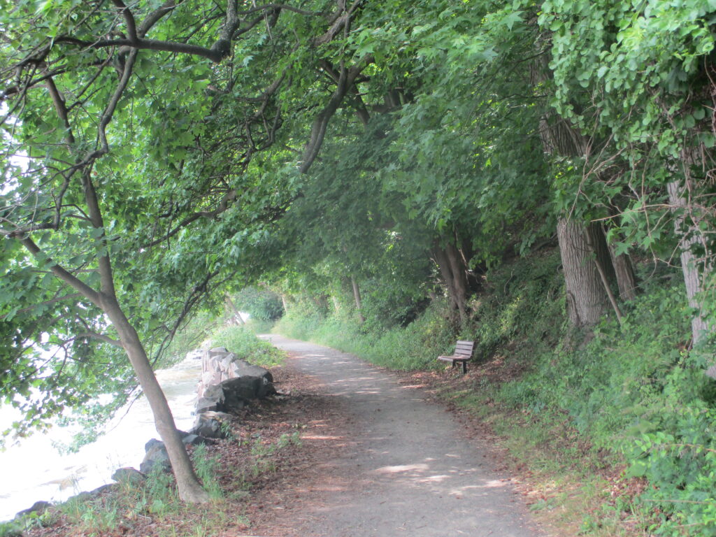
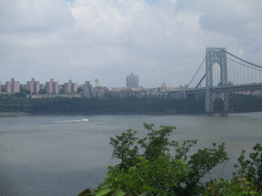
From the parking area at the south end of the Boat Basin, proceed past a stone refreshment stand and continue south on the white-blazed Shore Trail, a wide, level path that runs along the shore of the Hudson River. The George Washington Bridge is visible directly ahead, with the New York City skyline beyond. As you proceed along the trail, you’ll notice several sets of stone steps that lead into the river. These were once used to access swimming beaches along the river. Benches have been placed along the trail to allow walkers to rest and admire the views.
In about a mile, you’ll reach Ross Dock—a large picnic and recreation area. The trail continues ahead, proceeding across a grassy area at the base of the cliffs. At the south end of the Ross Dock area, the Shore Trail goes through a pedestrian tunnel under the entrance road. The trail then bears right and continues south along a paved road.
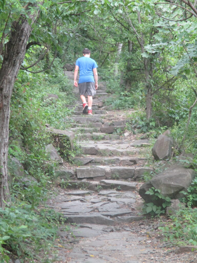
In 600 feet, you’ll see a flight of stone steps on the right. A sign identifies these steps as the route of the Carpenters Trail, marked with blue blazes. Turn right and climb the steps. You’ll soon reach the imposing stone wall (partially covered with vines) which supports the approach road leading into Ross Dock. Here, the trail turns left and ascends a wide stone staircase which leads to two stone-arch tunnels—first, under the approach road, then under the Henry Hudson Drive. The trail now turns right and proceeds north, parallel to the Henry Hudson Drive, soon reaching a switchback turn. The trail continues to ascend less steeply on switchbacks, following broad rock-lined steps, with views over the Hudson River. After another short but steep ascent on rock steps, the Carpenters Trail reaches the top of the cliffs, where it intersects with the aqua-blazed Long Path.
Turn left, then immediately bear left at a fork to reach a panoramic viewpoint over the river, with two benches. Ross Dock is visible below on the left, and the George Washington Bridge is on the right. Note the red lighthouse across the river, adjacent to the New York tower of the George Washington Bridge. You’ll want to take a break here to rest from the climb and enjoy the great views.
When you’re ready to continue, head north on the Long Path (also the route of the Carpenters Trail), following the signs for Allison Park and the Dyckman Hill Trail, and proceed slightly uphill. In 250 feet, the blue-blazed Carpenters Trail leaves to the left, but you should continue ahead on the Long Path. The Long Path runs parallel to and just below the level of the Parkway, with views through the trees over the river to your right. Soon, a short side trail to the right leads to a panoramic viewpoint over the river.
After passing a stone parapet on the right, the Long Path passes several stone walls. In another half mile, the trail passes to the right of a gas station along the Parkway, where water, restrooms and snacks are available.
Just north of the gas station, the Long Path crosses a wooden bridge over a stream. The trail soon reaches the iron fence surrounding Allison Park, where it turns left, then turns right and follows the paved access road leading to the park. Although the Long Path skirts the park, the park is open to the public (pets not permitted), and you might want to take a side trip into the park, which offers views over the Hudson River.
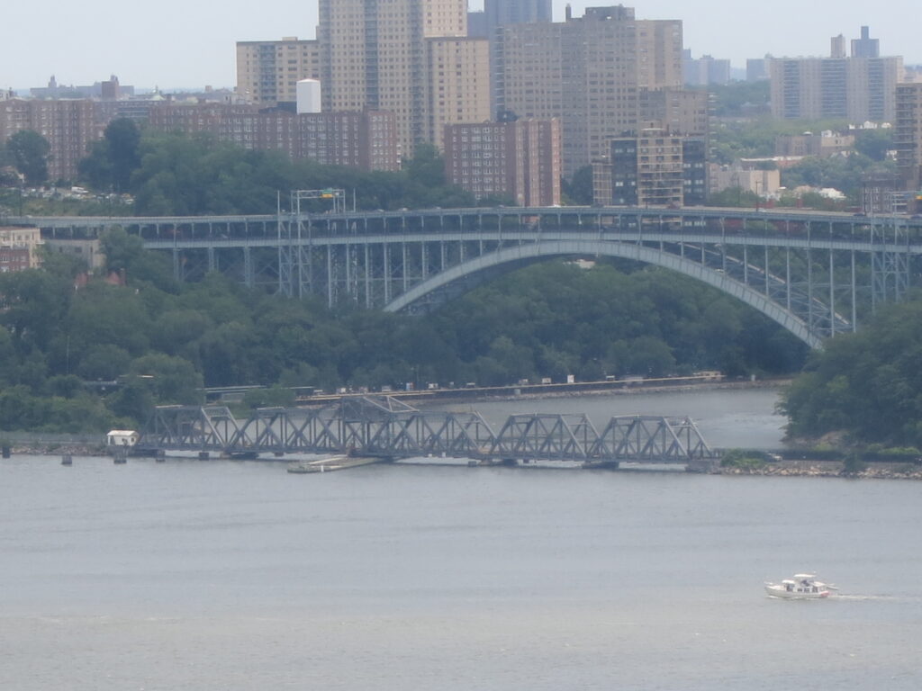
At the next intersection, the park access road turns left and goes under the Parkway. Just beyond, the Long Path bears left and heads uphill. It continues north along a parapet which overlooks the grounds of St. Peter’s University on the right. This parcel is the only one along the Palisades that remains in private ownership. After passing St. Michael’s Villa, the Long Path follows the guardrail and a grassy area along the Parkway, then bears right and reenters the woods, crossing a wet area on puncheons. It soon bears left and follows an abandoned paved road. A short distance ahead, an unmarked trail on the right leads to a viewpoint over the Hudson River, with the Englewood Boat Basin visible directly below and the Spuyten Duyvil (spanned by two bridges) on the other side of the river. As the trail once again approaches the Parkway, the pavement ends, and the Long Path continues ahead on a footpath below the level of the Parkway.
After crossing a bridge over a wide stream, the Long Path descends stone steps and reaches Palisade Avenue in Englewood Cliffs. Turn right, leaving the Long Path, and follow the sidewalk along the park entrance road. You will see a sign which marks the start of the yellow-blazed Dyckman Hill Trail. Continue along the park entrance road, which curves to the right and begins to descend, passing excellent views of the river, with the Englewood Boat Basin visible directly below.
Just beyond a waterfall on the right, follow the yellow blazes as they turn left and descend stone steps, passing by another waterfall and then going through an underpass beneath the entrance road. The trail then turns right and continues to descend on stone-paved switchbacks and stone steps. Be cautious as you descend, as the stone paving may be uneven, and the route may be slippery when wet or covered by leaves. When you again reach the park entrance road, cross the road, turn right, then turn left at the end of the stone wall and descend concrete steps. Upon reaching the river level, head across the picnic area to the parking area where you left your car.
This hiking article is provided by Daniel Chazin of the New York-New Jersey Trail Conference. The Trail Conference is a volunteer organization that builds and maintains over 2,000 miles of hiking trails and publishes a library of hiking maps and books. The Trail Conference’s office is at 600 Ramapo Valley Road (Route 202), Mahwah; (201) 512-9348; www.nynjtc.org. Daniel Chazin can be reached at [email protected].