
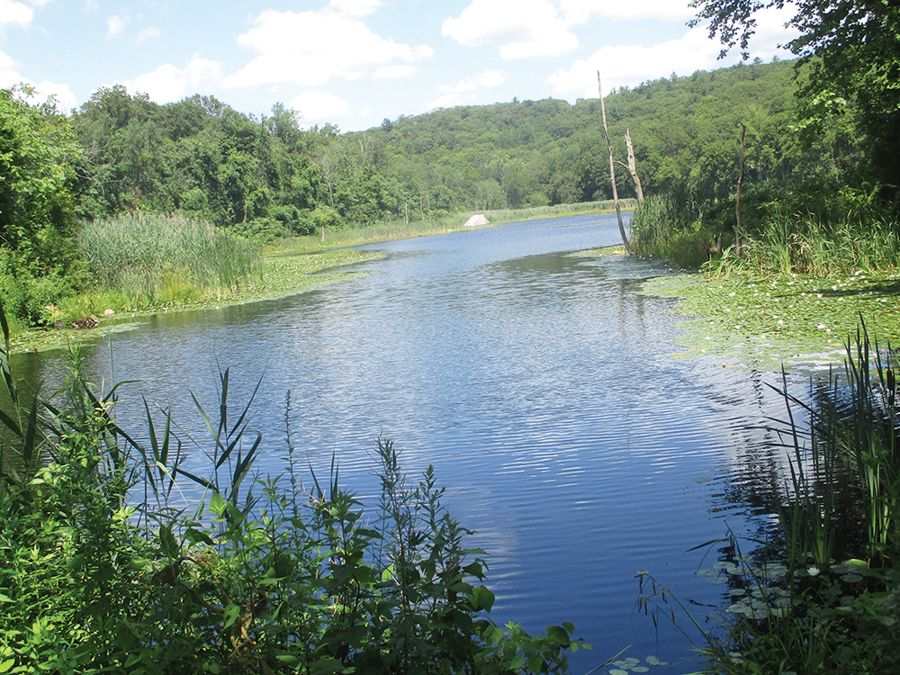
This easy-to-moderate five-mile hike loops around a section of Sterling Forest State Park east of Long Meadow Road in Orange County, New York. It begins at the scenic Laurel Meadow Pond and climbs to pass openings of the historic Augusta Mine, which supplied ore to the Southfield Furnace during the Civil War. After ascending to an attractive ridge, the trail descends on switchbacks to cross a stream, then climbs again to reach the start of the loop. The hike involves a total of about 500 feet of vertical elevation gain, but all of the climbs are moderate. It should take about three hours and dogs are allowed on leash.
Most of this “lollipop” loop hike follows “single-track” multi use trails recently constructed by the Palisades AmeriCorps trail crew of the New York-New Jersey Trail Conference, along with volunteers from the Palisades MTB (a mountain bike club). These multi use trails are open to hikers but they also are used by mountain bikers. Although park regulations provide that bicyclists must yield to hikers, hikers should be alert for approaching bicycles (both ahead and behind) on these “single-track” trails, and hikers may wish to step off the trail and permit bicyclists to pass them.
To reach the trailhead from Bergen County, take N.J. Route 17 north to the New York State Thruway. Bear left at the fork (following I-87 toward “Albany”) and take the first exit, Exit 15A (Sloatsburg). Turn left at the bottom of the ramp onto N.Y. Route 17 north. Proceed north on Route 17 for 1.4 miles and take the exit for Sterling Forest. Follow Sterling Mine Road (County Route 72) west for 3.0 miles, then turn right onto Long Meadow Road (County Route 84). In 3.6 miles, after passing the intersection with Old Forge Road, continue ahead on Long Meadow Road for another 0.1 mile and make the next right (onto a dirt road) at a sign for “Laurel Meadow Ponds.” Proceed for 0.2 mile to a concrete parking area on the right side of the road or to the second parking area on the right, with a dirt surface, and park in one of these parking areas. The trailhead is about 30 miles from Teaneck and it should take about 35 minutes to get there.
If coming from Riverdale or Westchester County, take I-87 North (New York State Thruway) and head west over the Tappan Zee Bridge. Continue to Exit 15A (Sloatsburg) and follow above directions.
To begin the hike from the second (dirt) parking area, head east into the woods on a wide grassy path, following the yellow triangle blazes of the McKeags Meadow Connector Trail (do not turn left and follow the yellow triangle blazes along a woods road.) After passing a locked gate, you’ll cross a causeway, with Laurel Meadow Pond on the left and a wetland on the right.
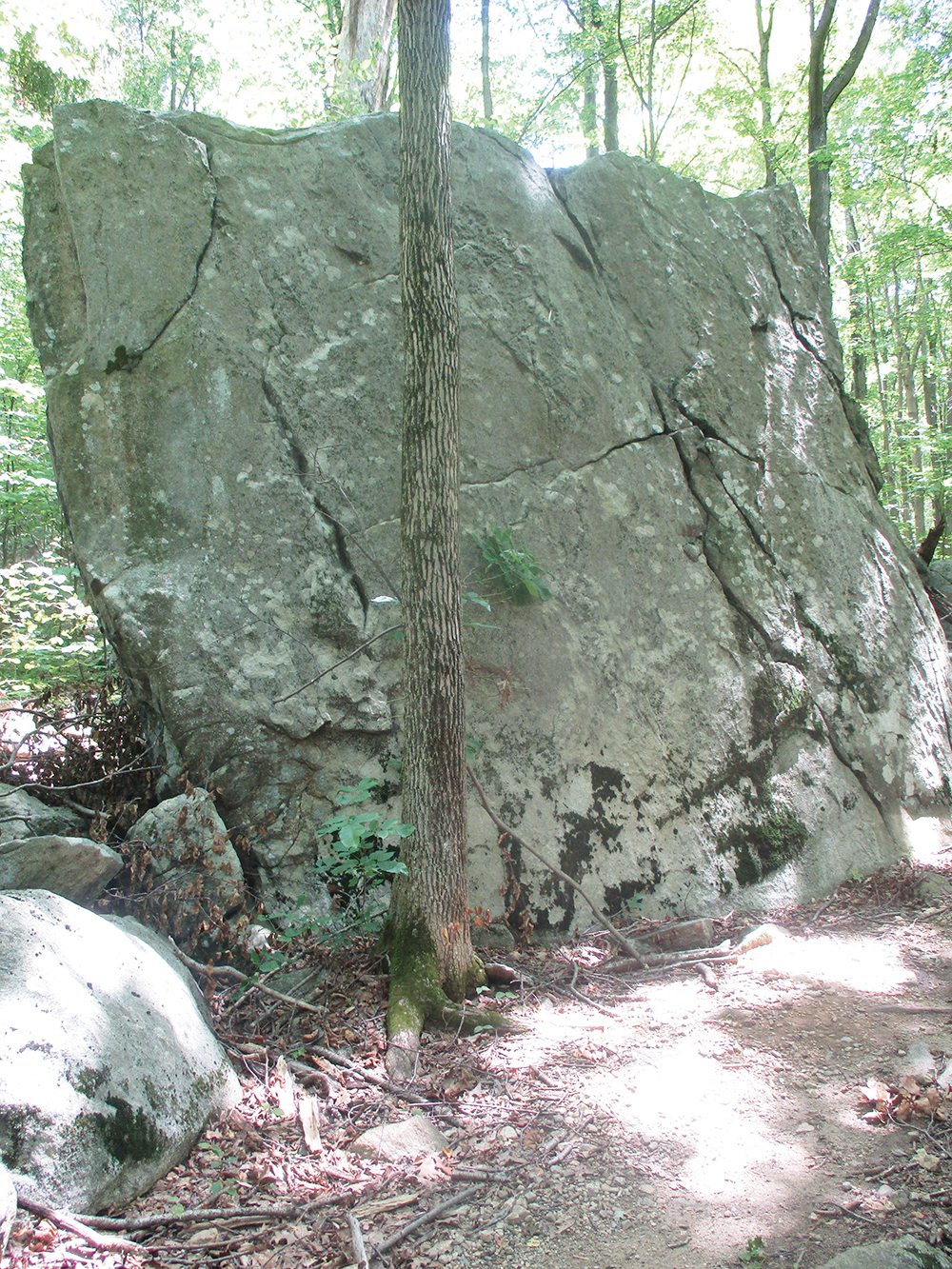
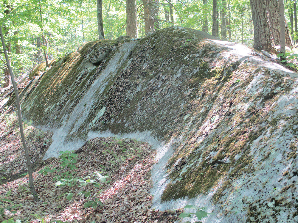
Beyond the pond, the trail briefly climbs on a wide woods road, then continues to climb on a “single-track” trail constructed by the Palisades AmeriCorps trail crew. Soon, the McKeags Meadow Connector ends at a junction with the green-stripe-on-yellow-blazed McKeags Meadow Trail. Turn left onto the McKeags Meadow Trail, which begins a gradual descent, passing a huge boulder on the right. The trail proceeds north past Laurel Meadow Pond, visible through the trees on the left, then climbs on switchbacks.
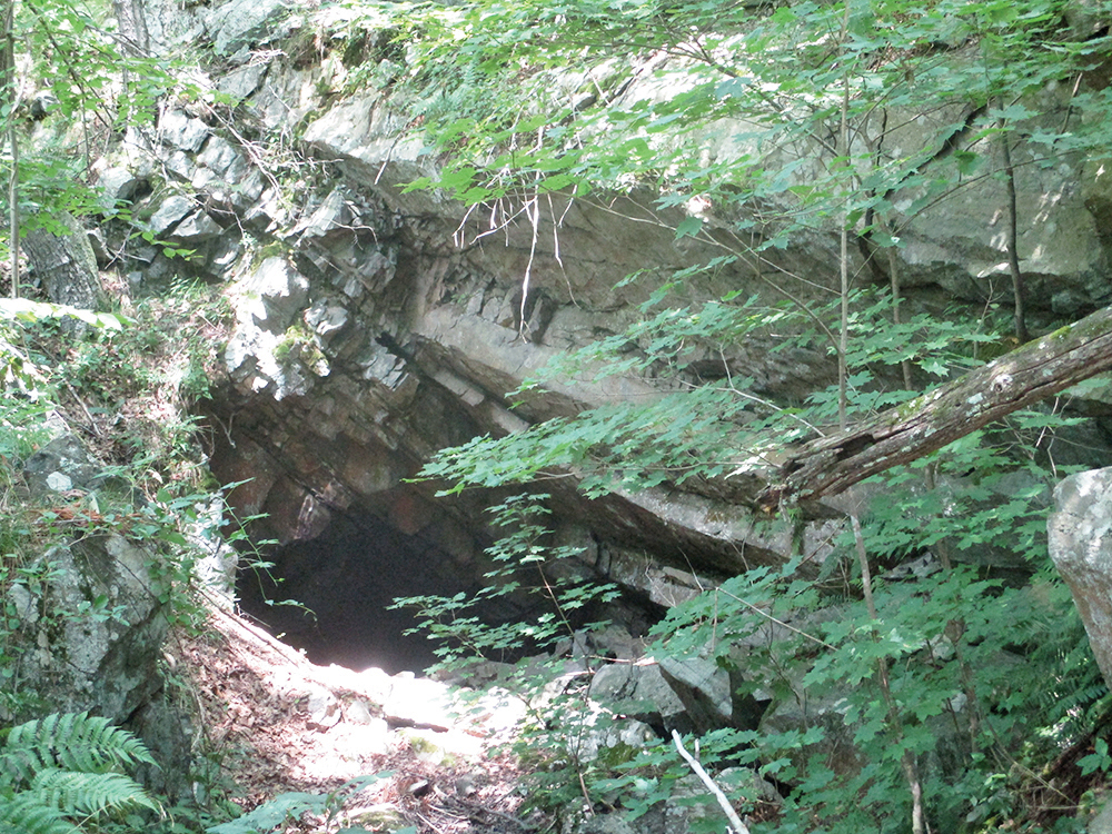
At the top of the climb, you’ll come to a T-intersection. Here, the McKeags Meadow Trail turns sharply right but you should turn left onto the Augusta Mine Trail, marked with green-dot-on-white blazes. This trail was constructed in 2022 by volunteers from the Palisades MTB, along with the Palisades AmeriCorps trail crew of the New York-New Jersey Trail Conference. After crossing a stream on large rocks, you’ll pass on the right a long trench at the base of a cliff. This is an opening of the Augusta Mine.
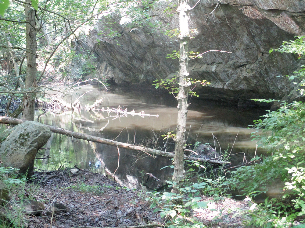
Continue heading north on the trail, and you’ll soon reach a second mine opening. This long, narrow trench at the base of an overhanging rock is filled with water. On the left, there is a large open area. Just beyond, you’ll notice piles of mine tailings (discarded rocks extracted from the mine) on the right.
A short distance beyond, the trail curves sharply to the right and begins a short climb. The trail levels off, descends and continues along gently undulating terrain. In about a mile (from the start of the Augusta Mine Trail), the trail traverses a level stretch through dense hemlock and mountain laurel and ends at a junction with the yellow-“H”-on-red-blazed Hutchinson Trail.
Turn right onto the Hutchinson Trail, which climbs gradually on switchbacks to a ridge, where it levels off. The trail traverses a beautiful hemlock forest, with an understory of mountain laurel, passing a long, slanted rock covered with moss and lichens. Along the way, it crosses a wet area on a long wooden bridge.
After following the ridge for over a mile, the Hutchinson Trail ends at a junction with the Redback Trail, marked with solid magenta (a combination of red, purple and pink) blazes. Turn right onto the Redback Trail, which descends steadily on switchbacks. This trail has been rebuilt by the Palisades MTB and although it is clear and passable, some work is still underway.
Through the trees, you’ll get glimpses of the Sterling Ridge to the west. After descending about 300 vertical feet in half a mile, the Redback Trail crosses a stream on rocks (this crossing may be difficult if the water is high). Just beyond, you’ll reach a junction with the green-stripe-on-yellow McKeags Meadow Trail.
Turn right onto the McKeags Meadow Trail, which begins a steady climb on a footpath lined with barberry thickets. The trail levels off, resumes its climb, then reaches the crest of the rise and begins to descend. Soon, you’ll come to the junction with the Augusta Mine Trail where you began the loop of the hike. Turn left, continuing to follow the McKeags Meadow Trail. When you reach the junction with the yellow-triangle-blazed McKeags Meadow Connector Trail, bear right and follow the trail down to the Laurel Meadow Ponds parking area, where the hike began.
This hiking article is provided by Daniel Chazin of the New York-New Jersey Trail Conference. The Trail Conference is a volunteer organization that builds and maintains over 2,000 miles of hiking trails and publishes a library of hiking maps and books. The Trail Conference’s office is at 600 Ramapo Valley Road (Route 202), Mahwah; (201) 512-9348; www.nynjtc.org. Daniel Chazin can be reached at dchazin@aol.com.


